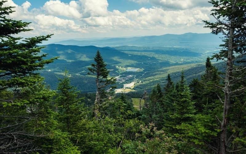
Changing fall foliage, gentle seascapes, wild mountain tops, quaint fishing villages, dense forests – New England is one of the best hiking destinations in the United States. From backcountry expeditions to lakeside family picnics, an epic adventure awaits for everyone.
New England comprises the states of Vermont, New Hampshire, Maine, Massachusetts, Connecticut, and Rhode Island. It is home to some of the most varied flora and fauna in the country, and there is almost too much variety of landscape to soak up in one day – almost.
While some folk might consider a New England hike to be ‘less epic’ than a walk out west, we’re here to debunk that myth. The sheer variety and density of rock, woodland, and history in the Northeast is unrivaled anywhere in the country.
Table of Contents
- 1. Mount Washington
- 2. Mount Katahdin
- 3. Cadillac Mountain
- 4. Franconia Ridge Loop
- 5. Mount Moosilauke
- 6. North & South Baldface
- 7. Mount Cardigan West Ridge Trail
- 8. Beehive Trail, Acadia National Park
- 9. Ocean Path Trail, Acadia National Park
- 10. Precipice Trail, Acadia National Park
- 11. West Rattlesnake Mountain
- 12. Flume Gorge Trail, Franconia Notch State Park
- 13. Cannon Mountain, Franconia Notch State Park
- 14. Diana’s Baths, White Mountains
- 15. Bash Bish Falls, Massachusetts
- 16. Mount Mansfield, Stowe
- 17. Freedom Trail, Boston
- Best Hikes in New England: Happy Hiking!
1. Mount Washington
- Type: Out and Back/Loop
- Difficulty: Moderate/Strenuous
- Length: 7/8.5 miles
Mount Washington stands high above the White Mountain National Forest and is part of the Presidential Mountain Range, the highest in the Northeast. Frequented year-round by hikers, skiers, and rock climbers, New England’s highest peak can be ascended by foot, by car via the Mount Washington Auto Road, or the famous Cog Railway!
The most popular hiking trails up the mountain start from the Pinkham Notch Visitor Center and rise 4,300 ft to the summit.
From the Notch, head for ‘Tuck’s Trailhead’. Soon after passing a waterfall, the trail forks. For those seeking a quieter slog, the Lion’s Head Trail rises steeply and offers incredible views down into the ravine.
Alternatively, the Tuckerman Ravine Trail offers great views of the Lion’s Head, the ravine, and the headwall. For the best experience, we recommend going up one and down the other!
The ‘easiest’ hiking trail up Mount Washington, the Jewell Trail, begins at the Cog Railway side.
This trail provides quite a day out with splendid views over the White Mountains, the most rugged range in the Northeast, as well as the rising cog train! From this side, the Ammonoosuc Ravine Trail rises steeply past large waterfalls and the Lake of the Clouds AMC hut. Hikers often choose to go up one trail and down the other for a memorable loop.
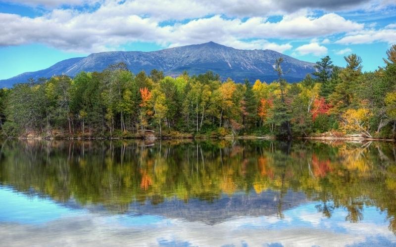
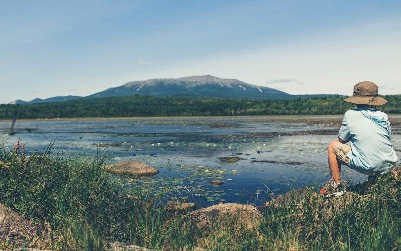
2. Mount Katahdin
- Type: Loop
- Difficulty: Strenuous
- Length: 9 miles
In the northeasternmost state of Maine, a sharp knife-edge ridge cuts the skyline: Mount Katahdin. It is the final destination for many Appalachian Trail thru-hikers, and perhaps one of the most photographed mountains in New England.
Over 10 trails lead to its summit. In our opinion, a traverse of the Knife Edge Trail between Pamola Peak and Mount Katahdin is the most exhilarating day out. However, this is a challenging day. This long trail requires careful planning, fitness, and experience, and should never be attempted in arduous conditions.
From the Roaring Brook Campground, follow the blue blazes for the Helon Taylor Trail. Soon, you leave the trees and the exposure is striking. From Pamola Peak, traverse the 1.1-mile-long Knife Edge Trail. This airy traverse, at times only 4 ft wide, is lined with 2000-foot drops. It requires careful stepping, agility, and confidence. However, relish the incredible position!
From Baxter Peak, either descend the Saddle or Cathedral Trails, the latter being shorter but much steeper. These connect to Chimney Pond Trail, which brings you back to Roaring Brook Campground.
Note: Baxter State Park limits access to Mount Katahdin to protect natural resources and wildlife. Reserve a parking spot at one of their three trailheads (make sure you know which hike you are doing) on weekends, and in July and August.
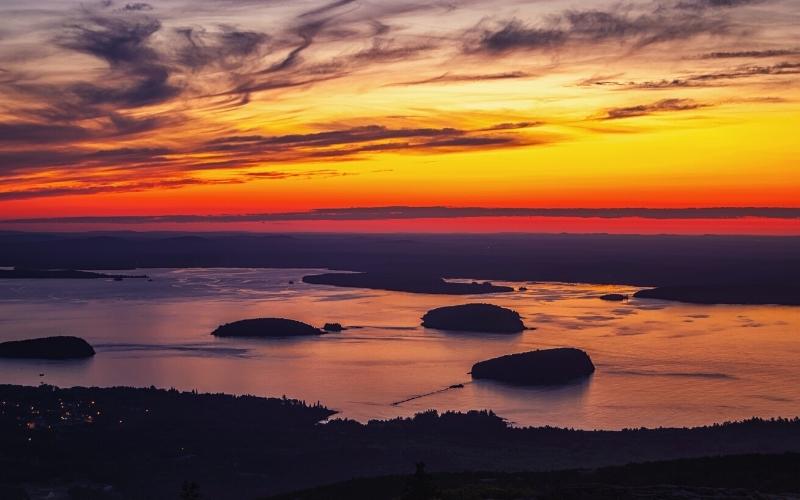
3. Cadillac Mountain
- Type: Loop
- Difficulty: Easy/Intermediate
- Length: 3/7 miles
Sitting at 1,530 ft on Mount Desert Island within Acadia National Park, Cadillac Mountain is the highest point along the North Atlantic seaboard. This glaciated-scoured peak overlooks rocky beaches, bays, lush forests, and the quaint village of Bar Harbor. The best part? These views are accessible by foot, bike, and car!
North Ridge Trail (4.4 miles round trip) is the most popular route to the summit and offers an all-around great experience.
The shortest and steepest way up, West Face Trail (3.1 miles), offers great views over Bubble Pond and Eagle Lake and is the option for rock-savvy folk.
The South Ridge Trail (7 miles) is one of the longest in Acadia and offers the widest breadth of views.
You can also drive up Cadillac Mountain, though during the busy months, we advise checking Acadia National Park to see if bookings are required.
Regardless of how you get up, we recommend leaving well before first light to ensure you catch the full sunrise.
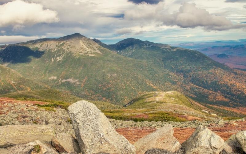
4. Franconia Ridge Loop
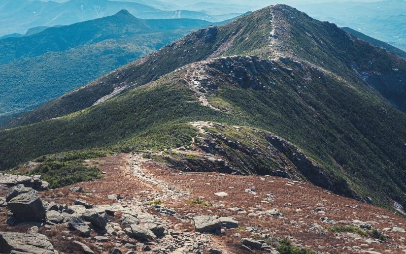
- Type: Loop
- Difficulty: Strenuous
- Length: 8.9 miles
The Franconia Ridge Loop traverses peaks of the second-highest mountain range in the White Mountains: Mount Lafayette, Mount Lincoln, and Little Haystack. The trailhead is only 2 hours and 10 minutes north of Boston, in New Hampshire. This long trail is a must-do when in New England!
Start on the Old Bridle Path Trail on the Northside of I-93. Soon, you arrive at a fork with two trail options: go up one, down the other!
The Falling Waters Trail is the more popular ascent. It crosses several creeks and waterfalls in dense woodland, then suddenly pops out over the treeline onto the summit of Little Haystack. The views over the White Mountains are great, and the 1.7-mile traverse to Mount Lafayette is nothing short of thrilling!
Climb steadily up Mount Lincoln then Mount Lafayette. From here, descend via the Greenleaf Trail, where you will pass the AMC Greenleaf Hut, which is one of eight lodging locations in the White Mountains. From here, head down toward the trailhead by the Old Bridle Path Trail.
This loop is also done in reverse, by continuing on the Old Bridle Path Trail at the fork. This way is steeper but also quieter. It offers more expansive views toward the Franconia Ridge you’ll soon be traversing.
5. Mount Moosilauke
- Type: Out and Back/Loop
- Difficulty: Easy/Challenging
- Length: 8.9 miles
Mount Moosilauke’s name comes from the language of the Abenaki people – ‘bald place’. There are four different trailheads, though regardless of which you choose, the mountain’s exposed and treeless summit will provide exceptional 360-degree views.
The easiest ascent is via the Gorge Brook Trail, which has an elevation gain of 2,400 feet and begins from the Ravine Lodge Trailhead.
Cross over the Gorge Brook, pass a memorial, and wind through the forest. Relish the views over the Sandwich Range, the Kancamagus Highway, Lincoln, and the Franconia Ridge. From the windy summit, either retrace your steps for an out-and-back hike or descend the Carriage Road to Snapper Trail, then down to form a loop.
The most challenging hike up has 3,100 feet of total elevation gain in 3.8 miles. It is part of the Appalachian Trail.
From the Beaver Brook Trailhead, you’ll soon meet the Beaver Brook Cascades. Here, the going gets tough. Caution is required as there are slippery rocks and this is one of the steepest hikes in the Whites. After 2 miles, the trail merges with the Benton Trail in the alpine for the final summit push. Carefully descend the same way.
6. North & South Baldface
- Type: Loop
- Difficulty: Challenging
- Length: 9.8 miles
The Baldface Circle Trail might fall off the peak bagger’s radar because it doesn’t reach 4,000 ft, but this is an epic hike with 3,569 ft of elevation gain. This long trail provides consistently sumptuous scenery and a jaw-dropping view of Mount Washington over the Carter Range.
Start at the Baldface Circle trailhead. The most common way up is via the South peak first. From the Emerald Pool junction, head up for 2.3 miles to the summit. Be careful in wet conditions as this open rocky section can be slippery. It may require light scrambling.
Once on the South summit, follow the Circle Trail toward the summit of North Baldface. To continue the loop, keep following the trail down.
7. Mount Cardigan West Ridge Trail
- Type: Out and back
- Difficulty: Easy/Moderate
- Length: 3 miles
This easy-to-moderate hike is a great way to spend a day outside with the family, for trail runners who want a quick blaze up and down, for a rest day, or simply for anyone who wants great, accessible views! This trail can be tackled year-round, too.
From the trailhead in the parking lot, follow the orange-blazed trail markers over wooden bridges and through the forest. The trail is straightforward, with an elevation gain of 1,225 ft. When the trees clear, the views open up and the fire tower on the summit is seen. Retrace your steps to descend.
8. Beehive Trail, Acadia National Park
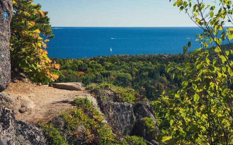
- Type: Loop
- Difficulty: Challenging
- Length: 1.4 miles
This is one of the most unique hikes in Acadia National Park. It is a great way for thrill-seekers to prepare for the Precipice Trail since it features a cliff walk and climbing metal rungs on a short, exposed granite rock face.
Numerous trails start from across the Sand Beach parking lot. Follow signs for the Beehive Loop Trail. A flat section meanders through the forest until reaching a junction. Head right. It is best to walk this trail counter-clockwise for traffic flow.
Now, the fun begins! Walk above big boulders and staircases, narrow ledges, then climb the rung ladders. During the 450 ft of elevation gain, the views get more expansive until, at the summit, the horizon is fully outstretched: Sand Beach and Great Head, Thunder Hole, and the Gulf of Maine.
9. Ocean Path Trail, Acadia National Park
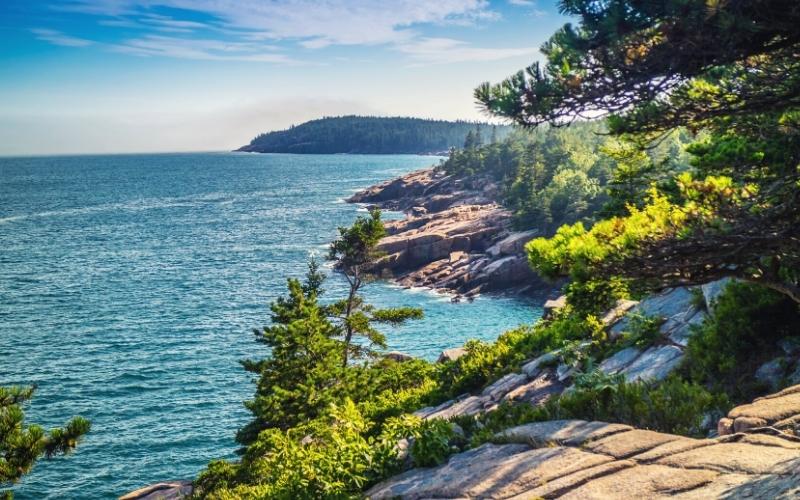
- Type: Out and back
- Difficulty: Easy
- Length: 2.2 miles
From the south end of the Sand Beach parking lot, follow signs for the trail. The walk is flat, so enjoy the many different rocky viewpoints. Halfway to Otter Point, we highly recommend stopping at Thunder Hole. Why thunder? Well, if it’s high tide, the billowing waves crashing into the sea cliffs sound like Thor himself is throwing a tantrum in very close proximity!
Onward, there is the option to deviate up the Gorham Mountain Trail (2 miles), a great vantage point. Then, near Otter Point, a small trail leads down to Monument Cove, where you can watch rock climbers abseiling. The light here is incredible at sunrise!
10. Precipice Trail, Acadia National Park
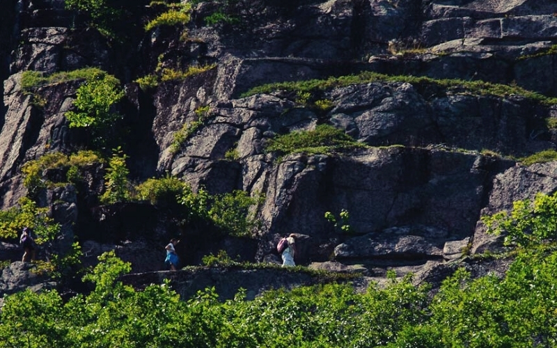
- Type: Loop
- Difficulty: Challenging
- Length: 2.5 miles
The Precipice Trail to the summit of Champlain Mountain is one of the most exposed trails in all of New England. Experienced hikers will climb boulders, ladders, and metal rungs, and walk along narrow ledges over steep drops. The psyche is guaranteed to be high!
The best time to tackle this challenging trail is in August and early autumn. The trail is closed from March-July for peregrine falcon nesting. In winter? Icy and dangerous conditions await.
The trailhead on Park Loop Road is ten minutes from Bar Harbor. Get there early! Once you set off, it’s uphill for the strenuous 1,060 ft elevation gain. One minute you’ll be slogging up a big staircase, the next you’ll be climbing beneath car-sized boulders! Keep an eye out for the blue blazes on the rocks.
Tread across the narrow cliff walk and relish the exposure. The views over the water and the foliage below are magnificent, though careful stepping is required. Soon, you enter the famous part of the trail – steep, metal rungs. Climb these until you pop onto the summit.
Descend via the Champlain North Ridge Trail to the Orange and Black Trails. Don’t worry, this is just a walk!
11. West Rattlesnake Mountain
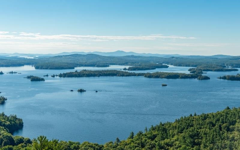
- Type: Out and back
- Difficulty: Moderate
- Length: 2.0 miles
The viewpoint from the West Rattlesnake outcrop offers superb views over Squam Lake and its many islands. This hike can be done year-round, however, trail closures due to mud maintenance might affect access in the spring.
Follow signs for The Old Bridle Path. As you gradually ascend, notice the oak, beech, hemlock, and pine forest. Continuing below the outcrops, there is a shift in the community of trees. Now, look for red and white oaks, red pine, staghorn sumac, and maple trees. Near the summit, look out for Douglas’ Knotweed, a rare herb found in only a few places in New Hampshire.
To get to the true summit, East Rattlesnake, continue over the ridge. Alternatively, go down Five Finger point.
12. Flume Gorge Trail, Franconia Notch State Park
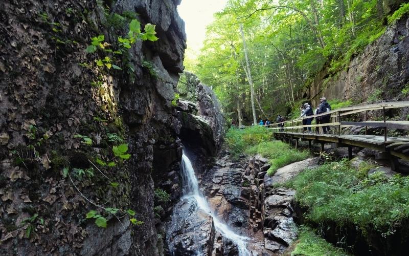
- Type: Loop
- Difficulty: Moderate
- Length: 2.0 miles
At the base of Mount Liberty, New Hampshire, you can watch as water rushes 800 feet between the high walls of Conway granite as it has for thousands of years, slowly forcing a 12-20 foot pathway of rock. Standing between 70 and 90 ft, the gorge walls are impressive!
This is one of the most popular New England hikes, and a fee is often required between May and October. Plan ahead and reserve.
The Flume Gorge Trail begins at the Flume Visitor’s Center. The moderate trail follows boardwalks, goes over bridges, and up many stairs, offering incredible views into the gorge, of the moss-covered walls and glaciated boulders, and of the flora surrounding you.
13. Cannon Mountain, Franconia Notch State Park
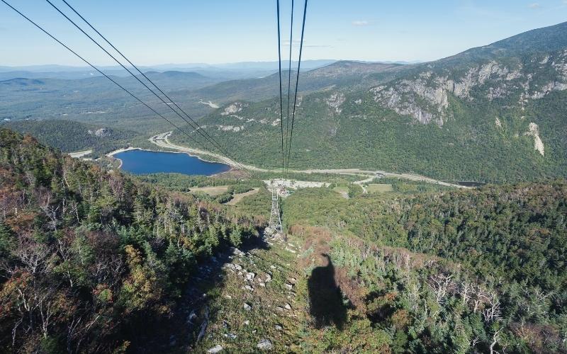
- Type: Out and back
- Difficulty: Challenging
- Length: 5.6/4 miles
Nestled in Franconia Notch State Park, this 4,100-footer is part of the Western White Mountains in the Kinsman Range. Cannon Mountain is one of New England’s most popular ski destinations. However, the off-season offers numerous mountain hikes for the keen walker!
From just off the I-93, the Hi-Cannon Trail rises steeply from the Lafayette Campground for 2.8 miles to the summit. This way offers a great view over Lonesome Lake for when you need to wipe your brow!
The shortest and most popular way up Cannon Mountain is via the 2-mile Kinsman Ridge Trail. This is an absolute calf-burner, but the views at the top are rewarding.
Pretty Echo Lake lies about halfway up. Soon after, the rewards of a steep hike are relished. A trail to the left brings you to the top of a large outcrop, with a stunning view spanning many aforementioned New England classics: Mount Lafayette, Lincoln, Little Haystack, and Mount Moosilauke.
From here, hike up to the summit, which has a lookout deck with binoculars!
14. Diana’s Baths, White Mountains
- Type: Out and back
- Difficulty: Easy
- Length: 1.2 miles
This short trail in Bartlett, near North Conway, is perfect to squeeze in either before or after hiking one of the larger peaks in New Hampshire, or for anyone seeking the cool shade. This mellow jaunt to ‘Diana’s Falls’ – fed by the Big Attitash Mountain – brings you past many rocks, pools, ledges, streams, and small waterfalls.
The first activity in the area was in the 1860s when George Lucy built a house, barn, and water wheel-powered sawmill here. In the 1890s, he built a boarding house for tourism, then in the 1930s upgraded his water wheel and sawmill by building a concrete dam with a turbine system.
The original buildings were removed nearly 100 years after they were first built, but hikers can still see remains.
The trail begins on a gravel-paved trail in the forest. Soon, you will begin walking up toward the falls. On the way, sunbathe on a rock, cool off in a pool of crystal-clear water, slide down a natural rockslide, and enjoy the clean air. This is a beautiful respite, and it is understandable why the Lucys stayed for over 100 years!
After reluctantly leaving your walk, continue to the crown jewel: Diana’s Falls, which measures nearly 75 ft.
15. Bash Bish Falls, Massachusetts
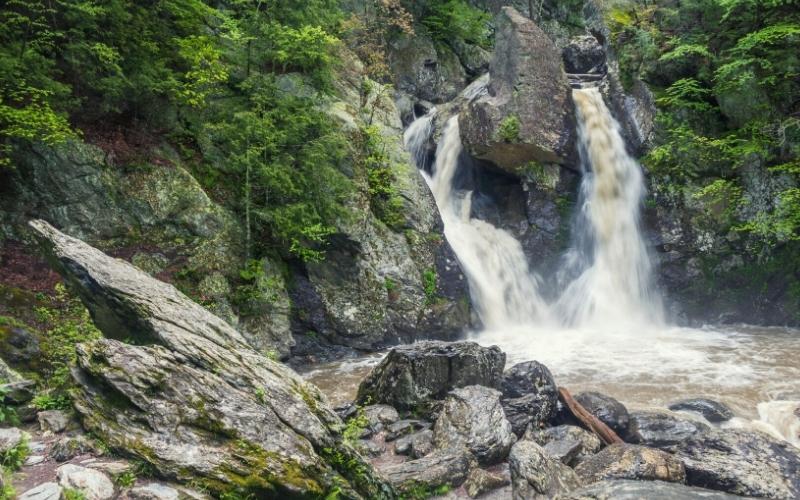
- Type: Out and back
- Difficulty: Easy/Moderate
- Length: 1.2/1.5 miles
There are two starting points to get to the impressive Bash Bish Falls, which are in the Taconic Mountains of Berkshire County: Mount Washington Road, Massachusetts; or at Taconic State Park, New York. If you are meeting someone, make sure you know which parking lot you’re headed to! Phone reception is minimal in these mountains.
The Bash Bish Falls trail from Massachusetts is shorter, but steeper and more rugged, making for a challenging hike. Leave the lower car park on Fall Roads. Ascend steeply over boulders, exposed roots, wooden steps, and stairs along Bash Bish brook through dense forest. Soon, the twin falls colliding down for nearly 80 feet reveal themselves.
Alternatively, the ascent from the Taconic State Park car park in New York is a little longer but more easy-going. This is the better option for those with young kids, and a great way to cross the state line on foot!
16. Mount Mansfield, Stowe
- Type: Loop/Out and back
- Difficulty: Challenging
- Length: 6.6/6/9.4 miles
Mount Mansfield, in Smugglers Notch State Park, dominates the Northeast skyline and is Vermont’s highest peak. It is home to some of the best skiing New England has to offer, but in the summer and early autumn, it is a day hiking paradise, receiving over 40,000 visitors.
While the Long Trail is the classic and most frequented on the mountain, the Sunset Ridge Trail (3.3 miles one way) is shorter and offers equally-sublime views since it is above the treeline.
In contrast, the Laura Cowles Trail (2.7 miles) steeply climbs the side of a ravine and is largely sheltered.
Both of these trails form a fantastic loop, though we recommend coming down the Sunset Ridge Trail.
The mountain’s classic trek is via the Long Trail South (9.4 miles out and back) from Route 108. This is one of the best hikes in New England and is almost all above treeline – one of the few alpine zones in the Green Mountain State!
From the east side of the mountain, ascend the trail for 1.7 miles until reaching the Taft Lodge, built in 1920. Continue up the slabby rock – careful when wet! – to meet the Hell Brook and Adam’s Apple Trails.
Soon, leave the trees to embark on the best part of this epic hike: the ridgeline to the Chin. This is a difficult and exposed section, and perhaps best for experienced hikers, however, it is one of the finest treks in New England.
Once on the summit, bask in the views of the surrounding mountains and Lake Champlain. Pay attention to the time and the weather. Getting caught in a storm up there is dangerous.
The easiest way to the top is via the Auto Toll Road at Stowe Mountain Resort. Walk the ridgeline from the Nose to the Chin.
17. Freedom Trail, Boston
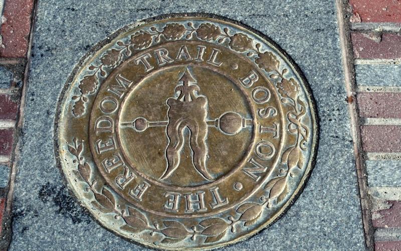
Unlike our New England nature hikes, the Freedom Trail is a collection of 16 nationally significant historic sites in Boston and Charlestown, Massachusetts.
Connected by a physical red line embedded into the city sidewalks, sites include churches, burying grounds, benches, ships, monuments, bookstores, meeting houses, and more. Collectively, they tell the story of the American Revolution and will bring you all the way back to the 17th century.
There are many different ways to enjoy the Freedom Trail, and how long it takes will largely depend on your interests. You can use a map, audio guide, brochure, guidebook, or smartphone app to help guide you from one place to another. Each historic site will also have docents or an exhibit to provide more information.
Visitors also have the opportunity to join a 90-minute Foundation’s tour (1 mile) with an 18th-century costumed guide. The tour leaves the Visitor’s Center four times a day.
Best Hikes in New England: Happy Hiking!
New England is undoubtedly one of the greatest places to hike in the United States. From leisure day hikes on the coast of Maine to full-day epics ascending the 4,000 ft peaks in New Hampshire and Vermont, there is a New England hike for everyone!
If you liked this post, please feel free to share it with your friends! And if you have any questions or comments then drop us a line in the box below.
