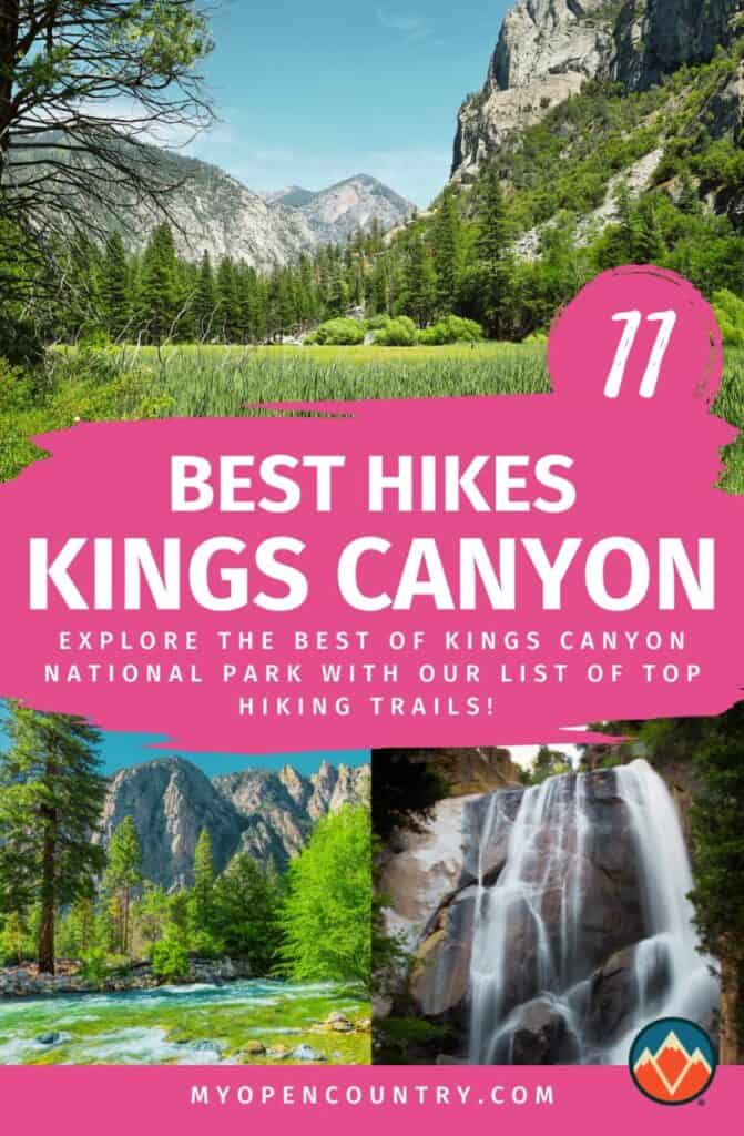
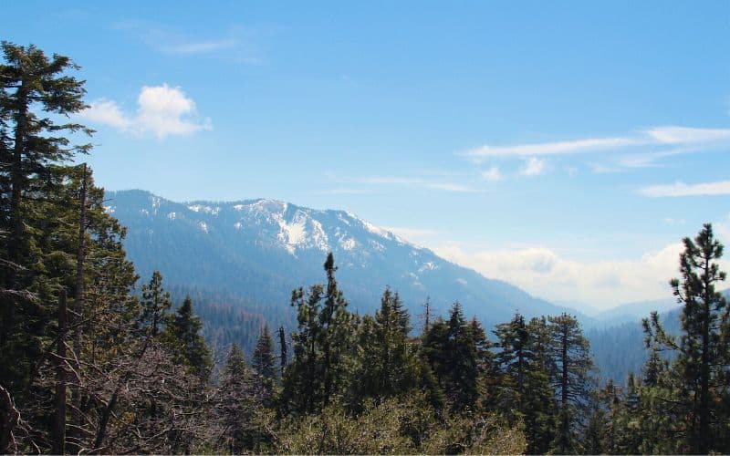
Boasting massive giant sequoias, scenic vistas, and rugged peaks, makes Kings Canyon National Park a hikers paradise but selecting one trail out of the hundreds of miles of options isn’t easy.
To help ensure that your next trip to Kings Canyon goes off without a hitch, we created this list of the top 11 hikes in the park. Up next, we’ll walk you through the best hikes in Kings Canyon so you can make the most of your time in the Sierra Nevada mountains.
Do
Don’t

Table of Contents
RELATED READING: Check out more of our guides to hiking in California.
Save for later!!! ⤵️
What are the 11 Best Kings Canyon Trails to Hike?
If you’re looking for an adventure, then we’ve picked 11 amazing Kings Canyon hikes for you to try below.
- Mist Falls Trail
- Rae Lakes Loop
- General Grant Loop Trail
- Zumwalt Meadow And Roaring River Falls
- Hart Tree Trail Loop
- Paradise Valley Trail
- Moro Rock Trail
- Hart Tree, Fallen Goliath, and Redwood Creek Loop
- Buena Vista Peak
- Big Baldy Ridge Trail
- Panoramic Point Trail
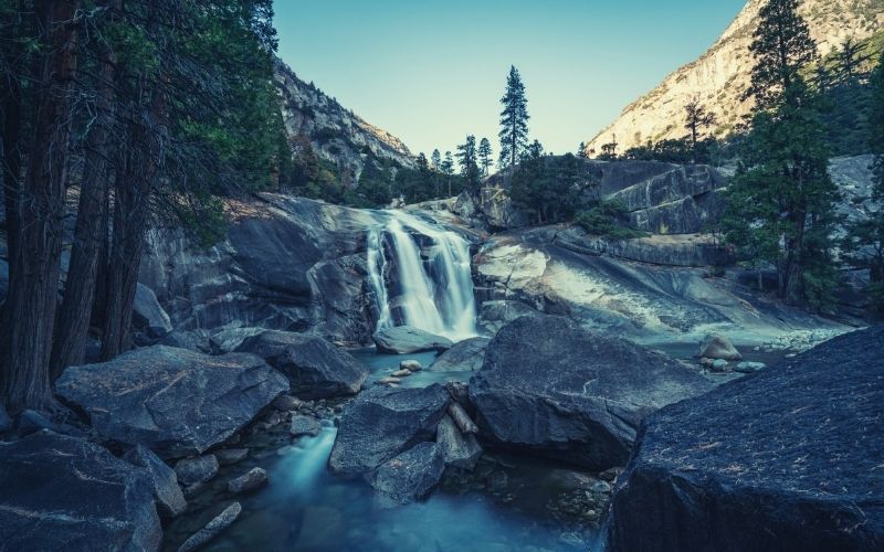
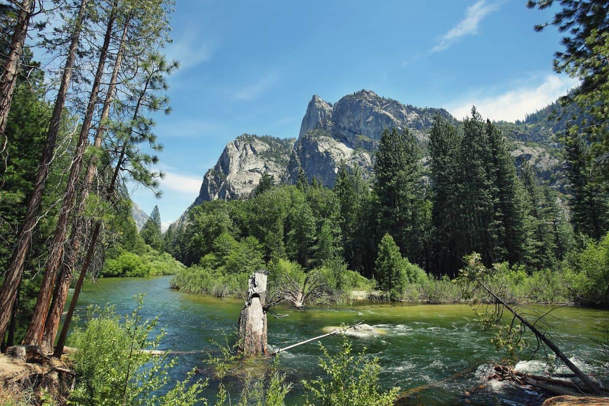
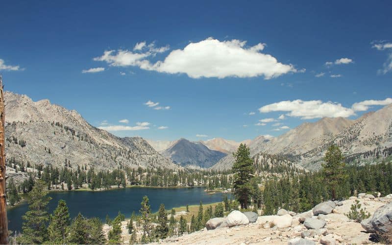
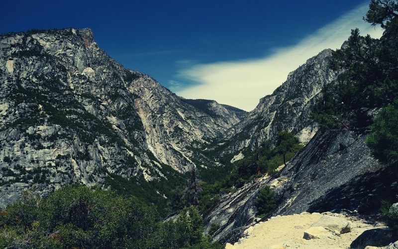
1. Mist Falls Trail
The Mist Falls Trail provides stunning waterfalls and sprawling meadow views making it one of our favorite hikes in the area.
Starting from the trailhead near the Road’s End Permit Station, this trek follows a sandy path through the forest near the Kings River. Along the way, you’ll gain relatively little elevation, which makes this trek suitable for most hikers, despite its relatively long distance.
Eventually, the path will arrive at the base of Mist Falls, where you can gaze up and enjoy the beautiful view. On a sunny day, you can also see many of the rugged peaks of the Sierra Nevada as a reward for your efforts. Not bad for starters…
- Type: Out-and-back
- Length: 8.2 miles (805ft ascent)
- Difficulty: Moderate
- Access: Trailhead near the Road’s End Permit Station in Cedar Grove
2. Rae Lakes Trail Loop
The Rae Lakes Loop backpacking trail is arguably the most famous trek in Sequoia and Kings Canyon National Parks, and a must-do for the more adventurous visitor.
This loop clocks in at around 41.4 miles round-trip and it boasts nearly 7,000 feet of elevation gain, so it’s not for the faint of heart. It also travels along part of the famed John Muir Trail, which is one of the region’s most popular thru-hikes, and also the Pacific Crest Trail. Good hiking boots are a must!
The Rae Lakes Loop trail starts at Road’s End and most trekkers choose to travel in a clockwise direction. From the get-go, the path immediately starts gaining elevation, bringing you up to a high alpine plateau where stunning lakes abound.
As you make your way around the loop, you’ll also get a chance to climb up to the top of Glenn Pass, where the views are truly out of this world. While you can’t quite see as far as Yosemite Valley from the pass, the views on the gorgeous Rae Lakes Loop are sure to be a highlight of your trip.
However, since this multi-day backpacking trip does require spending at least a couple of nights in the backcountry, you’ll need to get a permit for your stay. Do keep in mind, though, that this hike is exceptionally popular. This being so, you should plan to apply for a wilderness permit online as soon as possible before your trip.
If you’re looking for an even longer backpacking trip, then consider tackling the 72-mile-long High Sierra Trail which will take 6-8 days to tackle.
- Type: Loop
- Length: 41.4 miles (6,971ft ascent)
- Difficulty: Hard
- Access: Trailhead at Road’s End Permit Station in Cedar Grove
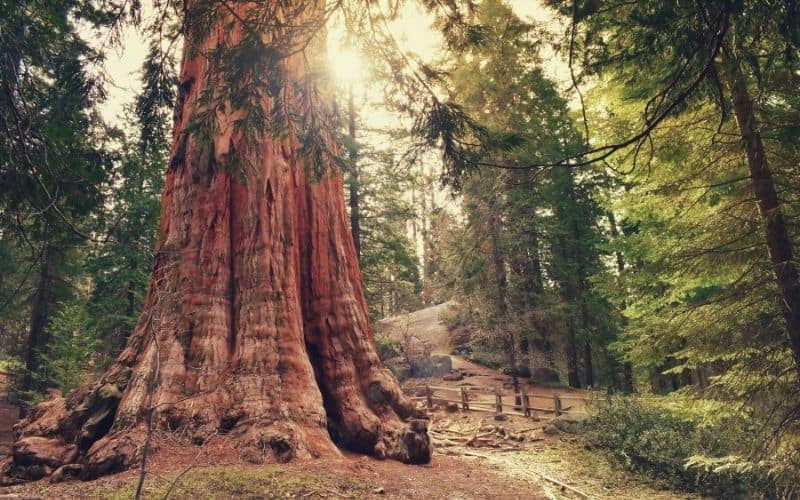
3. General Grant Loop Trail
The General Grant Tree Loop offers a chance to see the second largest tree in the world——this casual walk through Grant Grove is among the top trails in Kings Canyon National Park.
Setting off from the General Grant Tree parking lot, this short paved trail travels through a giant Sequoia Grove over the course of a 0.5-mile loop. Soon enough, it arrives at a collection of big trees that includes the famed General Grant Tree.
Since this day hike is pretty short, it’s great to pair with some other nearby hikes. Depending on your interests, one great option includes the North Grove Loop, which provides even more amazing views of the General Grant Grove.
Alternatively, you can stop by the nearby Kings Canyon National Park Visitor Center after your trek. At the visitor center, you can pick up trail maps and talk to a ranger for advice if you’re looking for more adventure options for your trip to the park.
- Type: Loop
- Length: 0.5 miles (56ft ascent)
- Difficulty: Easy
- Access: General Grant Tree parking lot near the Kings Canyon National Park Visitor Center
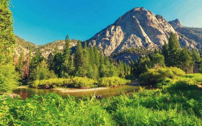
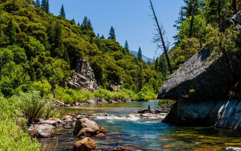
4. Zumwalt Meadow And Roaring River Falls
The trek to Zumwalt Meadow and Roaring River Falls is a quick and fun day hike that’s suitable for a wide range of hikers and provides a chance to see some beautiful Sierra scenery.
After departing the parking area, this 4.1-mile trail travels along the South Fork Kings River through meadows and forested terrain. The path treats visitors to views of towering granite walls and sprawling alpine meadows until it arrives at the impressive Roaring River Falls.
Furthermore, while the path connecting the Zumwalt Meadow Loop and Roaring River Falls isn’t fully accessible for wheelchair users, there are some accessible options available. The first portion of the Zumwalt Meadow path is mostly level. Meanwhile, the Roaring River Falls path is paved and is wheelchair accessible near the trailhead.
You can extend this hike on the River Trail to Roaring River Falls, which will add 3 miles to your journey.
- Type: Out-and-back trail
- Length: 4.1 miles (475ft ascent)
- Difficulty: Moderate
- Access: Zumwalt Meadow parking lot near Cedar Grove Village
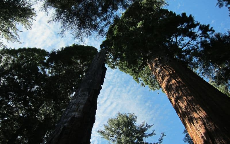
5. Hart Tree Trail Loop
A superb choice for folks looking to get off the beaten path, the Hart Tree Trail loop is a longer trek that takes you through a seemingly endless forest of giant sequoias.
Once you leave the trailhead, the trail meanders up and over undulating terrain, offering spectacular views and a chance to see the famed Hart Tree, which is one of the largest in the world.
That being said, if you’re up for more walking, you can extend this trek to the nearby Redwood Mountain Grove and Sugar Bowl loops. When done as day hikes, however, these trails are quite long, so be prepared for quite a lot of walking if you opt for the extended loop.
- Type: Out-and-back
- Length: 10.6 miles (2,066ft ascent)
- Difficulty: Hard
- Access: Redwood Saddle Trailhead off of the Generals Highway
6. Paradise Valley Trail
Covering part of the Rake Lakes Loop, the Paradise Valley Trail is one of the most popular day hikes in Kings Canyon National Park for experienced trekkers.
With a total distance of over 17 miles, the Paradise Valley Trail makes for a long day out in the mountains. However, if you’re looking for a truly amazing trekking trail, Kings Canyon National Park’s Paradise Valley is hard to top.
On this hike, you’ll walk through large stands of beautiful ponderosa pines, into a massive canyon, and then toward Mist Falls. This is also one of the best places in Kings Canyon National Park to see wildlife, so keep an eye out for bears as you trek!
- Type: Out-and-back
- Length: 17.1 miles (2,972ft ascent)
- Difficulty: Hard
- Access: Road’s End parking area in Cedar Grove
7. Moro Rock Trail
When it comes to spectacular views of Kings Canyon and Sequoia National Park, the Moro Rock Trail is hard to beat.
Right off the bat, this trail starts climbing up a set of steep stone and concrete steps as you make your way to the top of a huge granite dome. Slowly but surely, you’ll climb to the top of the dome where expansive views of Kings Canyon National Park await.
Although this hike is short, its steep elevation gain makes it quite challenging. So, be sure to take your time on the trail. However, if you have energy after your ascent, consider checking out the nearby treks to Hanging Rock and Bobcat Point, or the Big Trees Trail in the Giant Forest.
This hike can be extended on the Crescent Meadow Loop Trail, a 1.7-mile, family-friendly stroll around the idyllic, lush meadows.
- Type: Out-and-back
- Length: 0.4 miles (187ft ascent)
- Difficulty: Moderate
- Access: Parking area on Crescent Meadow Road
8. Hart Tree, Fallen Goliath, and Redwood Creek Loop
Tagging all the highlights of Redwood Canyon in a single-day hike, this loop is a super choice for keen trekkers.
Starting at a parking area to the south of the Generals Highway, this 7.3-mile round-trip loop trail hikes deep into the heart of Redwood Canyon. It passes by some of the largest groves of giant sequoia trees and offers plenty of views of the surrounding area. Plus, the hike gives you a chance to see the Fallen Goliath, a gigantic downed sequoia tree.
Do keep in mind, however, that this region of Kings Canyon National Park is not accessible in the winter. You will also need to drive on a dirt road for a portion of your travels, so come prepared with a reliable vehicle.
This hike can also be extended by 3 miles but heading south on the Redwood Canyon Trail.
- Type: Loop
- Length: 7.3 miles (1,305ft ascent)
- Difficulty: Moderate
- Access: Redwood Saddle parking area off of the Generals Highway
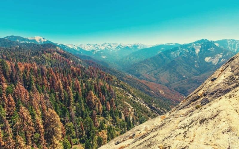
9. Buena Vista Peak
Easily the most popular peak ascent in Kings Canyon National Park, the trail to Buena Vista Peak is the perfect short-day hike.
At just 2 miles round trip, the Buena Vista Peak trail is among the shortest day hikes with a view of Kings Canyon and Sequoia National Park. For this adventure, you’ll walk along a well-worn path that leads steadily upward to the summit.
Once at the summit, you can gaze out over the spectacular vistas of the Sierra Nevada and the nearby John Muir Trail. Then, when you’re done with your hike, you can head over to the Grant Grove Village to check out some of the massive giant sequoias, like the General Grant Tree.
- Type: Out-and-back
- Length: 2 miles (400ft ascent)
- Difficulty: Easy to moderate
- Access: Buena Vista Peak parking area on the Generals Highway
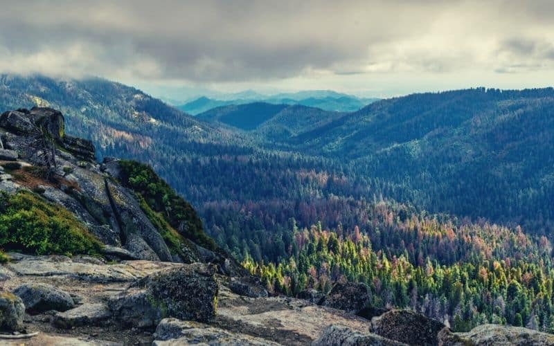
10. Big Baldy Ridge Trail
Providing one of the most iconic views of the High Sierra, the Big Baldy Ridge Trail should be at the top of every hiker’s to-do list.
Following a mostly casual trail with moderate elevation gain, this hike ventures along the Big Baldy Ridge to a lookout with sweeping views of the valley below. During the summer months, this hike also boasts gorgeous wildflowers, which add to the beautiful scenery.
However, the Big Baldy Ridge Trail is also a great option for wintertime trekking. In fact, with a set of trekking poles and microspikes in hand, the ridge makes for one of the best viewpoints for hikers in the snow-covered Sierra.
If you still have energy left after climbing Big Baldy, there are plenty of other great hikes to check out, like nearby Buena Vista Peak. Or, if you want even more adventure, you can head down south and check out (on Highway 198) Sequoia National Park’s General Sherman Tree. The options are truly limitless!
- Type: Out-and-back
- Length: 4.4 miles (1,391ft ascent)
- Difficulty: Moderate
- Access: Big Baldy Ridge parking on Highway 198
11. Panoramic Point
If you’re looking for an easy, family-friendly hike to end the day or break yourself into things, take the 15-minute saunter up to Panoramic Point.
As the name suggests, the views from the apex of this hike are sublime, giving you a sweeping panorama from which you can spot Hume Lake and all the big peaks of the Sierras.
The elevation gain on this hike is a mere 100 feet, so it’s suitable for toddlers or parents carrying kids in a child carrier backpack.
- Type: Out-and-back
- Length: 0.5 miles
- Difficulty: Easy
- Access: Grant Grove Village
Kings Canyon Hiking: A World Of Adventure Awaits
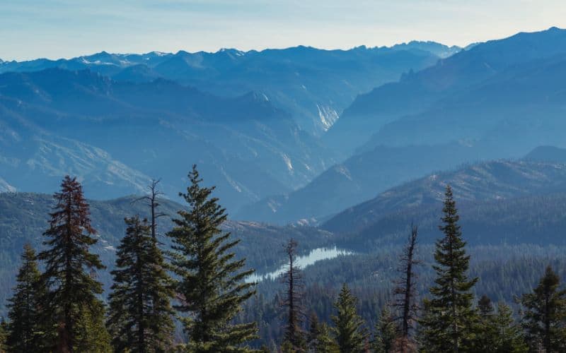
Out of all the national parks in the Sierra Nevada, Kings Canyon is a true hiker’s paradise. While it might not get as much fanfare on the international stage as nearby Yosemite National Park, the adventures you can have in Sequoia – Kings Canyon National Parks are second to none.
We hope that our guide to the best hikes in Kings Canyon National Park helped you discover your next hiking adventure. For more adventures you could check out the Alta peak Trail, Tokopah falls trail in Sequoia National Forest.
If you were lucky enough to hike any of these Kings Canyon trails on your last visit to the park, let us know in the comments below. Also, be sure to share this article with your friends to help them plan their next trip, too!
Save for later!!! ⤵️