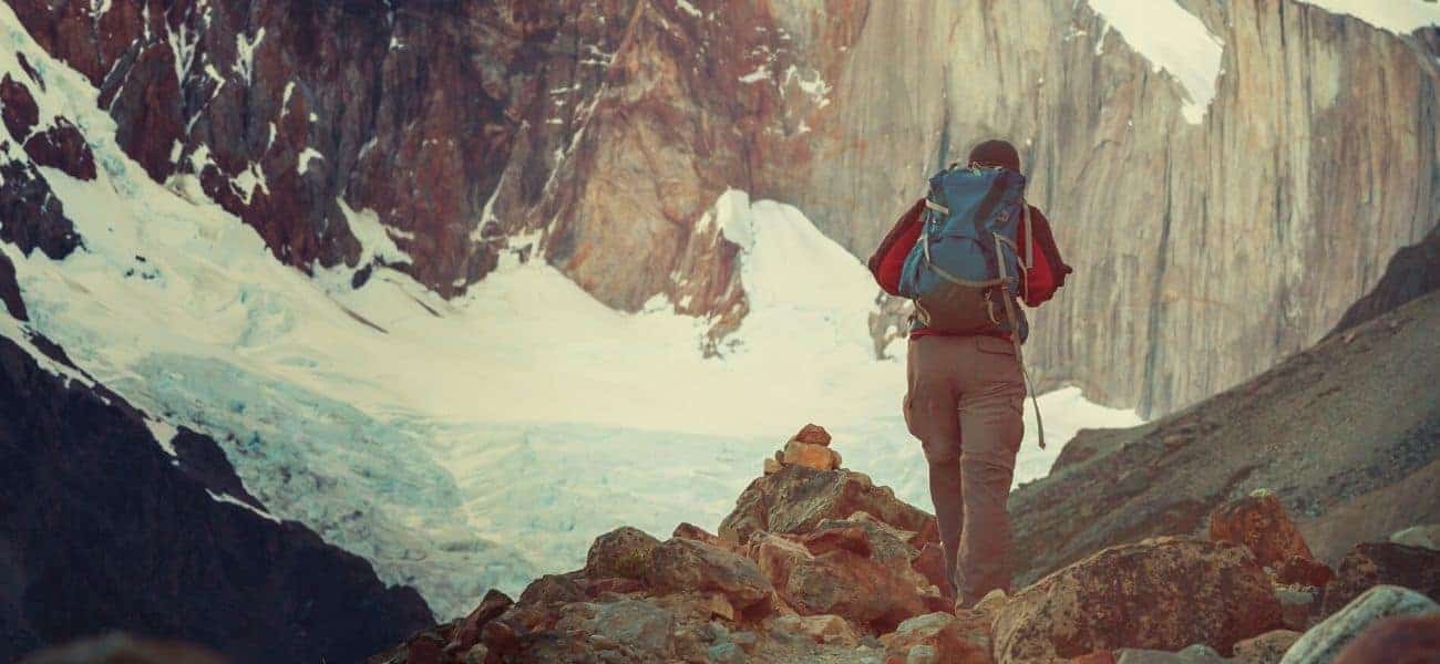
Before you choose where to go backpacking, there are a few things you need to know. This includes why route selection is important, all about the Triple Crown, and where you can find the best backpacking routes in the US and worldwide.
Why is route selection important when backpacking?
The main reasons why route selection is important when backpacking is that you need to find something suitable for your abilities and skills
What factors influence where you go backpacking?
The factors that might influence where you go backpacking are weather conditions, seasonal variations, distance, permits, wildlife, and costs.
How to choose backpacking route difficulty level?
The goal when choosing a backpacking route is to find a trail that provides enough challenge to make it interesting but one that’s not so challenging that you are incapable of finishing it or enjoying your time on it.
Do you need a backpacking permit?
You will need a backpacking trip to backpack in all national parks, in most state parks, and in many wilderness areas across the US.
Where to go for coastal backpacking?
Below, we’ve made a list of some of the best coastal backpacking routes.
- Lost Coast Trail, California
- North Country National Scenic Trail/Lakeshore Trail, Michigan
- Fairy Head Loop Trail, Maine
- Oregon Coast Trail
- Coast Trail, Point Reyes National Seashore, California
- Kalalau Trail, Kauai, Hawaii
- Coastal Prairie Trail, Everglades National Park, Florida
- South West Coast Path, England
- Blue Trail, Cinque Terre, Italy
- West Coast Trail, Canada
- East Coast Trail, Canada
- Abel Tasman Track, New Zealand
- Te Araroa Trail, New Zealand
- The Great Ocean Walk, Australia
- Wales Coast Path, Wales
- The Skye Trail, Scotland
Where to go for forest backpacking?
Some of the best forest backpacking destinations are listed below.
- Mt. Baker-Snoqualmie National Forest
- Sierra National Forest, California
- Pinchot State Forest, Pennsylvania
- Sequoia and Kings Canyon NP, California
- George Washington and Jefferson National Forests, Kentucky & West Virginia
- Green Mountain National Forest, Vermont
- White Mountain National Forest, Maine
- Pisgah National Forest, North Carolina
- Shawnee National Forest, Illinois
Where to go for canyon backpacking?
The best states for canyon backpacking are the canyon-risch southwestern states of Arizona, Utah, Nevada, and Colorado, though there are plenty to be found in states like California, Oregon, Texas, and Georgia.
Where to go for mountain backpacking?
Some of the best places to go for mountain backpacking include the Sierra Nevada, the White Mountains, Rocky Mountain National Park, Grand Teton National Park, Mt Rainier NationalPark, Olympic National Park, the Blue Ridge Mountains, the Italian Dolomites, the French and Swiss Alps, the Himalaya, the Andes, the Cordillera Blanca, and the Cordillera Huayhuash.
Which state is most popular with backpackers?
California, Colorado, and Utah are the three most popular states for backpacking.
Which state is least popular with backpackers?
The least popular states for backpacking are central states Iowa, Kansas, and Nebraska.
What is the ‘Triple Crown’ in backpacking?
In backpacking, the ‘Triple Crown’ refers to the three longest and most coveted thru-hiking trails, the Continental Divide Trail (CDT), the Pacific Crest Trail (PCT), and the Appalachian Trail (AT).
Where does the Appalachian Trail start and end?
The Appalachian Trail begins at Springer Mountain, Georgia, and ends at Mt. Katahdin, Maine.
How long to backpack the entire Appalachian Trail?
Most backpackers take 5 to 7 months to backpack the Appalachian Trail from end to end.
What states does the Appalachian Trail pass through?
The Appalachian Trail passes through Maine, New Hampshire, Vermont, Massachusetts, Connecticut, New York, New Jersey, Pennsylvania, Maryland, West Virginia, Virginia, Tennessee, North Carolina, and Georgia.
What points of interest are on the Appalachian Trail?
The following is a list of points of interest on the AT.
- Blood Mountain Battleground, Georgia
- Helen, Georgia (an AT community)
- Hiker Hostel, Dahlonega, GA
- The Appalachian Trail Cafe, Millinocket, ME
- Appalachian Trail Visitors Center, Monson
- 100-Mile Wilderness, Maine
- Millinocket, Maine’s Appalachian Trail Cafe
- Monson, Maine
- Mount Katahdin, Baxter State Park, Maine
- Mt. Greylock War Memorial Tower, Massachusetts
- Famous Places on the Appalachian Trail in New Hampshire
- Appalachian Mountain Club’s Visitor Center, Pinkham Notch, New Hampshire
- High Point State Park, New York
- Chimney Rock, North Carolina
- Hot Springs, North Carolina
- Appalachian Trail Museum, Pine Grove Furnace Park, Pennsylvania
- Damascus, Virginia (an AT community)
- Walton’s Mountain Museum, Virginia
- Waynesboro, Virginia (and AT community)
- Wood’s Hole Hostel, Virginia
- Appalachian Trail Conservancy’s Headquarters in Harpers Ferry, WV
What are popular sections on the Appalachian Trail?
The following are some of the most popular section hikes on the AT.
- The 100-Mile Wilderness, Maine
- Anthony’s Nose, New York
- Port Clinton to Lehigh Gap, PA
- Pinkham Notch to the Androscoggin River, White Mountains
- Shenandoah National Park, Virginia
- Virginia Grayson Highlands, Virginia
- The Roan Highlands, Tennessee and NC
Where does the Pacific Crest Trail start and end?
The Pacific Crest Trail begins near the village of Campo at the Mexican border and ends at the Northern Terminus monument at the Canadian border.
How long to backpack the entire Pacific Crest Trail?
Most backpackers take 5 or 6 months to hike the PCT from end to end.
What states does the Pacific Crest Trail pass through?
The PCT passes through California, Oregon, and Washington.
What points of interest are on the Pacific Crest Trail?
The list below includes some must-see points of interest on the PCT.
- Foster Point, Mount Laguna.
- Mount San Jacinto
- Mount Baden Powell
- Forester Pass
- Lake Tahoe
- Goat Rocks Wilderness
- Bishop Pass.
- Senora Pass.
- Hat Creek Rim
- Desolation Wilderness
- Castle Crags.
- Three Sister Wilderness
What are popular sections on the Pacific Crest Trail?
The most popular sections of the PCT are the Goat Rocks Wilderness, Sierra Buttes, Laguna Mountain, Mount San Jacinto, the Mojave Desert, and Deadfall Lakes and Mount Eddy.
Where does the Continental Divide Trail start and end?
The CDT begins on the Mexican border at Crazy Cook is in Lordsburg, New Mexico and ends at Waterton Park, which is actually 4 miles over the Canadian border.
How long to backpack the entire Continental Divide Trail?
Most backpackers take 5 or 6 months to hike the CDT from end to end.
What states does the Continental Divide Trail pass through?
The CDT passes through New Mexico, Colorado, Wyoming, Idaho, and Montana.
What points of interest are on the Continental Divide Trail?
The list below includes some must-see points of interest on the CDT.
- Crazy Cook Monument (the CDT begins here!)
- Pie Town, NM
- Ghost Ranch, NM
- Cumbres and Toltec Scenic Railroad, CO
- Salida (resupply town), CO
- Grays Peak (the highest summit on the CDT), CO
- Great Divide Basin, WY
- Cirque of the Towers, WY
- Yellowstone NP, WY
- Chief Joseph Pass, ID/WY
- Chinese Wall, Bob Marshall Wilderness, MT
- Glacier National Park, MT
What are popular sections on the Continental Divide Trail?
The most popular sections on the CDT are Glacier National Park (MT), San Pedro Parks Wilderness (NM), Weminuche Wilderness (CO), Cataract Lake (CO), and Chinese Wall (MT).
What are popular US state backpacking routes?
Listed below are the ten most popular backpacking routes in the US.
- John Muir Trail
- Appalachian Trail
- Skyline Trail Loop, Mt. Rainier NP
- Alum Cave Trail to Mt. LeConte, Great Smoky Mountains NP
- Sky Pond Via Glacier Gorge Trail, Rocky Mountain NP
- Bright Angel Trail, Grand Canyon NP
- Wonderland Trail, Mt. Rainier NP
- The Narrows, Zion NP
- Enchanted Valley, Olympic NP
- Half Dome, Yosemite NP
Where does the John Muir Trail start and end?
The John Muir Trail begins at Happy Isles in Yosemite National Park and ends on the peak of Mount Whitney.
How long is the John Muir Trail?
The John Muir Trail measures 211 miles from end to end.
How difficult is the John Muir Trail?
What points of interest are on the John Muir Trail?
The John Muir Trail is considered a challenging route, mainly because the trail is almost entirely above 8,000 feet.
Where does the Lost Coast Trail start and end?
The Lost Coast Trail begins at Mattole and ends at Black Sands Beach.
How long is the Lost Coast Trail?
The Lost Coast Trail measures 24.6 miles from end to end.
How difficult is the Lost Coast Trail?
The Lost Coast Trail is generally considered to be moderately challenging.
What points of interest are on the Lost Coast Trail?
The most notable points of interest on the Lost Coast Trail are the Punta Gorda Lighthouse, Sea Lion Gulch Camp, Spanish Creek, Big Flat, and Buck Creek.
Where is Rae Lakes Loop?
The stunning Rae Lakes Loop is located in Sequoia and Kings Canyon NP, California.
How long is Rae Lakes Loop?
Rae Lakes Loop measures 41.4 miles long.
How difficult is Rae Lakes Loop?
Rae Lakes Loop is generally considered to be moderately challenging.
What points of interest are on Rae Lakes Loop?
The main points of interest on Rae Lakes Loop are Kings River and Bubbs Creek, Mist Falls, and Paradise Valley.
Where does the High Sierra Trail start and end?
The High Sierra Trail begins at Crescent Meadow and ends at Whitney Portal in the Eastern Sierra.
How long is the High Sierra Trail?
The HST measures 71 miles from end to end.
How difficult is the High Sierra Trail?
The HST is generally considered to be challenging and strenuous due to the elevation, elevation gain, the ruggedness of the trail, and the absence of resupply points.
What points of interest are on the High Sierra Trail?
The highlights of the HST include Mount Whitney, Precipice Lake, Bearpaw Meadow High Sierra Camp, Lone Pine Creek Canyon, Kaweah Gap, Hamilton Lake, and Valhalla.
Where is Pemi Loop?
The Pemi Loop Trail is located in Pemigewasset Wilderness, New Hampshire.
How long is Pemi Loop?
The Pemi Loop Trail is 31.5 miles long.
How difficult is Pemi Loop?
The Pemi Loop is generally considered to be challenging, mainly due to the ruggedness of the trail and steep climbing.
What points of interest are on Pemi Loop?
The main highlights on the Pemi Loop are Franconia Falls, Mt. Bond Summit, North Twin Summit, and Liberty Summit.
Where does the Hoh River Trail start and end?
The Hoh River Trail begins at the Visitor Centre and ends at Glacier Meadows.
How long is the Hoh River Trail?
The Hoh River Trail is 17.4 miles long.
How difficult is the Hoh River Trail?
The Hoh River Trail is well maintained and generally considered moderate.
What points of interest are on the Hoh River Trail?
The main points of interest on the Hoh River Trail are the views of Mount Olympus (various points along the trail) and Blue Glacier.
Where is the Manistee River Trail?
The Manistee River Trail is located near Mesick, Michigan.
How long is the Manistee River Trail?
The Manistee River Trail is 19-23 miles long (depending on which route you take).
How difficult is the Manistee River Trail?
The Manistee River Trail is generally considered to be moderately challenging.
What points of interest are on the Manistee River Trail?
The main highlights on the Manistee River Trail are the ‘Little Mac’ suspension bridge, Red Hill Lookout and, of course, the River itself.
Where is Paria Canyon?
The geological wonderland that is Paria Canyon is located in the Paria Canyon-Vermilion Cliffs Wilderness on the Arizona/Utah border.
What points of interest are there in Paria Canyon?
The main points of interest in Paria Canyon are The Wave and Buckskin Gulch.
Where does the Ice Age Trail start and end?
The Ice Age Trail begins in Interstate State Park in Polk County in northwestern Wisconsin and ends on Potawatomi State Park in Door County.
What points of interest are on the Ice Age Trail?
The main points of interest on the Ice Age Trail are Devil’s Lake, Kettle Moraine, Straight Lake, Point Beach State Forest, and Gibraltar Rock.
What are popular international backpacking routes?
Below is a list of some of the most popular backpacking routes worldwide.
- Camino de Santiago, France/Spain
- West Highland Way, Scotland
- Haute Route, Switzerland and France
- Alta Via 1 & 2, Italy,
- Te Araroa, New Zealand
- Everest Base Camp, Nepal
- Annapurna Circuit, Nepal
- Machu Picchu, Peru
- The “O” Circuit, Torres del Paine, Chile
- Cordillera Huayhuash, Peru
Where does the Camino de Santiago start and end?
The Camino de Santiago begins at Saint Jean Pied de Port in France and ends at the Cathedral of Santiago de Compostela in Galicia, Spain.
How long to backpack the Camino de Santiago?
The Camino de Santiago takes most backpackers 30 days to complete.
How difficult is the Camino de Santiago?
The Camino de Santiago is generally considered to be moderately challenging.
What points of interest are on the Camino de Santiago?
The main points of interest on the Camino de Santiago are the Cathedral of Santiago de Compostela, Pamplona, Sierra del Perdón, Puente de la Reina, Catedral de Santa María de Burgos, and Real Colegiata de San Isidoro.
Where does the West Highland Way start and end?
The West Highland Way begins on Douglas Street in the town Milngavie and finishes in Gordon Square in Fort William.
How long to backpack the West Highland Way?
It takes most hikers 6–8 days to complete the West Highland Way.
How difficult is the West Highland Way?
The West Highland Way is generally considered to be fairly challenging.
What points of interest are on the West Highland Way?
The main highlights on the West Highland Way are The Devil’s Staircase, Glengoyne Distillery , the Falls of Falloch, and the Buachaille Etive Mor.
What to know before choosing which state to go backpacking in next?
The most important things to know before choosing which state to go backpacking in are permit regulations, weather conditions, what wildlife you might encounter, and how much it will cost to travel there and back.
What landscapes to expect backpacking in Hawaii?
In Hawaii, backpackers can expect everything from beautiful beaches and lush rainforests to volcanic mountains.
What are recommended backpacking routes in Hawaii?
The top backpacking trails in Hawaii include Hanakapi’ai Beach via the Kalalau Trail, Waimanu Valley, the Na Pali Coast (Kalalau) Trail, and the Napau Crater via Napau Trail.
What landscapes to expect backpacking in Michigan?
In Michigan, backpackers can enjoy a variety of landscapes, including lakeshores, river trails, and old-growth forest trails.
What are recommended backpacking routes in Michigan?
The best backpacking routes in Michigan are the North Country National Scenic Trail, Superior Hiking Trail, Kekekabic Trail, and the Border Route Trail.
What landscapes to expect backpacking in Arkansas?
In Arkansas, backpackers can enjoy scenic mountain views, waterfalls, rivers, unique rock formations, and stunning old-growth forests.
What are recommended backpacking routes in Arkansas?
The best backpacking routes in Arkansas are Cane Creek Lake Trail, Butterfield Trail (Devil’s Den State Park), the Womble Trail, and the Lake Ouachita Vista Trail.
What landscapes to expect backpacking in Colorado?
In Colorado, backpackers can experience everything from towering mountains, alpine tundra and glaciers to dune-covered desert, sprawling forests, and alpine lakes.
What are recommended backpacking routes in Colorado?
The best backpacking routes in Colorado include Crater Lake, the Lost Creek Wilderness Loop, the Blue Lakes Trail, the Four Pass Loop, the Colorado Trail, Sky Pond, and Longs Peak.