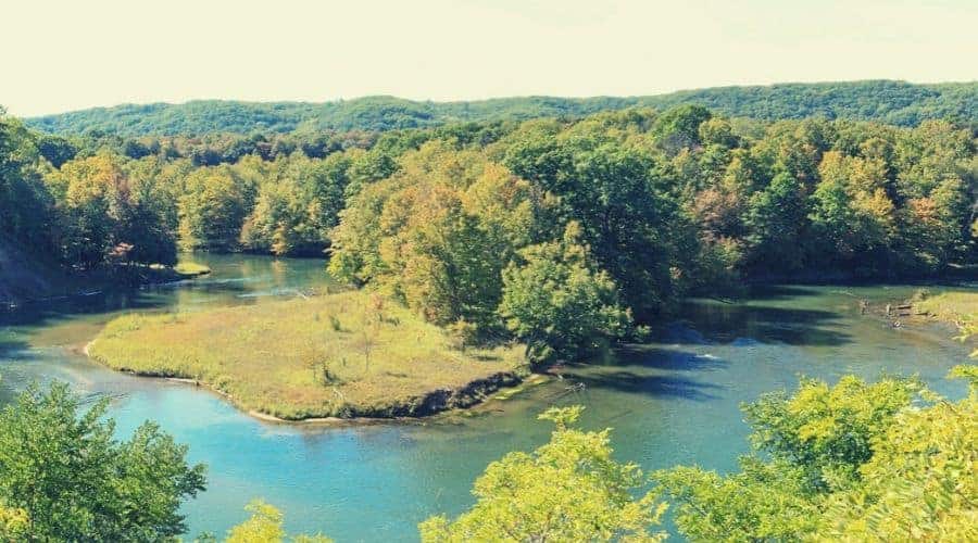
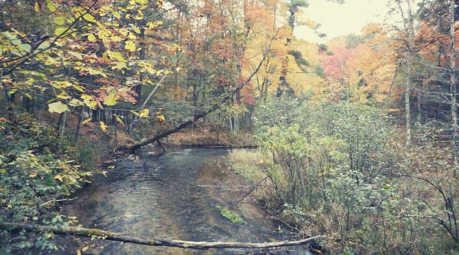
As an intro to overnighting in the wild, they don’t come much better than this loop trail along Manistee River. This very mellow and moderate trail wends gently through and around towering hardwood forest, reedy wetlands, creeks, delectable streams and waterfalls, and also features a wealth of scenic viewpoints that will have lovers of all things green and glorious rejoice.
Oh, and then there’s the river itself, which, we should add, is a bit of a looker too…
Whether done over a weekend or stomped with a single overnight stop, the trail is among, if not the best backpacking trail in Michigan’s Lower Peninsula.
This is a very popular trail, meaning you’re unlikely to have it all to yourself, but the scenery is such that most visitors — even the most crowd-averse — will find themselves unmoved by the presence of other trekking traffic and lapping up the splendor of their surroundings instead.
In this article, we’re going to run you through all the ins and outs of the hike, offering a few insights into the history of the area as well as tips for pre-trip planning and a thorough, start-to-finish trail description.
Table of Contents
Introduction
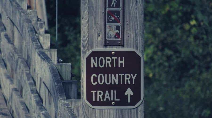
The North Country Trail system is no stranger to gushing praise. One of the undoubted highlights of this soon-to-be 4600-mile beast, however, comes in the form of a slight but altogether sumptuous diversion comprised in the Manistee River Loop — a fairly new addition to the Huron-Manistee National Forest’s network of trails which has quickly become one of the most popular hikes in the state despite its relative youth.
RELATED READING: Check out our guides to more Michigan hiking trails.
History & Ecology of the Area
History
The North County Trail (which flanks the west side of the Manistee River on our featured loop), was created in 1980 thanks to a revision of existing legislation in the National Trails System Act. On the Manistee River’s east side, a coarse, rudimentary trail used by fishermen was developed into what is today the Manistee River Loop in 1992.
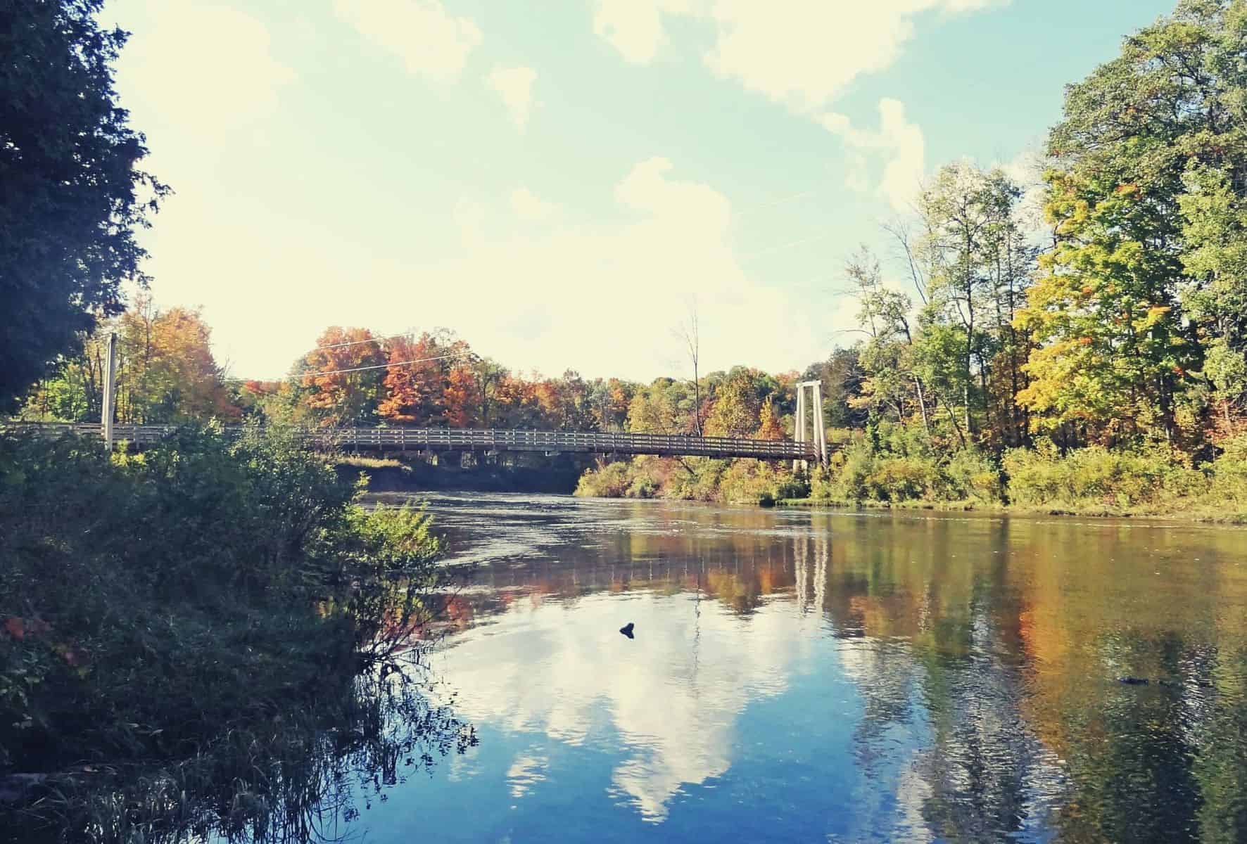
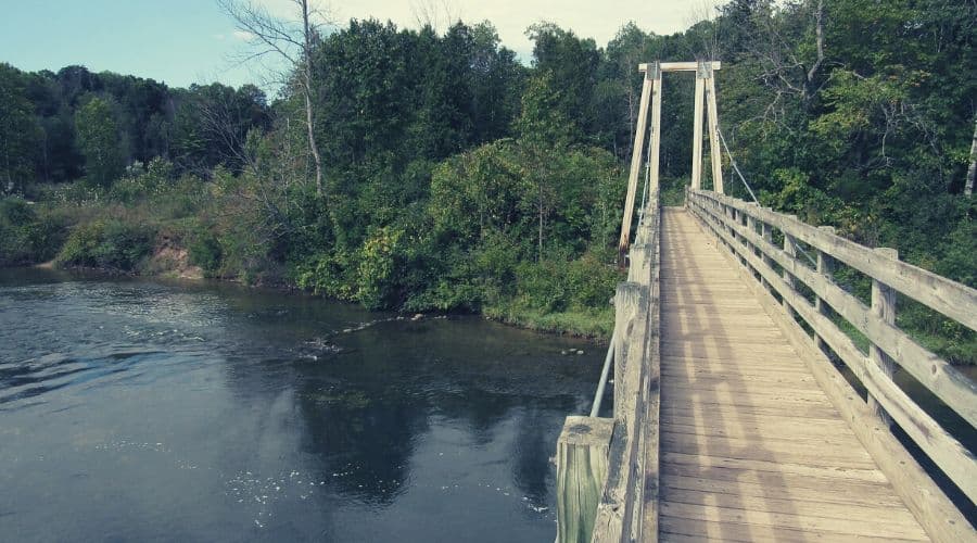
Four years later, the two trail segments were connected following the construction of the suspension bridge at the Manistee River Trailhead, making the 20-mile loop (minus the 3-mile extension to Seaton Creek Campground) that exists today and saving hikers the hassle of leaving a second car at the end of the trail in order to return to their starting point.
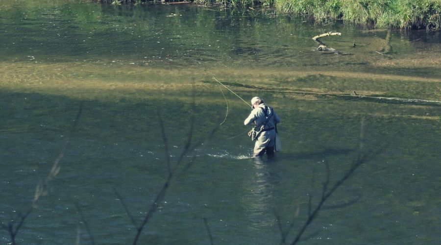
Ecology and Wildlife
The MRT and NCT both play host to a very wide array of flora, fauna, and old-growth perennials. Some of these include the following: oak, cedar, white pine, lodgepole pine, downy rattlesnake plantain (Goodyera pubescens), woodland sunflowers, fungi galore, bobcats, raccoons, black bears, deer, and the pileated woodpecker.

Trail Type & Difficulty
The trail is a loop, beginning/ending at one of four trailheads.
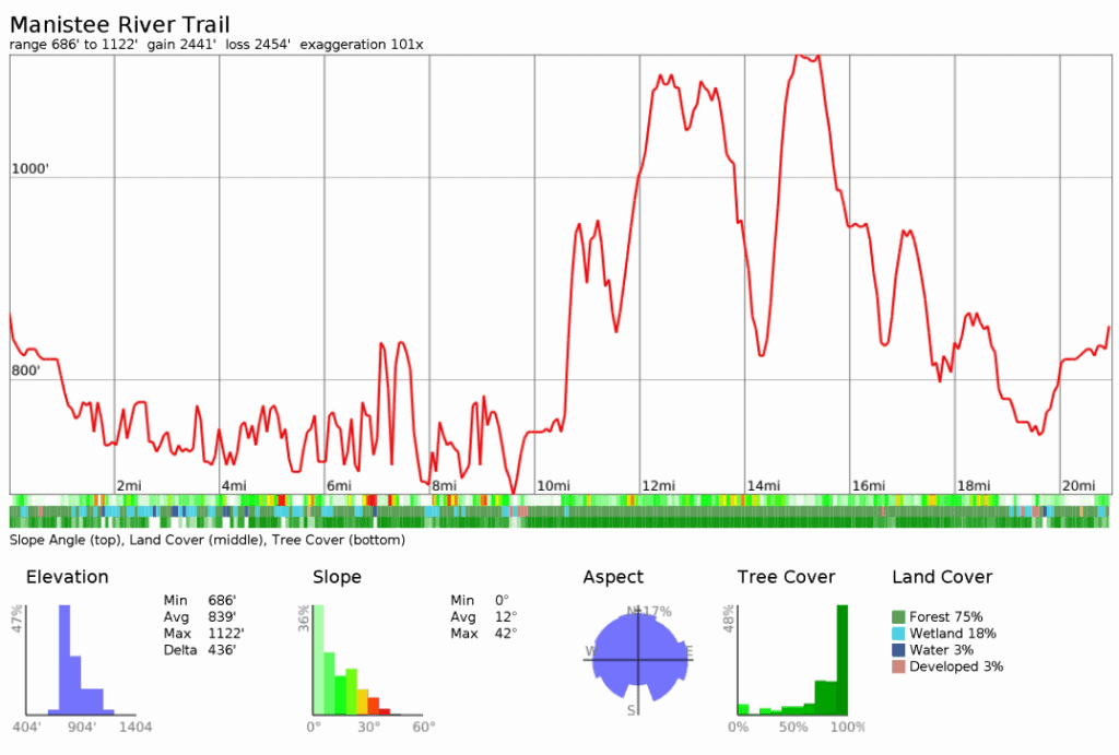
It’s an easy-moderate hike: the trail covers just over 23 miles and has 2,600ft of total ascent. Although not groomed, the trail is well-trodden, never too steep, and offers easy walking from start to finish.
Planning
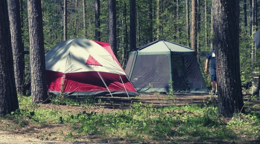
Planning your hike on the Manistee River Loop is fairly straightforward. That said, you should be prepared to be entirely self-sufficient for the duration of your hike as facilities are limited and no opportunities to restock on supplies (unless leaving the trail on a sizable diversion).
As mentioned below, camping at the Red Bridge River campground is on a first-come, first-served basis, but those planning to camp at Seaton Creek can make reservations in advance.
For those planning to skip the established campgrounds, you can save on pack weight by leaving cooking fuel and stoves at home and instead make use of the fire rings and grills in situ at the various backcountry camping sites dotted along the MRT.
While we’re all for winging it and choosing camping spots spontaneously, on this hike it’s a good idea to have a few potential camping locations in mind before arriving. This way you can make sure you maximize your time at the best viewpoints and have a ‘Plan B’ in place if any of the backcountry sites happen to be full.
Though many variations are possible, we’d recommend making your first camp at one of the sites between the 1 and 3-mile markers south of Seaton Creek, and then your second camp at the Red Hill Lookout, thereby leaving a 9.5-mile walk back to Seaton Creek on your final day.
Best Time to Hike the Manistee river Trail
The MRT Loop is doable year-round but can become a touch busy in peak season (June-September). Summer visitors should be prepared for high temperatures (over 90F) and relatively busy trails; winter visitors should expect very cold temperatures (as low as 5F at night) and travel by snowshoes or cross-country skis only.
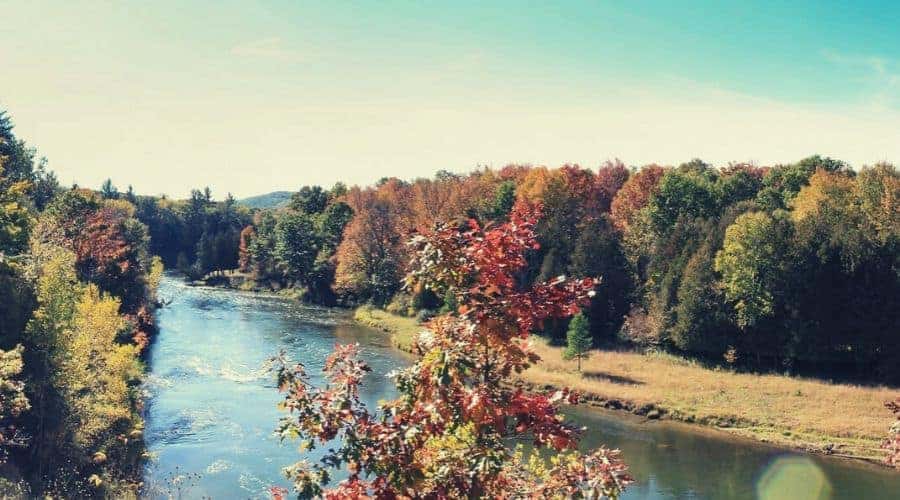
The ideal time to visit is in shoulder/bridge months such as April or October, when temps are cool at night but generally ideal for hiking throughout the day. During these periods, moreover, the trails tend to be pleasantly quiet. In the fall in particular the forest tends to put on something of a visual extravaganza, with the canopy transforming into a sea of scarlet, gold, coral, and ochre.
Permits
A National Forest vehicle permit is not required to park at the trailheads at Red Bridge or Upper River Road. At Seaton Creek Campground and the Marilla Trailhead, however, visitors must pay a $6 daily fee at the self-registration station. No permit is required to camp at the free primitive campsites spread along the MRT.
Trailheads
Other Michigan Trips
Despite being one of the least visited national parks, Isle Royale is probably the most Revisited! Find out about this under-appreciated gem with Gear Signals in-depth guide on Everything you need to know about Isle Royale.
There are four main trailheads for the Manistee River Loop Trail. Of these four trailheads, only the Manistee River Trailhead and Red Bridge River Access Trailhead offer camping facilities nearby.
- The Manistee River Trailhead can be found 1.4 miles from the Seaton Creek Campground at the end of McClish Road. To reach the campground, travel south on M-37 for 4.5 miles, then turn right and travel west on 26 Mile Road for a further 3 miles. At the fork in the road, veer right and travel north on FR 5993 for 0.4 miles to the campground. From the campground, head northwest on the MRT access trail for 1.4 miles to the trailhead.
- The Marilla Trailhead lies just southwest of Hodenpyl Dam Pond. From Manistee, drive north on Highway 31 for 16 miles and then turn right onto 9 Mile Road. Drive east on 9 Mile Road until reaching Marilla Road, then turn left, continue for half a mile, and then turn right onto Beers Road. The trailhead is on the left after 2 miles. Parking is $6 per day or $15 per week.
- Red Bridge River Access Trailhead: From Manistee, drive east on M-55 for 15 miles, then turn left and travel north on High Bridge Rd. for 6 miles before turning right and traveling east on N Coates Hwy. for 8 miles. From the campsite, head northwest on the (slightly steep) access trail to join the North Country Trail.
- The Upper River Rd. Trailhead: One mile before the Red Bridge River Access trailhead (approaching from the west), turn left onto Upper River Road. The trailhead is on the left after roughly 400 yards.
Shuttle/Transportation
No public transport currently serves any of the trailheads.
Trail Routes
The following route description assumes that you will be hiking the Manistee River Loop over 2 and a half days and starting at Seaton Creek Campground.
Day One
After arriving at Seaton Creek Campground, head northwest for 1.4 miles toward the suspension footbridge and the Manistee River Trailhead. From here, head south and continue downstream, passing the first of the designated backcountry campsites after a little over a mile.
Just past the three-mile mark, you will come to another cluster of primitive campsites and a large waterfall — the ideal spot to spend the night!
Day Two
Continue hiking southwest through spotted clearings in the oak and pinewood forest, wending over dunes and bluffs along a ridge that offers great views of the river below.
After roughly 9 miles (from the trailhead) you will reach the Red Bridge Campsite, where there are picnic tables, toilets, and drinking water. We’d recommend stocking up on water at this point as the next reliable source is some 10 miles along the trail!
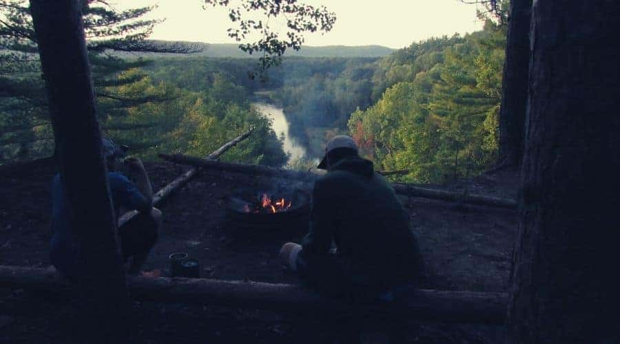
From Red Bridge River Access, follow the North Country Trail access trail up a steep ridge to the start of the NCT proper. Now turning north, the first notable feature encountered is the Red Hill Lookout Point (11.5 miles from the trailhead). This site offers awesome views back across the river and the Huron-Manistee National Forest and is also relatively quiet on account of being slightly off the main trail.
Day Three
Continue north on the NCT for an additional 8.5 miles from the Red Hill Lookout until you reach the intersection of the MRT and NCT at the suspension bridge. From here, take up the access trail to return to Seaton Creek Campground.
Campsites
More than 20 backcountry campsites and established campgrounds dot the trail, as seen in this map from the USDA Forest Service.
Established Sites With Facilities
- Seaton Creek Campground: By far the largest campground on the loop and also the richest facility-wise: it has seventeen family sites, two group sites, and facilities include drinking water, restrooms, trash collection, parking, campfire rings, grills, and picnic tables. Pets are allowed. Open May-October.
- Red Bridge River Access: With only four sites, you’ll have to arrive early to ensure a spot at the Red Bridge camping area: sites are allotted on a first-come, first-served basis and no booking is available. Open year round.
- Government Landing: Situated next to Red Bridge River Access site, Government Landing is also a first-come, first-served campsite and offers only 3 sites and 7 parking spaces.
Alternatively, scoot a little off-trail, away from the river, and get down to some 100%-pure wild camping! Dispersed camping is allowed on both trails as long as tents are 200 feet from any source of water and 100 feet from the trail.
Other Sites
On the MRT
On the east side of the Manistee River, dotted along the MRT between Seaton Campground and Red Bridge River Access, there are a number of rustic but designated campsites with very basic facilities such as picnic tables, fire pits, grills, or even just a cleared space to pitch your tent. Frill-free is the name of the game. These sites are normally much quieter than the established campsites, offer better views, and — best of all — don’t cost a penny!
On the NCT
On the west side of the river, many choose to set up camp at Eddington Creek or at the confluence of the small streams around Sheep Ranch Road. Both are quiet spots with access to drinking water from the streams. Another popular place to pitch up is at the Red Hill Lookout point, but to camp here you’ll need to carry all your water for the night from the Red Bridge River Access site as there is no water source in the vicinity.
Suggested Gear List
We’ve put together a short list of suggested gear, for a more in-depth discussion on what to pack for a backpacking trip then check out our Backpacking Checklist Guide.
Camping Kit
- Tent (including rain fly)
- Bug net if tarp or hammock-camping
- Sleeping bag
- Sleeping pad
- Stove and fuel (optional if using fire pits at established or backcountry campgrounds)
- Cooking utensils, cutlery, pots
Personal
Good to Know
- In winter, the trail can be done on cross-country-skis or snowshoes
- Dogs are allowed but must be kept on a leash on both trails (MRT and NCT)
- Phone reception in the Huron-Manistee National Forest is spotty at best, and non-existent at worst (best?)
- Sometime soon the NCT may well be linked to the Appalachian Trail, thus making a single long-distance track that would be the longest in the US
Resources
- Link to a downloadable trail map
- The phone number for the Manistee Ranger Station is 231-723-2211
- For accommodation in the area, contact the Manistee County Convention & Visitors Bureau on 877-626-4783 or the Traverse City Convention & Visitors Bureau on 800-872-8377
