Ranging from succulent-filled deserts to snow-covered peaks to the deep blue Pacific, there’s no denying that the Golden State has environmental diversity unlike any other in the United States.
Cali also has a wealth of awesome hiking trails that cater to the tastes and ability levels of all hikers. Whether it’s taking in the endless ocean views along the Big Sur coastline or climbing the Half Dome cables in Yosemite, there’s fun to be had for everyone!
In this guide, we’ll cover the state’s most incredible trails. We’ll also share each hike’s main attractions, parking info, difficulty, and length so you’ll be all set for your adventures.
Table of Contents
- 1. Half Dome
- 2. Yosemite Falls Trail
- 3. Lost Coast Trail
- 4. Lost Palms Oasis Trail, Joshua Tree National Park
- 5. Boy Scout Tree Trail
- 6. John Muir Trail (Pacific Crest Trail)
- 7. Gray Butte Trail
- 8. Mist Trail
- 9. Rubicon Trail, Lake Tahoe
- 10. Sea Lion Point Trail
- 11. Solstice Canyon Trail
- 12. Fern Canyon Trail
- 13. Sandstone Peak, Santa Monica Mountains
- 14. Mount San Antonio
- 15. Tahoe Rim Trail
- 16. Lands End Trail, San Francisco
- 17. Panorama Trail, Bluffs Trail, and Ridge Trail
- Best Hikes in California: Happy Hiking!
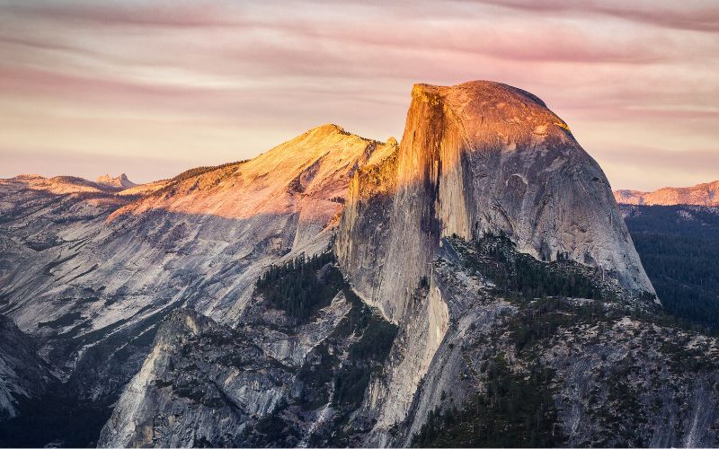
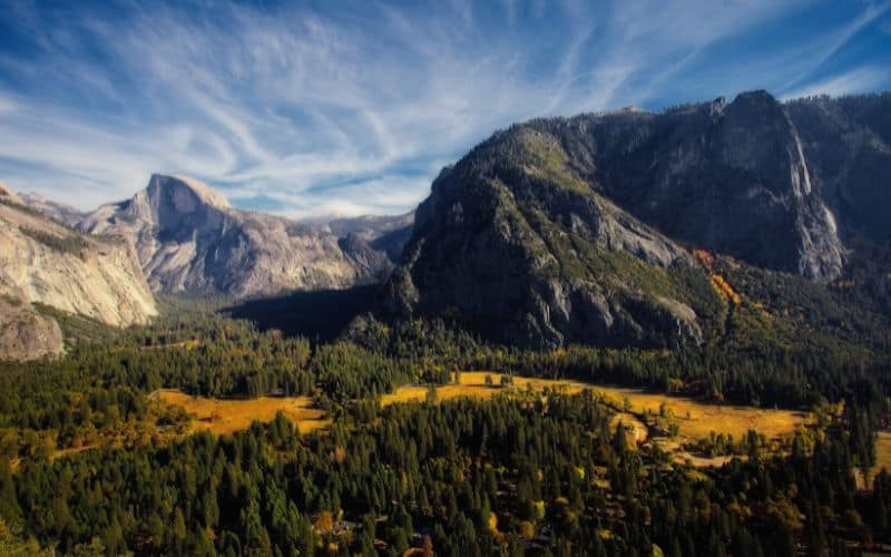
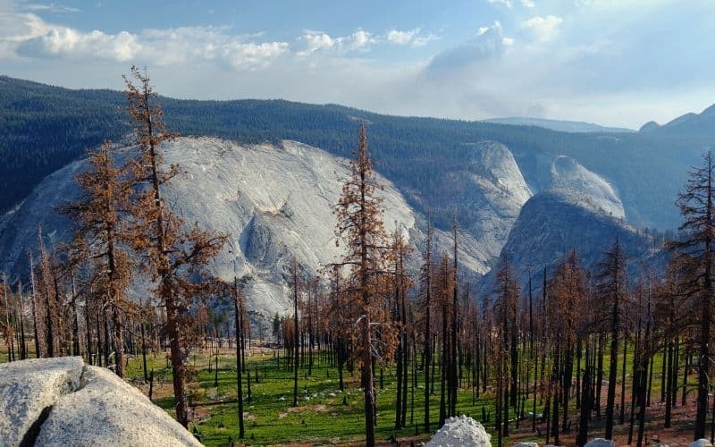
1. Half Dome
- Type: Out-and-back
- Difficulty: Strenuous
- Length: 16 miles
Half Dome is an iconic granite rock formation standing almost 5,000 feet above California’s Yosemite Valley. The Half Dome hike is considered by many as the most challenging, yet rewarding trail in Yosemite National Park.
The epic views of Vernal and Nevada Falls, Liberty Cap, Yosemite Valley, and the High Sierra make this one of our favorite hikes in the Golden State, if not the nation as a whole.
The majority of hikers take around 10 to 12 hours to complete the arduous 16-mile hike with 4,800 feet of elevation gain. This famous out-and-back trail is steep, strenuous, and not for the faint of heart.
The last 400 feet to reach Half Dome’s summit are ascended by using a series of cables. We recommend bringing gloves to get a good grip and protect your hands. The cables are taken down during the winter for safety reasons, so plan accordingly if you want to hike to the summit.
The best time to do the Half Dome day hike is from May to September. Most visitors take the shuttle to do this hike and jump off at the Happy Isles shuttle stop, but parking is available at the Mist Trail trailhead.
The Half Dome permit required for this hike is available as a lottery beginning in early March. This is one of the most popular hikes in Yosemite and getting a hiking permit is highly competitive.
2. Yosemite Falls Trail
- Type: Out-and-back
- Difficulty: Strenuous
- Length: 9 miles
The trail to the top of North America’s tallest waterfall is one of the finest treks in Yosemite National Park, and one the greatest in California. The impressive Yosemite Falls rises 2,425 feet from the valley floor. An intense climb leads to unforgettable views of the famous waterfall and also the entire Yosemite Valley and Merced River below.
The Yosemite Falls hike is a 9-mile trail made up of two sections: Columbia Rock Trail and Top of Yosemite Falls Trail. The total elevation gain on this hike is 3,700 feet.
The first part of the Yosemite Falls Trail, Columbia Rock Trail, is a moderate, 2-mile round-trip hike with a 1,000 feet elevation gain filled with switchbacks. Once you reach Columbia Rock, you’ll be rewarded with amazing views of Sentinel Rock, Half Dome, and Yosemite Valley. This section of the hike takes 2 to 3 hours round trip.
From there, it’s a strenuous, 7-mile round-trip hike up steep and rugged terrain to reach the top of the falls with a 2,700 feet elevation gain. This part of the trail usually takes people 6 to 8 hours to complete (round-trip).
The best time to visit the Yosemite Falls Trail is when the water flow is highest in the spring. To get to the Yosemite Falls trailhead, take the Valleywide shuttle in Yosemite National Park to stop #7 or park at the Camp 4 parking lot.
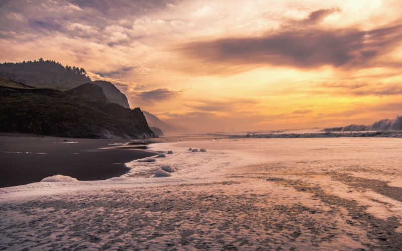
3. Lost Coast Trail
- Type: Out-and-back
- Difficulty: Strenuous
- Length: 34 miles
The memorable Lost Coast Trail winds along the King Range National Conservation Area’s coastal wilderness and offers a true California adventure.
This hike takes you through Northern California’s famed redwood forests for some awe-inspiring vistas of the Pacific Ocean. From elephant seals to eagles, the wildlife viewing opportunities here are incredible.
Two sections make up the Lost Coast Trail: a 25-mile-long section to the north and a 9-mile-long section to the south.
The northern trail begins at Mattole Beach and ends at Black Sands Beach. The hike itself is mostly level along the beach with some sections of boulders, tide pools, streams, and bluffs.
Some areas (from Sea Lion Gulch to Randall Creek and from Miller Flat to Gitchell Creek) may be impassable during high tide when the waves cover the beach completely. Be sure to check the tide chart and time your hike accordingly. The area north of Telegraph Creek is open for camping.
The southern trail is located in Sinkyone Wilderness State Park and extends from Hidden Valley to Needle Rock. Hiking amongst the coastal chaparral, you’ll see open meadows with wildflowers and towering redwood trees.
The entire Lost Coast Trail takes most hikers around 3 to 4 days to complete. Permits are required to camp overnight along both sides of the trail in the wilderness and state park.
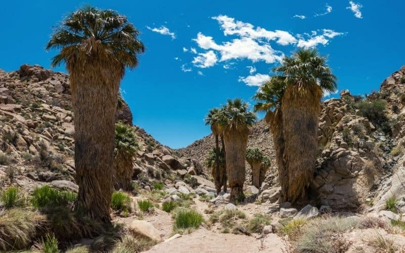
4. Lost Palms Oasis Trail, Joshua Tree National Park
- Type: Out-and-back
- Difficulty: Moderate
- Length: 7.5 miles
Joshua Tree National Park in Southern California offers a stark contrast to the lush forests found in the northern part of the state. The dry and desolate Mojave Desert is home to the area’s iconic Joshua Trees, giant boulders, and – surprisingly – a palm-filled oasis within Joshua Tree National Park.
The Lost Palms Oasis Trail is a 7.5-mile, moderately difficult trail meandering through sandy washes and down into a desert canyon scattered with California fan palms and spring water pools.
This trail only has a 500 feet elevation gain when climbing back out of the canyon, but the possibility of extreme heat can make it very challenging. Completing this hike usually takes about 3 to 4 hours.
The best time to visit is October through April, basically anytime except for the summer. Temperatures in the summer months in the Mojave Desert can reach over 110F, which means excessive sun exposure and dehydration are a very real danger at this time of year.
The trailhead is located in the Cottonwood Spring parking area, right next to Cottonwood Campground near the park’s southern entrance. You’ll find picnic tables, restrooms, and drinking water back at the campground.
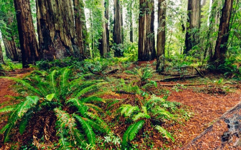
5. Boy Scout Tree Trail
- Type: Out-and-back
- Difficulty: Moderate
- Length: 5.5 miles
Located near the Oregon state border in Northern California, the Boy Scout Tree Trail is considered one of the best hikes in the Redwood National State Parks. This 5.5-mile long trail winds through an old-growth redwood forest and riparian zones in the Jedediah Smith Redwoods State Park, until it reaches the photogenic Fern Falls.
It’s a moderate trail with a mixture of easy sections accompanied by more challenging switchbacks and steep inclines. Most hikers take about 3 to 5 hours to complete the Boy Scout Tree Trail.
You’ll reach the Boy Scout Tree by taking a short trail about 2.5 miles in from the trailhead. The 2,000-year-old double redwood tree is named after the Boy Scout troop leader who discovered it.
This is the perfect trail if you are looking for a half-day hike to explore the giant redwood tree forest near Crescent City. The scenic drive to the trailhead is part of the appeal. The 2-mile-long, unpaved Howland Hill Road traverses the forest, ending at the trailhead in a redwood grove.
Parking at the Boy Scout Tree Trailhead is very limited, but there’s overflow parking along the dirt road.
6. John Muir Trail (Pacific Crest Trail)
- Type: Point-to-point
- Difficulty: Strenuous
- Length: 211 miles
The world-famous John Muir Trail is a 211-mile thru-hike that overlaps one of the best hikes in California, the Pacific Crest National Scenic Trail. The long-distance trail stretches across the remote wilderness from Yosemite Valley to Mount Whitney (14,496 feet), the highest point in the contiguous United States.
The hike traverses the majestic Sierra Nevada mountains via Yosemite National Park, John Muir Wilderness, Ansel Adams Wilderness, Kings Canyon National Park, and Sequoia National Park. This pristine area is considered by many to be the most scenic mountain landscape in the country.
The John Muir thru-hike typically takes hikers about 10 to 14 days to complete. But many hikers who are short on time opt to hike smaller sections of the trail instead.
There are decent re-supply shops along the trail at Tuolumne Meadows and Kearsarge Pass where you can get food and other supplies. Wilderness permits and bear canisters are required for this hike.
The ideal time to hike the John Muir Trail is in the warmer months from July through September.
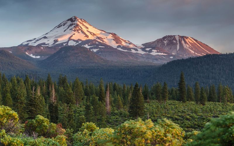
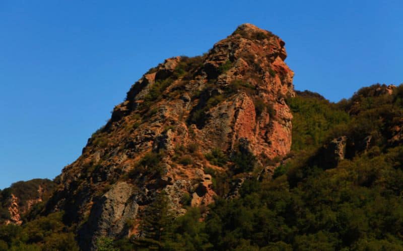
7. Gray Butte Trail
- Type: Out-and-back
- Difficulty: Moderate
- Length: 3.5 miles
Mount Shasta’s snow-covered peaks are a northern California landmark. At an elevation of 14,179 feet, this potentially active volcano in the Shasta-Trinity National Forest is the second-highest summit in the Cascade Range and the fifth-tallest summit in the state.
The Gray Butte Trail is one of Mount Shasta’s most popular hiking trails and has jaw-dropping views of the southern face of the mountain. This 3.5-mile moderate trail has 750 feet of elevation gain and typically takes hikers about three hours to complete.
The trailhead is located over 7,000 feet above sea level at Panther Meadows Campground. You’ll trek past Panther Meadows to old-growth red firs and mountain hemlock trees, and reach panoramic views of the Castle Crags, the Trinity Divide, and the Trinity Alps to the west and the Lassen Peak region of the Cascades to the southeast.
The best time to do this hike is late June to late October, when the weather is warmer and the trail is accessible.
8. Mist Trail
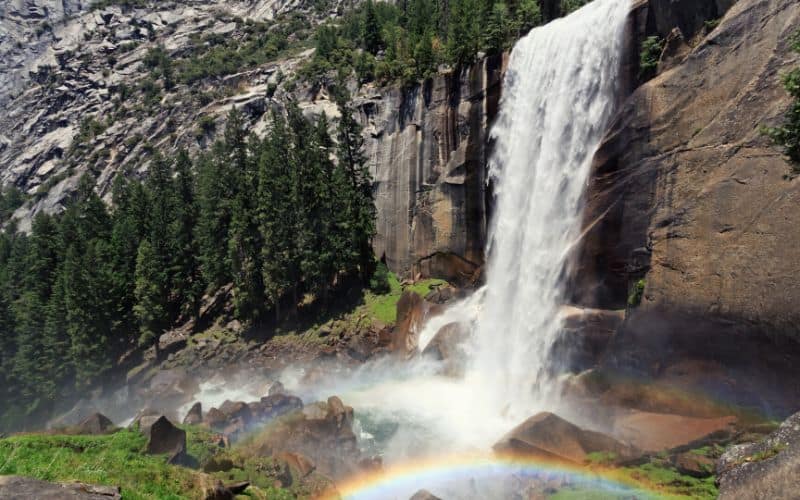
- Type: Out-and-back
- Difficulty: Moderate
- Length: 3 miles round-trip to Vernal Fall, 7 miles round-trip to Nevada Fall
Get covered in mist while walking along Yosemite National Park’s most popular hiking path, Mist Trail.
A trek along this bucket-list trail in eastern Yosemite Valley allows for up-close views of two spectacular waterfalls: the 317-foot Vernal Fall and the 594-foot Nevada Fall. Many hikers choose to take a combination of the Mist and John Muir trails to explore this area and some take the trail up to Half Dome.
Mist Trail is paved for the first mile and leads up to the Vernal Fall Footbridge, this is also the busiest part of the trail. If you’re visiting during the spring, the water levels might be high enough to catch a glance at Illilouette Fall from this section of the trail.
Continue on Mist Trail and up more than 600 granite steps to reach the top of Vernal Fall.
Following the Mist Trail will take you past Emerald Pool and Silver Apron to the top of Nevada Fall via rugged switchbacks. Take the footbridge across the Merced River to get a close-up view of the waterfall before heading back down or continuing to Half Dome.
The best time to visit the falls is in the spring when the water flow is at its highest. To get to the Mist Trail trailhead, take the Yosemite Valleywide or East Valley shuttles to shuttle stop #16 at Happy Isles. Curry Village (less than 1 mile away) has the closest parking lot because parking is not permitted at the trailhead.
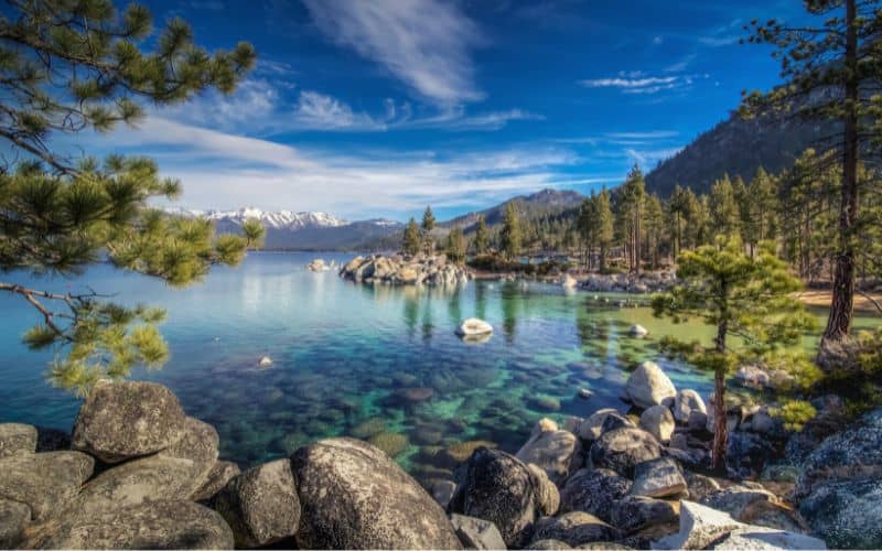
9. Rubicon Trail, Lake Tahoe
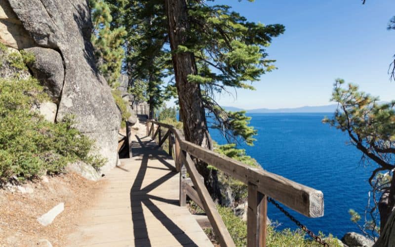
- Type: Out-and-back
- Difficulty: Moderate
- Length: 16 miles
The Rubicon Trail is a 16-mile, moderate hike along the southern lakeside cliffs of Lake Tahoe. This high-elevation lake in the Sierra Nevada mountains has multiple shades of blue and is the largest alpine lake in North America.
This hiking path stretches from D.L. Bliss State Park south towards the Vikingsholm Estate, a lakeside mansion built in the 1920s, but the hike can be completed in either direction. The trail reaches rocky viewpoints overlooking the tranquil lake and crosses through sandy coves along the shore.
The hike has three main trailheads: Rubicon Trailhead in D.L. Bliss State Park, Vikingsholm in Emerald Bay State Park, and the Eagle Point Campground in Emerald Bay.
Most visitors start the hike at the Rubicon Trailhead on the northern end of the trail or Vikingsholm near Emerald Bay to the south. It’s 4.6 miles from Rubicon Point to Vikingsholm, with a few miles more added to hike around Emerald Bay to the campground.
It typically takes hikers about 7 hours to complete this trek. The best time to hike the Rubicon Trail is from April to September. Roads to the trail may be closed during the winter.
10. Sea Lion Point Trail
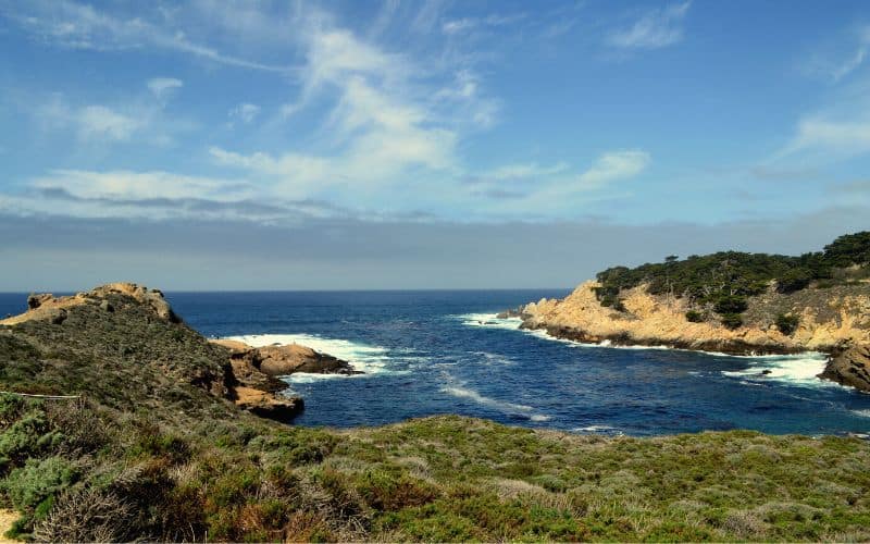
- Type: Loop
- Difficulty: Easy
- Length: 0.6 miles
Sea Lion Point Trail is the ultimate quick hike for seeing the local marine life with epic views of the ocean and the rugged Northern California coastline. This easy hike is a little over half a mile round trip along a spectacular section of the Point Lobos State Reserve near Carmel by the Sea.
The hiking path circles around the shore’s rocky bluffs and inlets and passes by Headland Cove and Sea Lion Cove.
These coves offer a unique opportunity to observe California sea lions, sea otters, and harbor seals in their natural habitat. You can watch these furry pinnipeds dive under the Pacific’s crashing waves, sunbathe on the rocks below, and bark back and forth at each other.
You’ll be greeted by cypress trees as you start the trail on the western side of the Sea Lion Point parking area. Take the path on the right when the trail splits to walk towards the ocean and the sea lion viewing areas. For a close-up view of the sea lions, use the stairs to head down to the cove, but watch for high tides and crashing waves.
This Sea Lion Point Trail is open year-round, but the staircase to the beach is usually closed during winter storms. It takes about 8 minutes for most visitors to complete this short hike.
11. Solstice Canyon Trail
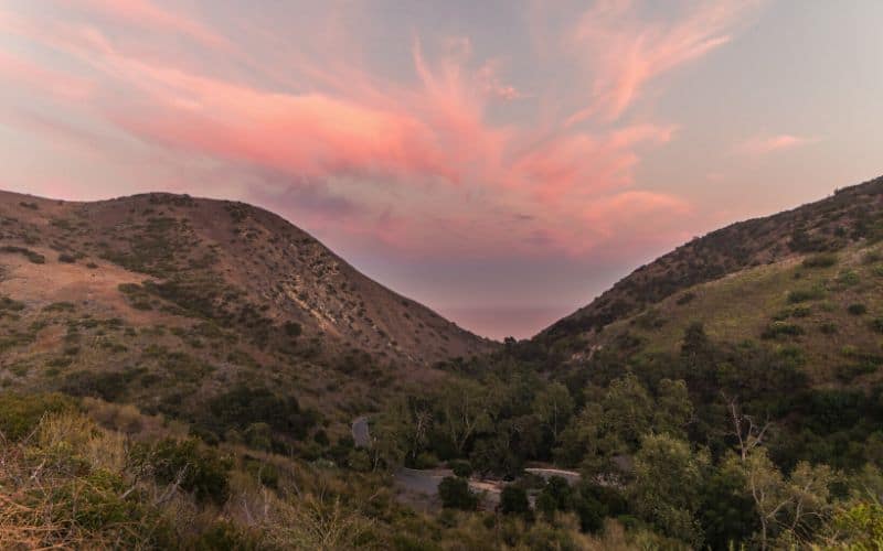
- Type: Out-and-back
- Difficulty: Easy
- Length: 2 miles
Those looking for a wilderness escape near Los Angeles should head north to the hills along the Malibu coast in Southern California. Located in the tranquil Santa Monica Mountains National Recreation Area, the Solstice Canyon Trail is one of the region’s most popular day hikes.
The easy hike is a 2-mile, out-and-back trail shaded by forests of oak and sycamore trees and winds alongside a creek.
The trail begins at the parking lot and is paved for the first half mile. The path eventually turns to dirt and heads up a gentle slope toward Solstice Waterfall. Along the way, you’ll pass the remains of the Keller House, a stone cabin that was built over 100 years ago. Just before arriving at the falls, you’ll reach the ruins of The Roberts Ranch House.
Once at the falls, you might get to see some of the local birds, including acorn woodpeckers and red-tailed hawks. The trail also has incredible views of the Pacific Ocean, the Santa Monica Mountains, and, of course, Solstice Canyon.
This hike can get busy, especially on the weekends, so start early to avoid the crowds.
12. Fern Canyon Trail
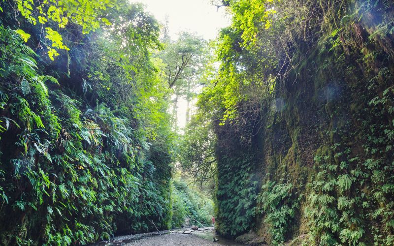
- Type: Loop
- Difficulty: Easy
- Length: 2 miles
Fern Canyon Trail is one of those rare short, yet incredibly rewarding hikes. It’s an easy, 2-mile round-trip trek through the spectacular flora and fauna of Northern California’s Prairie Creek Redwoods State Park. There are several other trails you can take to extend this beautiful hike and explore more of this forest paradise.
The hike’s trailhead is located about a quarter of a mile from Fern Canyon. The trail itself descends into a lush, moss-and-fern-filled canyon and crosses several streams. Don’t forget to wear waterproof hiking boots!
You can visit this trail year-round, but you might want to avoid the winter’s rainy season. If you’re planning on driving here between May 1 to September 30 you need to apply for a free Gold Bluffs Beach / Fern Canyon parking permit.
13. Sandstone Peak, Santa Monica Mountains
- Type: Loop
- Difficulty: Moderate
- Length: 6 miles
Sandstone Peak rises 3,111 feet above sea level and is the highest point in the Santa Monica Mountains. This classic LA-area hike has 1,760 feet of elevation gain and serves up awesome, 360-degree views of the Santa Monica Mountains, the Malibu coastline, the Channel Islands, and the city of Santa Monica.
There’s more than one way to reach Sandstone Peak, but most hikers prefer the 6-mile loop via the Mishe Mokwa Trail over the shorter Backbone Trail. The longer trek is not as steep and provides scenic vistas of Balance Rock, Echo Cliffs, Tri-Peaks, and Split Rock.
It typically takes visitors a little over 3 hours to complete this trek. The trailhead begins at the Sandstone Peak parking lot past the Circle X ranch Ranger Station on Yerba Buena Road.
14. Mount San Antonio
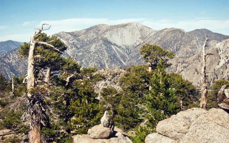
- Type: Out-and-back
- Difficulty: Strenuous
- Length: 11 miles
At 10,069 feet, Mount San Antonio, commonly referred to as Mount Baldy, is the tallest mountain in the San Gabriel Mountains and Los Angeles County. The hike is widely known as one of the best in Southern California.
The steep trail climbs 3,950 feet through the subalpine zone to the peak’s rocky terrain. The mountain’s peak provides sweeping views of the inland desert, the city of Los Angeles, and the Pacific Ocean.
There are two main routes to the top of the mountain. If you’re an experienced hiker looking for a challenge, ascend to the summit via the unmaintained Register Ridge Trail. This route has a 4,100 feet elevation gain in under 4 miles, so be prepared for a good workout!
Once you’ve seen enough of the breathtaking vista at the summit, you can head south on the Baldy Bowl Trail to see a unique barren landscape scattered with pine trees contorted by the fierce mountain winds and a bowl littered with huge boulders.
The trailhead and parking area for the Mt. Baldy hike are located just beyond Manker Campground, a little over an hour east of Los Angeles.
The best time to do this hike is at sunrise on a weekday in the warmer months. Avoid hiking Mt. Baldy in the winter when ice and snow cover its peak. Most hikers complete this trail in about 7 hours.
15. Tahoe Rim Trail
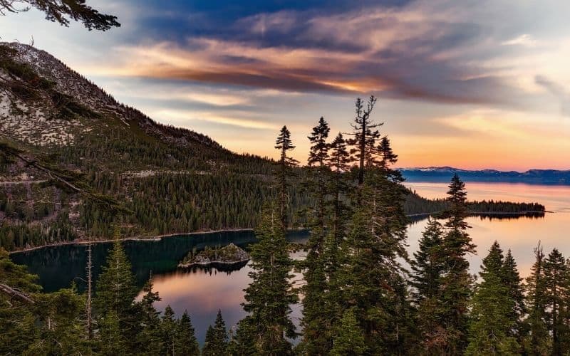
- Type: Loop
- Difficulty: Strenuous
- Length: 165 miles
Tahoe Rim Trail is an epic thru-hike around the largest alpine lake in North America. Lake Tahoe has gorgeous blue and turquoise water and is made all the more scenic by the surrounding pine forest and a backdrop of the Sierra Nevada’s snow-capped peaks.
This hike has eight sections totaling 165 miles with a 24,400 elevation gain. It typically takes about 2 weeks to finish and most hikers resupply in Tahoe City.
Many people prefer to do this grueling hike in segments or day-hike to the tallest mountains around the lake, Sonora Peak, Freel Peak, and Rose Peak.
The best time to complete the Tahoe Rim Trail is in the summer from July through September to avoid the snow and ice.
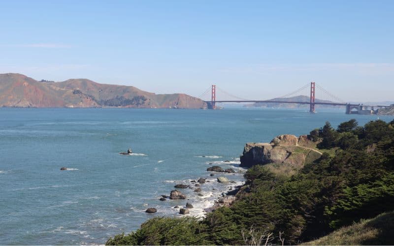
16. Lands End Trail, San Francisco
- Type: Out-and-back
- Difficulty: Easy
- Length: 3 miles
The Lands End Trail is a classic San Francisco trek. This enjoyable hike has spectacular views of the Northern California coastline and the iconic Golden Gate Bridge. On this trail through the Golden Gate Recreation Area, you’ll also get to see China Beach, the Sutro Baths, Mile Rock Beach, and Point Lobos. If you’re a fan of stunning bay area hikes, the Lands End Trail should definitely be on your list. With its mix of natural beauty and historical landmarks, it offers a unique and memorable experience for hikers of all levels. Whether you’re a local looking for a new adventure or a visitor to the area, this trail is a must-see for anyone looking to explore the beauty of San Francisco’s coastline.
You can hop on the trail at the Visitor Center parking lot near Cliff House or in the Sea Cliff neighborhood.
This is an extremely popular hike that gets packed during peak times. For the best experience, visit mid-week in the warmer and less-foggy months in late summer and fall.
This hike takes most people about 1.5 hours to complete.
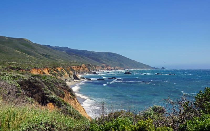
17. Panorama Trail, Bluffs Trail, and Ridge Trail
- Type: Loop
- Difficulty: Easy
- Length: 9 miles
Encompassing almost 5,000 acres and with 25 miles of trails, Andrew Molera State Park, near Big Sur, is the ideal spot for an epic coastal hike. One of the park’s top trails is the 9-mile loop made up of a combination of Ridge Trail, Panorama Trail, and Bluff Trail.
This scenic hike on the park’s western side meanders through redwood trees and along a pristine beach, and serves up stunning views of the ocean from the rugged coastline. A unique aspect of this hike is the wild strawberries that grow along the trail which you can snack on during your walk.
Ridge Trail climbs a lengthy ridge flanked by the Big Sur River Valley and the Pacific Ocean. The highest point of the trail is found on the Panorama Trail, which offers jaw-dropping views of Big Sur. The trek then heads downhill along Bluff Trail towards Molera Beach, where the Big Sur River meets the sea.
The complete loop has a 1,100 feet elevation gain and takes about 4 hours to complete.
Best Hikes in California: Happy Hiking!
Whether it’s trekking up a snow-capped summit in the Sierra or hunting for a spring-fed oasis in the Mojave, California has something for every type of hiker!
What are your favorite California trails? Let us know in the comments below. If you enjoyed this article, please share it with your hiking buddies!
