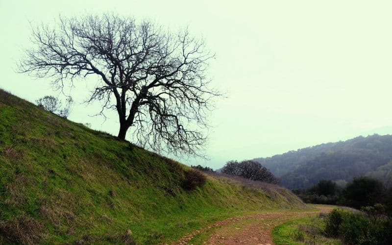
With numerous hiking trails in the Bay Area offering stunning cityscape and landscape vistas, choosing your next hike might be a challenge when you next visit. From various perspectives of the Golden Gate Bridge, the Pacific Ocean, coastal bluffs, towering redwoods, and the iconic bay itself there’s something for everyone to enjoy.
You can even explore the area’s logging, mining, and military history on various local hikes. With plenty of exciting activities to do, planning your time well is essential if you’re visiting the Bay Area in Northern California. To do so we have listed the top 15 Bay Area day hikes to help you choose.
Do
Don’t

Save for later!!! ⤵️

Table of Contents
- Where Are The Best Hikes In The Bay Area?
- 1. Twin Peaks Trail, Twin Peaks Nature Area
- 2. Glen Canyon Park
- 3. Land’s End and Coastal Trail, Golden Gate National Recreation Area
- 4. Golden Gate Bridge & Park, and the Presidio
- 5. Tennessee Valley Trail, Golden Gate National Recreation Area
- 6. Cataract Falls, Mount Tamalpais Watershed
- 7. Dipsea Trail, Muir Woods National Monument, and Mount Tamalpais State Park
- 8. North Ridge and Sunset Trail Loop, Angel Island State Park
- 9. Tomales Point Trail, Point Reyes National Seashore
- 10. Mount Diablo Grand Loop, Mount Diablo State Park
- 11. Eagle Peak Loop, Mount Diablo State Park
- 12. French Loop Trail, Reinhardt Redwood Regional Park, Oakland
- 13. Palos Colorados Trail, Joaquin Miller Park, Oakland
- 14. West Ridge Trail, Reinhardt Redwood Regional Park, Oakland
- 15. Quicksilver History Loop, Almaden Quicksilver County Park
- Ready For The Best Hiking In The San Francisco Bay Area?
Where Are The Best Hikes In The Bay Area?
We’ve put together a list of our 15 favorite Bay Area hikes in the list below.
- Twin Peaks Trail, Twin Peaks Nature Area
- Glen Canyon Park
- Land’s End and Coastal Trail, Golden Gate National Recreation Area
- Golden Gate Bridge & Park, and the Presidio
- Tennessee Valley Trail, Golden Gate National Recreation Area
- Cataract Falls, Mount Tamalpais Watershed
- Dipsea Trail, Muir Woods National Monument, and Mount Tamalpais State Park
- North Ridge and Sunset Trail Loop, Angel Island State Park
- Tomales Point Trail, Point Reyes National Seashore
- Mount Diablo Grand Loop, Mount Diablo State Park
- Eagle Peak Loop, Mount Diablo State Park
- French Loop Trail, Reinhardt Redwood Regional Park, Oakland
- Palos Colorados Trail, Joaquin Miller Park, Oakland
- West Ridge Trail, Reinhardt Redwood Regional Park, Oakland
- Quicksilver History Loop, Almaden Quicksilver County Park

1. Twin Peaks Trail, Twin Peaks Nature Area
The short 2-mile Twin Peaks trail is a postcard picture hiking trail in the heart of San Francisco. If the city’s famous fog isn’t too heavy, you can see the Golden Gate Bridge and Alcatraz Island from the 64-acre Twin Peaks Nature Area.
Coastal scrub, colorful lupine, and grassy hills make this San Francisco park a lush escape from the surrounding city. Despite the strong winds, the natural area is a habitat to the endangered mission blue butterfly. Nesting birds, rabbits, and coyotes are also often spotted.
Read all about this compact park that packs a punch on the city’s website.
- Type: Loop
- Length: 1 mile
- Elevation gain: 272 feet
- Difficulty: Easy
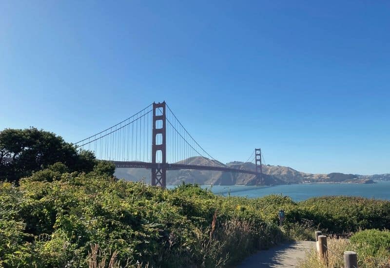
2. Glen Canyon Park
The 60-acre Glen Canyon Park is tucked between busy San Francisco neighborhoods and has 3.7 miles of fun hikes to explore. A variety of habitats are found in this small-sized urban park, including a thriving riparian ecosystem. Willow trees, horsetails, and red columbine grow along the creek.
This family-friendly, short hike is accessible to all experience levels and abilities. You can combine Islais Creek, Coyote Crags, and Gum Tree Girls trails to create an easy, 1.8-mile loop. Visit the San Francisco city website for details.
- Type: Loop
- Length: 1.8 miles
- Difficulty: Easy
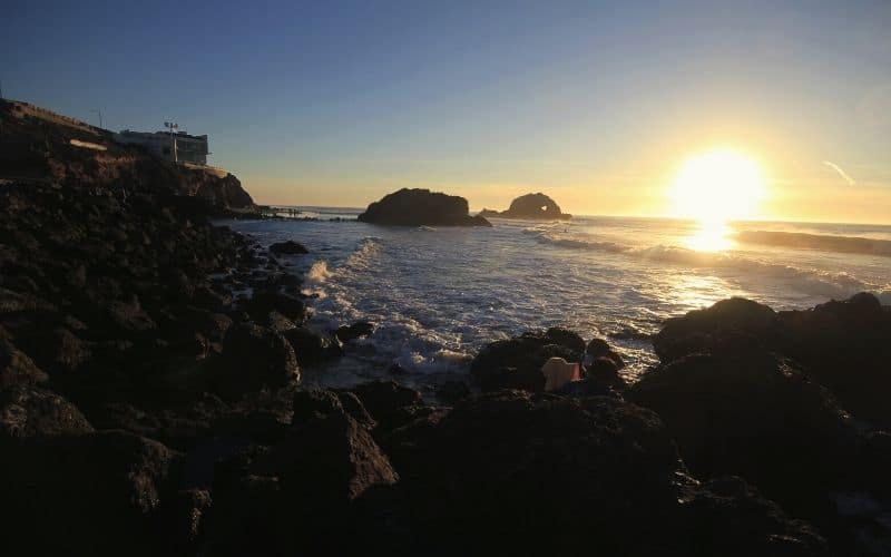
3. Land’s End and Coastal Trail, Golden Gate National Recreation Area
The Land’s End and Coastal Trail sits at the edge of the continent, where the land ends in the northwest corner of San Francisco. Here, you can take a journey through the Bay Area’s history while enjoying spectacular oceanviews of the rocky shores of the Pacific coast and the Golden Gate Bridge.
Start your stroll by Cliff House, an exclusive resort built in 1863. It’s perched above Ocean Beach and overlooks Seal Rocks, offering stunning views of the surrounding area. From there, head over to the Sutro Baths ruins, a formerly massive recreational enclosure built in 1894 or uphill to the Lands End Lookout.
Wander east along to Eagle Point Overlook for views over South Bay, and then head back via El Camino del Mar to see Legion of Honor and other military memorials. Other points of interest include remnants of shipwrecks, a memorial to USS San Francisco, a WWII cruiser, and Battery Chester at Fort Miley. Read more history at the park’s website.
- Type: Loop
- Length: 4 miles
- Difficulty: Moderate
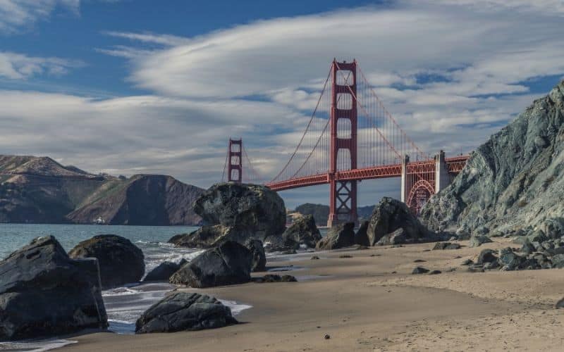
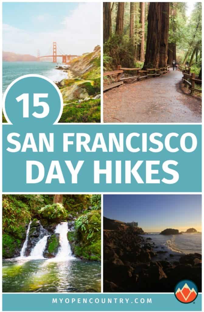
4. Golden Gate Bridge & Park, and the Presidio
The Golden Gate Bridge is a colorful and shining landmark of the West Coast. As the most famous bridge in America, it’s a ‘can’t miss’ while in San Francisco.
A 1.7 mile (one way) pedestrian walkway traverses the suspension bridge and connects to the hugely popular Presidio of San Francisco. You can visit the National Cemetery and veteran memorials, stare in awe at the 100-foot tall Spire sculpture, and get an Instagram-worthy image at Baker Beach with the famous golden bridge in the background.
After you’ve had your fill at Presidio, head south toward Mountain Lake and cross Lake Street. A tree-covered route on either side of Park Presidio Boulevard will take you directly to Golden Gate Park in less than a mile.
The park covers 1,017 acres and offers a network of routes to explore. Highlights include a grove of some of the oldest coast live oak trees in the city and a herd of American buffalo.
With so much to see and do, plan ahead on the Golden Gate Park, bridge, and Presidio.
- Type: Out and Back
- Length: 3.4 miles
- Difficulty: Easy
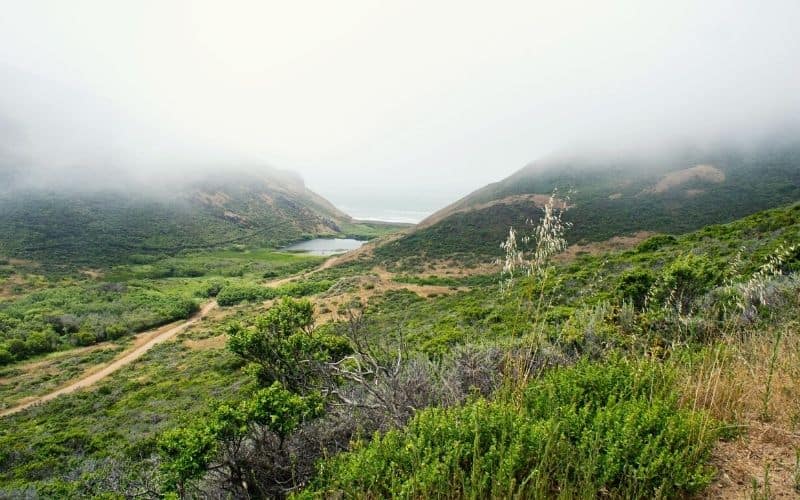
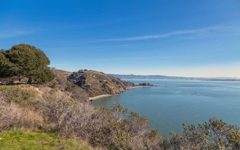
5. Tennessee Valley Trail, Golden Gate National Recreation Area
Tennessee Valley is one of our favorite hikes that offers an easy walk along a lush valley to a dark sand beach. The trail passes a small pond before reaching the secluded beach. At low tide, a portion of the engine of the SS Tennessee shipwreck is visible. The passenger steamship ran aground during heavy fog in 1853 and became the namesake of the surrounding area.
Located in the Marin Headlands just north of the iconic bridge, this area offers some of. the area’s best hikes. If you head up some of the canyon paths you’ll be rewarded with wide scenic vistas. For a more challenging loop back, climb up to Coastal Trail and connect to Wolf Ridge, Miwok, and Old Springs to return to the parking lot.
Be careful at high tide and check the website for weather alerts before heading out.
- Type: Out and back
- Length: 3.4 miles
- Difficulty: Easy
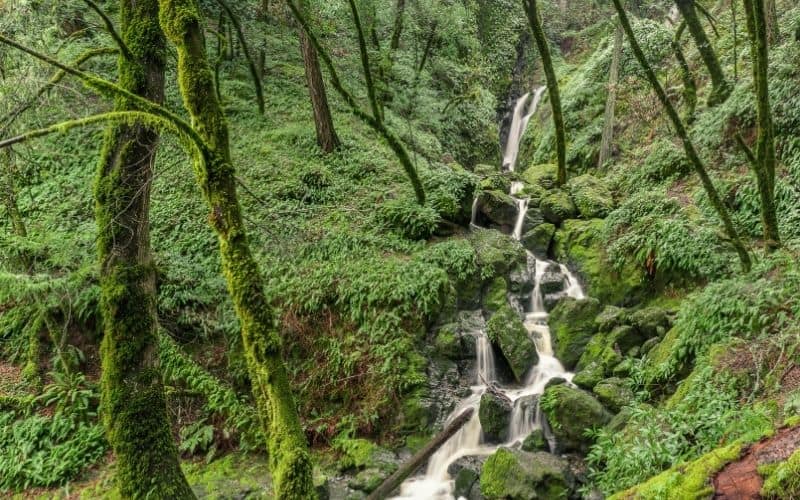
6. Cataract Falls, Mount Tamalpais Watershed
Head north for some of the best hikes in San Francisco at Mt. Tamalpais watershed, of which Cataract falls is a favorite. There are more than 150 miles of trails traverse the watershed, with many connecting to neighboring state and national parks offering plenty of alternative Northern California hikes.
Start at Alpine Lake and follow the Cataract Creek for about 1.2 miles as it leads to the main cascade. You can keep following the Cataract Trail alongside the creek until it ends after about 1.5 miles. There are also a number of trails to make it a loop and return to your car.
For updates and road closures, check the watershed’s website.
- Type: Out and back
- Length: 2.4 miles
- Difficulty: Moderate
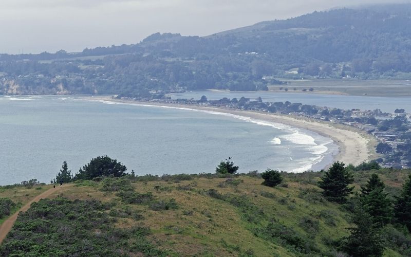
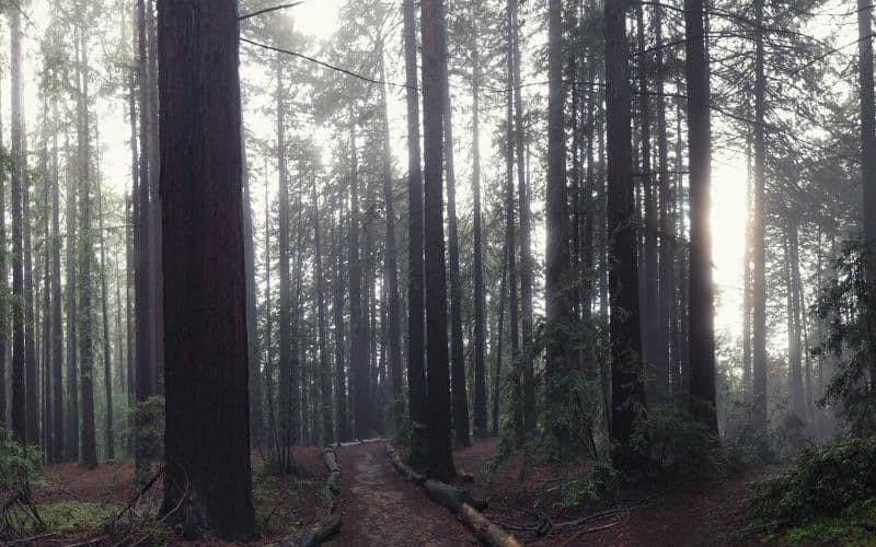
7. Dipsea Trail, Muir Woods National Monument, and Mount Tamalpais State Park
The Dipsea Trail is a challenging adventure just 23 miles northwest of the city, you can trek through old growth redwoods, deep canyons, and enjoy spectacular views. The trail begins by the Muir Woods NM visitor center, located on Muir Woods Road off the Panoramic Highway. The trail winds down difficult and steep terrain to Stinson Beach, so be prepared for a difficult hike back up.
An alternate route to Stinson Beach is a shorter but strenuous hike. This 6.8-mile loop starts at Pantoll trailhead. Head down Matt Davis Trail and connect to Dipsea for a short stretch. At the junction for Steep Ravine Trail, start the slog back up to complete your loop. You’ll hike along Webb Creek, pass a few waterfalls, and even climb up one waterfall via a fixed ladder.
Other great hikes in the area include the Steep Ravine trail loop and the Matt Davis Trail.
Check conditions at the Mt. Tamalpais SP website and/or Muir Woods NM website.
- Type: Out and back
- Length: 9.7 miles
- Difficulty: Challenging
8. North Ridge and Sunset Trail Loop, Angel Island State Park
The North Ridge and Sunset Trail Loop, located on Angel Island, is a Bay Area hike suitable for all skill levels, family-friendly, and partially paved.
Angel Island is the second largest island in San Francisco Bay and has a long and varied history, including being utilized as a quarantine station and later an immigration facility. It’s a very popular location for visitors, so arrive early to beat the crowd. The easy loop around the island offers one-of-a-kind views of the bay and Golden Gate Bridge.
Find links to ferries, opening hours, and more at the park’s website.
- Type: Loop
- Length: 4.8 miles
- Difficulty: Easy
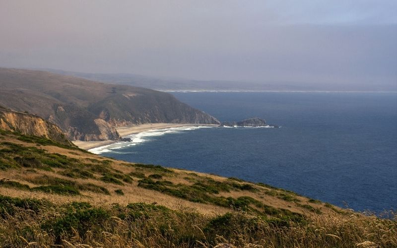
9. Tomales Point Trail, Point Reyes National Seashore
Tomales Point (aka Pierce Point) is located in Point Reyes National Seashore, a few hours north of the San Francisco Bay area out on the northern tip of the peninsula.
Start this long hike at McClure Beach access road and you will enjoy sweeping views of Tomales Bay, Bolinas Ridge, Bodega Bay, and the ocean. The path turns to sand at the end. Be careful of strong winds and steep cliffs, which can be unstable after rain.
Wild tule elk are often spotted in the area. Also keep an eye out for coyotes, deer, hawks, foxes, and seals by the water. Be sure to take a peek at the historic Pierce Point Ranch, McClures Beach, and Bird Rock.
Find more details at the Point Reyes website.
- Type: Out and back
- Length: 9.7 miles
- Difficulty: Moderate
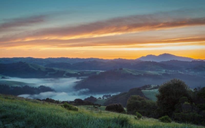
10. Mount Diablo Grand Loop, Mount Diablo State Park
While Mount Diable State park has some of the best Bay Area hikes, the Grand Loop is the most rewarding of the bunch, serving up stunning views for your entire hike to the top of Mt. Diablo. For this, Start at Juniper Campground and head clockwise via Deer Flat and Meridian Ridge roads, and Bald Ridge and North Peak trails. The trail climbs a total of about 1,900 feet.
This East Bay area park spans more than 20,000 acres and, on a clear day, you can see for hundreds of miles from the 3,849-foot peak of Mount Diablo.
There are several other routes to the summit of the devilish mountain. You can try the difficult 8-mile Mount Diablo Summit Trail starting at Mitchell Canyon Staging Area. Or try the shortest route and simply drive to the Summit Visitor Center and take an easy 1-mile stroll along the Mary Bowerman Interpretive Trail.
Find out more on the state park website.
- Type: Loop
- Length: 6.5 miles
- Difficulty: Moderate
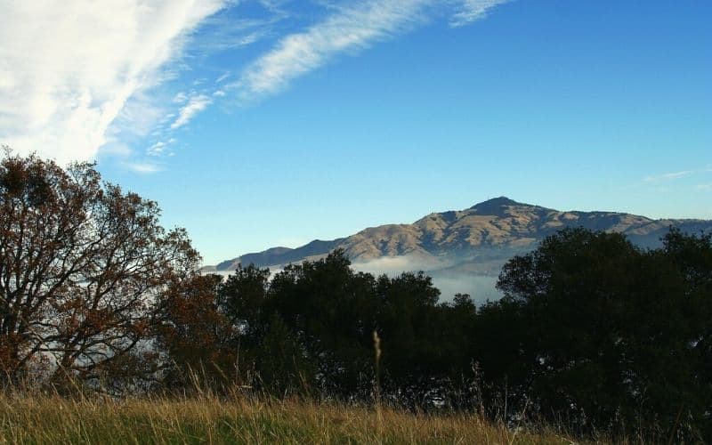
11. Eagle Peak Loop, Mount Diablo State Park
For a unique and tough hike that can feel hidden away from some of the busier Bay Area routes, try Eagle Peak Loop. It’s a challenging and fairly steep climb, with some loose gravel and scree, so trekking poles are recommended.
Take Mitchell Rock and Eagle Peak trails to reach the top. You can return on Back Creek or the longer route along Mitchell Canyon. If you’re feeling up to a challenge, keep going on Bald Ridge to summit Mount Diablo.
- Type: Loop
- Length: 6.5 miles
- Difficulty: Challenging
12. French Loop Trail, Reinhardt Redwood Regional Park, Oakland
The French Trail runs through a hidden Redwood forest in the 1,833-acre Reinhardt Redwood Regional Park, near downtown Oakland.
French Trail spans almost the entire length of the park and you can use either Stream, or East or West Ridge to close the loop trail. You will walk under towering trees, climb up the canyon, and work your way along the rim above the valley. It’s a great place to feel secluded within the city.
Keep an eye out for deer, raccoons, and even a rare golden eagle. The park is also home to some interesting local logging history.
- Type: Loop
- Length: 8 miles
- Difficulty: Moderate
13. Palos Colorados Trail, Joaquin Miller Park, Oakland
The Palos Colorados Trail. located in the 500-acre Joaquin Miller Park in Oakland, this easy trail is good for hikers of any experience level. Along the way, you’ll see majestic redwoods, a canyon covered in ivy, and Sausal Creek.
The park is also home to more than 200 species of native plants. You might even spot a few rare species of flora, like the Oakland star tulip, pallid manzanita, and leatherwood. Among the wildlife that call this urban sanctuary home are hawks, wild turkeys, gray foxes, deer, and skunks.
The city’s website has more information to read before heading out.
- Type: Out and back
- Length: 3 miles
- Difficulty: Easy
14. West Ridge Trail, Reinhardt Redwood Regional Park, Oakland
Climb the West Ridge Trail for a wide view of the bay, cityscapes, both the Golden Gate and Bay bridges, and the mountains in the other direction. Loop back on the Stream, French, or East Ridge trails.
This urban woodland of the Reinhardt Redwood park is home to the largest remaining natural grove of redwood trees in East Bay. Other tree species can also be found scattered across the area. Fun fact: Fish taken from the San Leandro Creek drainage, including the park’s Redwood Creek, were the basis for the naming of what we now call rainbow trout. It also has a vibrant logging history.
- Type: Loop
- Length: 7.9 miles
- Difficulty: Moderate
15. Quicksilver History Loop, Almaden Quicksilver County Park
The Quicksilver History Loop is located about 15 miles south of San Jose, this hike is ideal for history buffs. It was formerly home to famous mercury ore mining operations (aka quicksilver).
Start out on the Mine Hill Trail before connecting to the April Trail for a fantastic view of the bay. You can loop back via the April Tunnel.
You also might want to explore the only tunnel in the park that allows visitors inside with a short side adventure to San Cristobal Tunnel. Points of interest include mine entrances and mining equipment, remnants from old furnaces and miners’ homes, and a powder house (where explosives were stored).
- Type: Loop
- Length: 8 miles
- Difficulty: Moderate
Ready For The Best Hiking In The San Francisco Bay Area?
Leave your heart on the best hiking trails in the Bay Area of San Francisco as you explore the Golden City. With so many options, you’re bound to find the perfect spot to hike!
We hope you enjoyed this guide to the best San Francisco Bay Area hikes. If you have any questions, just ask in the comments below. Feel free to share this article with any other San Francisco-bound adventurers!
Save for later!!! ⤵️