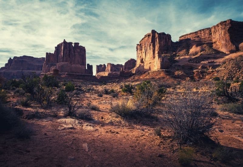
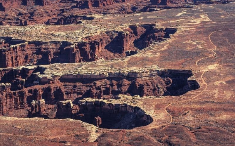
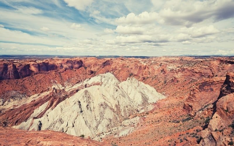
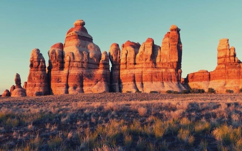
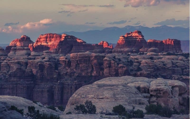
Featuring stunning vistas, rugged canyons, and incredible geological formations, there’s something for everyone to love at Canyonlands National Park.
With a park as large and varied as Canyonlands, planning a trip to the region involves quite a lot of pre-planning. This means that scoping out the best hiking trails in the park is a must before you leave home.
If you’re not sure which of the hikes in Canyonlands National Park are right for you, worry not—we’re here to help.
In this detailed guide, we’ll introduce you to 11 of the best hikes in each district of Canyonlands National Park. That way, you can make the most of your visit to Canyon Country.
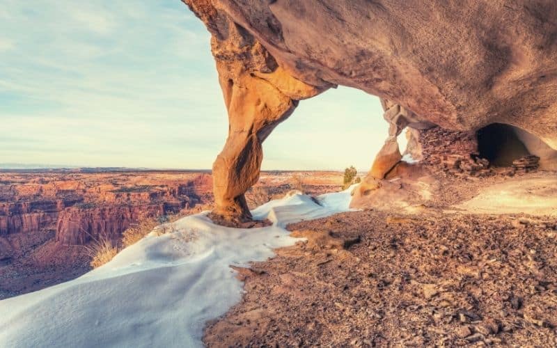
Tips for Hiking in Canyonlands National Park
While visiting any of the US’ national parks is sure to be a treat, it’s important that you know what you’re getting into before you head outside. At Canyonlands, in particular, extreme temperatures and difficult-to-follow trails are the norm.
So, as you plan your adventure, keep the following in mind:
- Your entrance pass is good for 7 days—make the most of it!
- Bring a lot of water to prevent dehydration
- Avoid hiking in the afternoon during the summer
- Try to follow the cairns
- Don’t forget a map and compass
- Pack plenty of food
- Bring microspikes for the wintertime
- If there’s snow on the ground, ask a ranger about current trail conditions
Also, don’t forget that the National Park Service visitor center in the park is open all year round. So, make sure to stop by and talk to a ranger if you have any questions before you start hiking.
RELATED: Check out Utah’s top trails for hiking
The 11 Top Canyonlands National Park Hikes
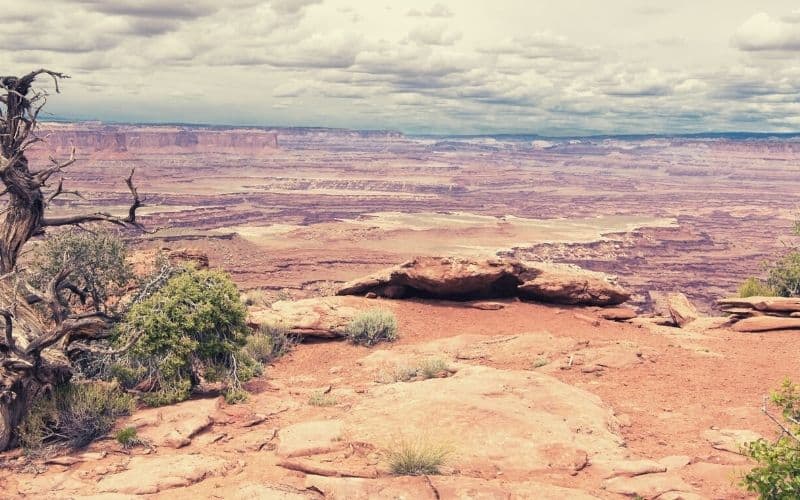
Island in the Sky
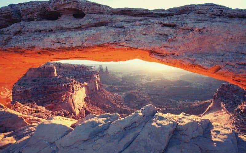
1. Mesa Arch
- Trail type: Loop
- Length: 0.5 miles (65ft ascent)
- Difficulty: Easy
- Access: Mesa Arch Trailhead on Grand View Point Road, Island in the Sky
One of the premier short Canyonlands hiking trails, the trek to Mesa Arch is among the top things to see and do in Moab, UT.
This straightforward family-friendly loop begins right off Grand View Road and follows a slickrock path to Mesa Arch. Once you’re at the arch, you’ll get to see not only a stunning geological formation, but also views of the beautiful La Sal Mountains in the distance.
If you’re willing to get up early, Mesa Arch also makes for a superb place to see the sunrise. Just be sure to arrive 30 minutes ahead of time so you don’t miss the view!
2. Whale Rock
- Trail type: Out-and-back
- Length: 1 mile (78ft ascent)
- Difficulty: Easy
- Access: Whale Rock Trailhead on Upheaval Dome Road, Island in the Sky
If you’re looking for great views of the Island in the Sky District and Upheaval Dome, this short hike to Whale Rock is a must-do.
Starting off from the parking area on Upheaval Dome Road, this walk follows a mostly flat, gravel path to the top of Whale Rock. At the top of this unique geological oddity, you can gaze out over Upheaval Dome, a massive crater that may have been formed by an ancient meteorite.
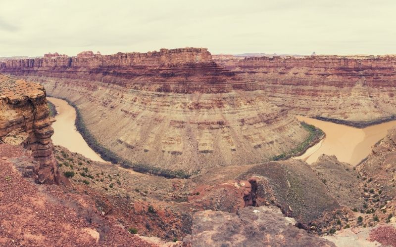
Meteorites or not, however, this trail also offers excellent vistas of the canyons carved out by the Green River and the Colorado River. So, it’s a fun jaunt that ought to be on everyone’s to-do list.
3. Aztec Butte Trail
- Trail type: Out-and-back
- Length: 1.7 miles (262ft ascent)
- Difficulty: Easy to moderate
- Access: Aztec Butte Trailhead on Upheaval Dome Road, Island in the Sky
For a chance to see some important cultural artifacts from the Ancestral Puebloan people, the Aztec Butte Trail is a sure bet.
On this 1-hour long day hike, you’ll walk across a sprawling grassland and up toward the top of a large sandstone dome. Here, you’ll get lovely panoramic views as well as a chance to visit a handful of well-preserved granaries (food storage areas) from the Ancestral Puebloan people.
Do keep in mind, however, that these cultural remains are highly protected. So, please keep your distance and do not touch the remains as a sign of respect for the people who called this place home.
4. Grand View Point Trail
- Trail type: Out-and-back
- Length: 2 miles (70ft ascent)
- Difficulty: Easy
- Access: Parking area at the end of Grand View Point Road, Island in the Sky
Offering up some of the best views in the Island in the Sky District, the journey to Grand View Point is one of the top trails in Canyonlands.
After departing from the parking area, this short trail leads over mostly flat terrain to a series of overlooks. The first overlook is paved and accessible for most visitors, though the path beyond it is gravel.
At each overlook, you’ll get marvelous panoramic views of the region, including of the canyons of the Colorado and Green rivers. What could be better?
5. Upheaval Dome Overlook
- Trail type: Out-and-back
- Length: 1.4 miles (278ft ascent)
- Difficulty: Easy to moderate
- Access: Parking area at the end of Upheaval Dome Road, Island in the Sky
While Whale Rock offers some great views of Upheaval Dome if you want to see the dome up close and personal, this is one trail you can’t skip. Along this quick out-and-back hike, you’ll meander over undulating terrain and make your way to the edge of this massive crater.
Although the origin of the crater is the subject of some scientific debate, one thing’s certain: Its multicolored surface and rugged features look pretty darn cool. So, it’s well worth a visit if you get a chance.
Oh, and if you’re looking for a longer adventure, consider doing the Syncline Loop instead. This trail leads around the main section of Upheaval Dome, so it’s the perfect trip if you only have one day in the park.
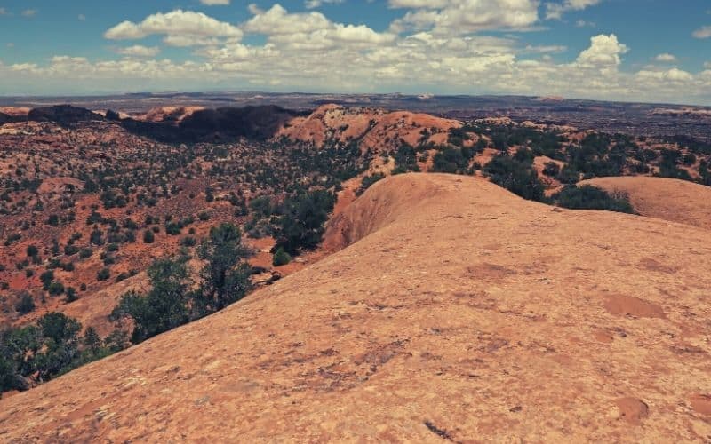
6. White Rim Overlook
- Trail type: Out-and-back
- Length: 1.8 miles (160ft ascent)
- Difficulty: Easy
- Access: White Rim Trailhead on Grand View Point Road, Island in the Sky
Perhaps the most iconic trek in Canyonlands National Park, this view over the White Rim Road is a fan-favorite of hikers everywhere.
White Rim Road is actually one of the most famous 4WD roads in Utah and permits for driving the road are hard to come by. However, walking this trail to an overview over the road doesn’t require a permit and should only take you a maximum of about 45 minutes to 1.5 hours.
To reach the overlook, you’ll follow the Gooseberry Trail to its terminus, where sprawling panoramic views abound. From the top, you can gaze down at the massive canyon below and catch glimpses of the snow-covered La Sal Mountains in the distance.
The Needles
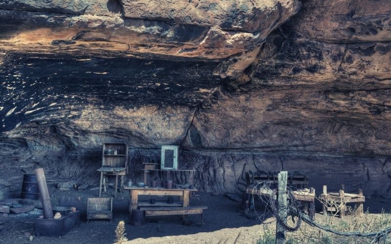
7. Cave Springs
- Trail type: Loop
- Length: 0.6 miles (62ft ascent)
- Difficulty: Easy
- Access: Trailhead off of Cave Spring Road, The Needles District
A popular quick day trip to The Needles District, the jaunt to Cave Springs is a fun and easy walk for the whole family.
The access for this loop hike starts off on Cave Spring Road and follows a well-worn track to an old cowboy camp. Interestingly enough, this cowboy camp dates back to the early 1900s and it was once run by the Indian Creek Cattle Company.
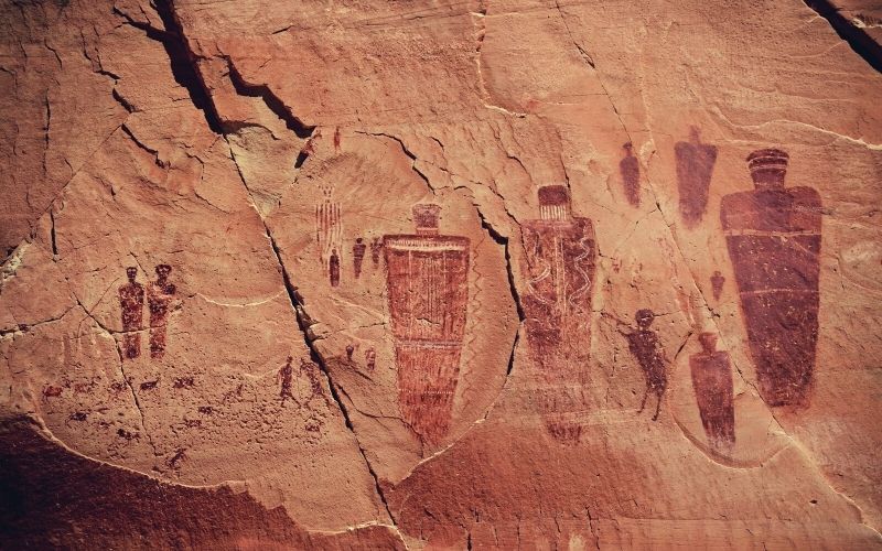
Once you walk past the camp, you’ll make it to Cave Spring, where you can find the remnants of Ancestral Puebloan rock art. Afterward, you can climb up a large rock formation to catch great vistas of the surrounding area as a reward for your efforts.
8. Chesler Park Loop/Joint Trail
- Trail type: Loop
- Length: 11 miles (600ft ascent)
- Difficulty: Hard
- Access: Elephant Hill Trailhead off of Elephant Hill Road, The Needles District (4WD required)
Among the more challenging hikes in The Needles, the Chesler Park Loop/Joint Trail is one of the very best outings in the park for the more adventurous visitor.
You’ll need a 4WD vehicle to access the Elephant Hill trailhead, so be sure to come prepared. Once you’re on the trail, you’ll climb up and over a number of slickrock slabs and into a narrow slot canyon.
Eventually, you’ll make it to Chesler Park, where you can find a campsite for the night if you so please (reserve a permit ahead of time). Beyond the camping area, you’ll find yourself on the Joint Trail, where you can scramble around in canyons before returning to the trailhead.
If your appetite for adventure isn’t quite sated by the time you get back, you can set off from the same trailhead to take on the hike to Druid Arch. Be aware, however, that doing so will double your daily mileage.
9. Confluence Overlook
- Trail type: Out-and-back
- Length: 10 miles (220ft ascent)
- Difficulty: Hard
- Access: Big Spring Canyon Trailhead on Route 211, The Needles District
Aptly named, the Confluence Overlook Trail offers a chance to see the confluence between the Green River and the Colorado River. Plus, it’s one of the less frequently visited hikes in the park, thanks to its relative remoteness. So, it’s a nice one-day outing if you’re looking to beat the crowd.
Starting off from the Big Spring Canyon Trailhead, this hike traverses a relatively open landscape, which is unusual for Canyonlands National Park. Nevertheless, you’ll travel over undulating terrain with little shade, so this isn’t a hike to do in the afternoon on a mid-summer day.
After about 5 miles of hiking, you’ll eventually find yourself on a large viewing area overlooking the confluence of these two mighty rivers. While you’re here, you can enjoy the panoramic vistas of The Needles and the confluence in the distance before meandering back to the trailhead.
The Maze
10. Great Gallery in Horseshoe Canyon
- Trail type: Out-and-back
- Length: 7 miles (764ft ascent)
- Difficulty: Moderate to hard
- Access: Horseshoe Canyon Parking Area off of Route 1010 from Highway 24 (4WD recommended)
Home to some of the best-preserved rock art in the United States, the Great Galley of Horseshoe Canyon is a particularly amazing hiking destination.
Accessing this hike is a bit tricky as you’ll want to approach from the west on BLM land. Follow Highway 24 to Route 1010 and then park at the large trailhead. On the trail, you’ll hike over varied terrain that eventually leads you into the canyon itself.
Here, you can gaze up at the life-sized paintings and steep sandstone cliffs that make the Great Galley in The Maze so special.
11. The Doll House Granaries
- Trail type: Out-and-back
- Length: 2.5 miles (80ft ascent)
- Difficulty: Moderate
- Access: Spanish Bottom Trailhead, Doll House Road (4WD required)
Arguably the most popular hike in The Maze, the trip to the Doll House Granaries is a great choice if you’re up for a real adventure. To access this remote trailhead, you must have a 4WD vehicle as you’ll spend nearly 4 hours on sandy roads.
As far as the hiking goes, you’ll follow a sandy trail from the parking area through a maze of rugged rock spires and hoodoos. Then, you’ll make your way through a narrow slot and to a beautiful overlook above the canyon. Eventually, you’ll find the ancient granaries inside a large alcove, which are worth checking out from a distance.
Once you’ve had your fill of the trail, you can head back the way you came. If you’re looking for a place to spend the night, there are plenty of campsites off Doll House Road, but you’ll need a permit for your stay.
Canyonlands National Park Hiking Trails: Choose Your Adventure
Any trip to the magnificent Canyonlands National Park is sure to be an adventure to remember. We hope that our list of the best hikes in Canyonlands helped you figure out which trails are right for your next trip to the park.
If you got a chance to enjoy any of these wonderful trails, let us know what you thought in the comments below! Oh, and feel free to send this article along to your friends and family so they can experience the magic of Canyon Country, too. Catch you out there!
