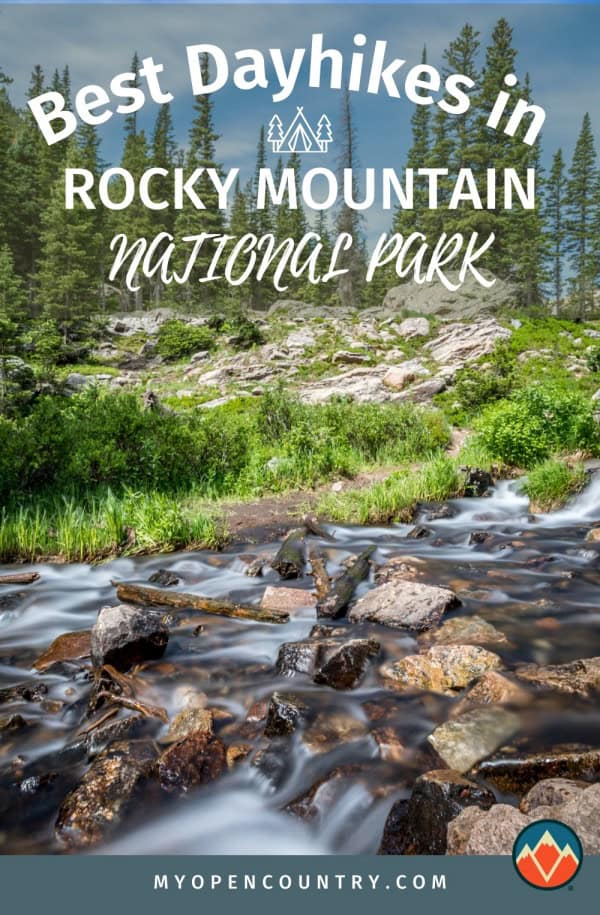
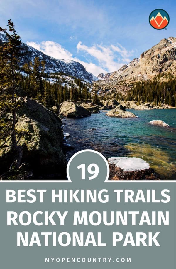
Visitors to Rocky Mountains National Park could be forgiven for being overwhelmed by the amount of choice on offer in terms of awesome hiking trails.
Whether you’re looking for a serious adventure by bagging one of the park’s lofty peaks or gentler day hikes to take on with the kids, Rocky Mountain National Park boasts a vast array of some of the most outstanding hiking trails anywhere in North America, if not the world.To help you narrow down the options and find the best trail for you, we’ve selected nineteen of the best hikes in Rocky Mountain National Park for hikers of all fitness levels and all levels of ability and experience.
Table of Contents
Save for later!!! ⤵️
Best Easy Hikes in Rocky Mountain National Park
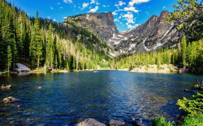
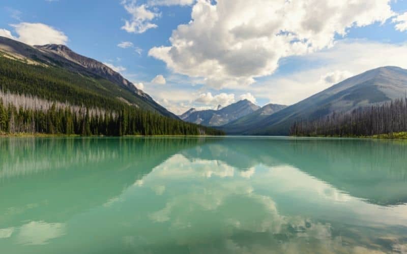
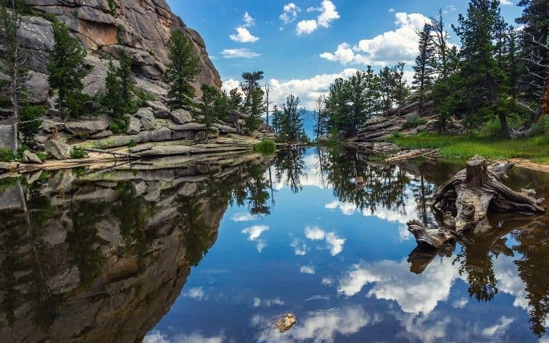
1. Lake Helene and Two Rivers Lake
- Type: Out and back
- Access: From Bear Lake Trailhead at Glacier Gorge parking lot on Bear Lake Road
- Length: 6.4 miles
- Total Ascent: 1,200 feet
This 6.4-mile out-and-back hike is the perfect introduction to Rocky Mountain National Park hiking for those who want to sample some of the area’s highlights without putting in too much effort.
Although the 1,200-foot total ascent may seem a lot for an ‘easy’ hike, the trail is very well-maintained and signed, and never steep.
Some of the features you’ll enjoy on this hike include a trio of stunning lakes, lush pine forest, a handful of pretty sub-alpine meadows, epic mountain views, and a surprising degree of solitude at the trail’s end at Two Rivers Lake.
A mile from the trailhead at Glacier Gorge, this trail leaves behind the pine forest and climbs steadily west, offering up spectacular views of Longs Peak, Keyboard of the Winds, Pagoda Peak, and Chiefs Head Peak before easing up on the ascent in the final mile below Lake Helene.
Once there, the views of Notchtop Mountain, Knobtop Mountain, and Ptarmigan Point are nothing short of gobsmacking. However, just a short saunter from the lake’s north end will take you to the equally impressive Two Rivers Lake, where you’ll enjoy much the same views but far smaller crowds.
Related Reading: Check out more great Colorado Trails here.
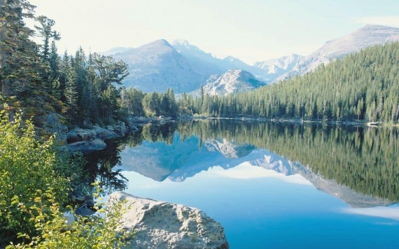
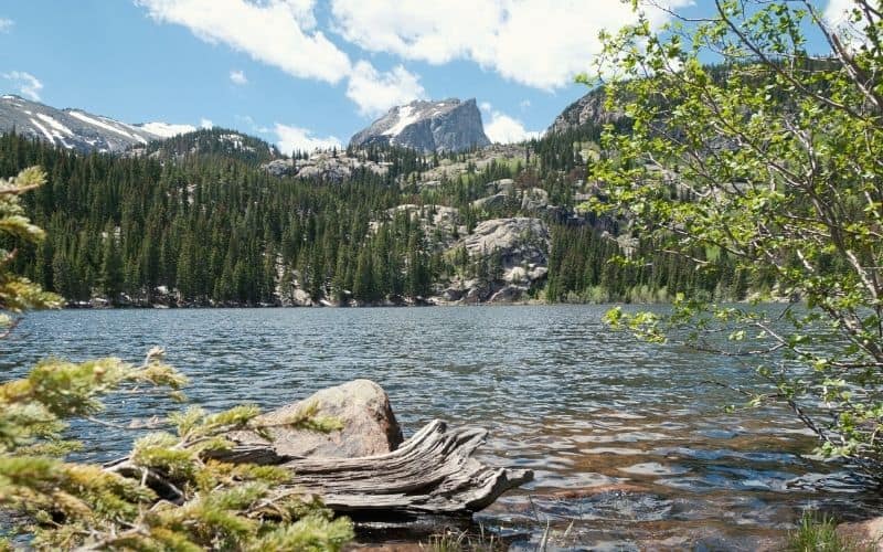
2. Dream Lake and Emerald Lake Trail
- Type: Out and back
- Access: Via Bear Lake Road off Highway 36 or on the RMNP shuttle to Bear Lake Trailhead
- Length: 3.6 miles
- Total Ascent: 650 feet
This hike is one of the most popular in the Rocky Mountain National Park – and with good reason. Throughout its 1.8 miles (one way), it serves up a visual feast every step of the way, including dense pine forests, alpine wildflowers, a trio of gorgeous alpine lakes, and the towering peaks of Hallett Peak, Longs Peak, and Flattop Mountain.
The trail starts at the Bear Lake Trailhead and is easy-going for the first 1.5 miles as it passes Nymph Lake and Dream Lake, before then climbing steadily to the water feature from which the trail takes its name, Emerald Lake (10,110 ft.)
The small glacial bowl in which the lake is found forms an enclave as scenic as any other anywhere in the park. Ringed by pine forest and steep scree slopes, the lake’s teal waters glisten below the giant, almost monolithic Hallett Peak on the left and the fang-like spires of the inappropriately named (from this angle, anyway) Flattop Mountain on the right.
In terms of effort-to-reward ratio, they don’t come much better than this…
This trail is very popular: to avoid the crowds, start your hike early.
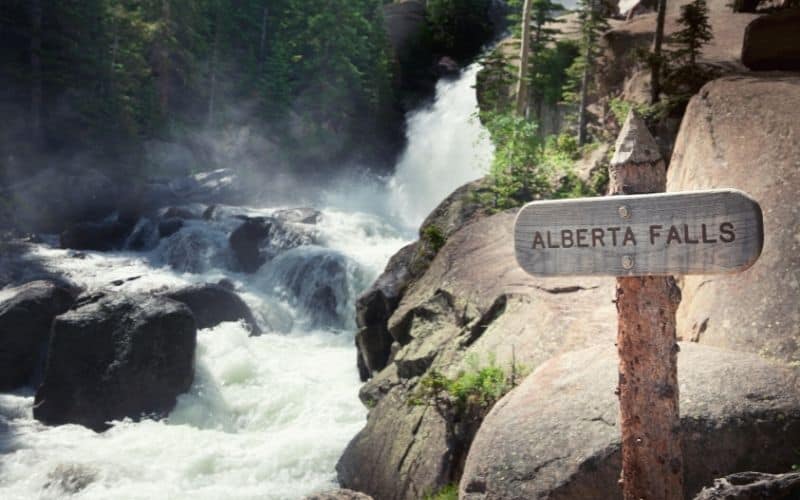
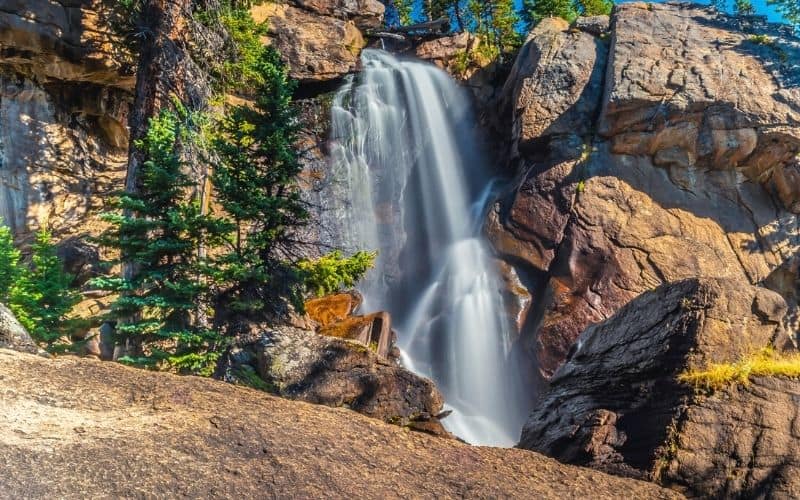
3. Alberta Falls
- Type: Out and back
- Access: From Glacier Gorge parking area and Glacier Gorge Junction trailhead
- Length: 1.8-miles
- Total Ascent: 200 feet
This short, scenic hike is ideal for those who want to get their kids out on the trails or who still have some gas in the tank after a day on one of the area’s lengthier hikes but aren’t yet ready to call it a day.
Beginning at the Glacier Gorge Trailhead, this hike winds gently upward alongside Chaos Creek through alternating pine forest and groves of stately aspen, whose fiery orange and yellow coloring in fall make the trail particularly worth hiking between late September and November.
After just 0.9 miles, the very well-maintained and heavily trafficked trail arrives at Alberta Falls, a gushing 30-foot waterfall that crashes down between the rock walls of a small gorge. Around the falls there are plenty of spots to kick back, enjoy a relaxing picnic or beer, and for sunrise or sunset photoshoots – if you’re lucky, an elk or two might even join you!
4. The Ute Trail
- Type: Out and back
- Access: Via Ute Crossing Trailhead, 10 miles west of Deer Ridge Junction
- Length: 4 miles
- Total Ascent: 410 feet
This short, relatively flat hike, which was once used by Arapaho and Ute Indians on their way between winter and summer hunting grounds, is one of the best hikes in Rocky Mountain National Park for those who want to acclimatize and break themselves into high-altitude hiking gently without compromising on views.
This 4-mile trail starts at the Ute Crossing Trailhead (near Rainbow Curve on Trail Ridge Road) on the Great Plains and crosses a broad swathe of alpine tundra on Tombstone Ridge on its way to the endpoint at Timberline Pass. It offers utterly outstanding views of Forest Canyon, Longs Peak, the Continental Divide, Moraine Park, and Estes Park every step of the way.
In addition to all those views, the other highlight of this hike is the opportunity for sightings of wildlife, including ptarmigans, marmots, bighorn sheep, mountain goats, ravens, hawks, coyotes, and elk.
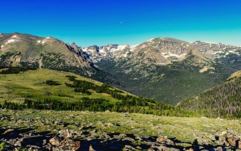
5. Alpine Ridge Trail
- Type: Out and back
- Access: Alpine Visitor Center on Trail Ridge Road
- Length: 0.65 miles
- Total Ascent: 140 feet
The Alpine Ridge Trail is normally one of the first hikes visitors to Rocky Mountain National Park choose to tackle. The reason for this is that it’s easily accessible and takes no more than 30 minutes to complete.
This, however, doesn’t mean that it’s a cakewalk. The hike starts just a fraction below 12,000 feet, so if you haven’t yet acclimatized to the thin air at this altitude, be prepared for a bit of a breathless struggle.
All that said, this hike offers a lot of reward for very little effort. After strolling or stumbling up the ridge on a paved staircase, you’ll enjoy gobsmackingly good views of the park.
Best Moderate Hikes in Rocky Mountain National Park
6. Bear Lake to Fern Lake Trailhead
- Type: Out and back or point-to-point
- Access: Via Bear Lake Trailhead, 9 miles from the turn-off on Highway 36
- Length: 9.2 miles
- Total Ascent: 1,200 feet
This wonderfully scenic 9.2-mile hike can be taken on in either direction, but by making use of Rocky Mountain National Park’s very handy free shuttle service and doing it in reverse (as described), you’ll be saving yourself a lot of ascent. Rocky Mountain National Park’s free shuttle buses operate in late spring, summer, and early fall.
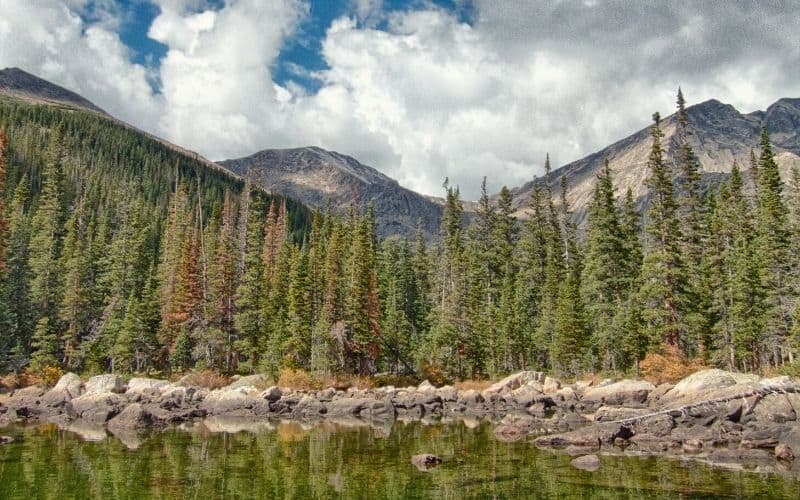
The highlights of this hike are almost too numerous to describe but include the chance for elk sightings, idyllic alpine meadows and lakes, and a vast array of towering rocky peaks. These peaks include Notchtop Mountain, Knobtop Mountain, Ptarmigan Point, Stones Peak, Little Matterhorn, and The Gable, all of which you’ll find picturesquely reflected in the waters of either Fern Lake, Odessa Lake, or Lake Helene.
7. Black Lake Trail
- Type: Out and back
- Access: From Glacier Gorge parking area
- Length: 9.4 miles
- Total Ascent: 1,463 feet
This moderate hike starts on one of Rocky Mountain National Park’s most heavily trafficked trails but soon escapes the crowds and carries you up into a high-mountain wonderland that includes an alpine meadow bedecked with vibrant alpine flowers, a duo of impressive waterfalls, three lakes, and amazing views of the surrounding peaks at the trail’s far more peaceful endpoint.
From the Glacier Gorge Trailhead, this trail follows the route to Alberta Falls described above before climbing to Mills Lake, where a rocky strand affords sumptuous views over to the pointy, 13,579-foot Chiefs Head Peak.
Following a short descent to Jewell Lake and a boardwalk crossing through marshland, the trail embarks on a series of steeper uphill sections that account for most of the hike’s total 1,463 feet of ascent. As consolation for your struggles, however, you’ll soon arrive at the gorgeous Ribbon Falls, just below your destination.
After an easy climb up the eastern flank of the waterfall, you’ll catch your first glimpse of Black Lake, situated in a wonderfully isolated glacial cirque with views of McHenry’s Peak, Chiefs Head Peak, The Arrowhead, and The Spearhead – none of which are anything less than majestic.
8. Ypsilon Lake Trail
- Type: Out and back
- Access: Via Lawn Lake Trailhead
- Length: 9 miles
- Total Ascent: 2,100 feet
This less-trafficked trail is one for those happy to put in a decent amount of ascent in return for the reward of seriously impressive mountain views and solitude.
The trail sets off from the Lawn Lake Trailhead in the Horseshoe Park area just west of Estes Park and starts with a gentle ascent along Roaring River and through dense pine forest, with occasional views of Deer Mountain and Longs Peak.
After a few short, steeper climbs, the trail eventually eases off on its way to its high point at 10,750 feet. From there, a short descent takes you down to the exquisitely cute Chipmunk Lake, where you’ll have exceptional views up to Ypsilon Mountain and Fairchild Mountain (13,502 ft.).
After another, steeper descent, the trail arrives at Ypsilon Lake, an ideal spot for lovers of solitude ringed by dozens of smaller social trails offering excellent views of Y-Mountain, Mt. Chiquita, and other giants in the Mummy Range.
9. Bluebird Lake and Ouzel Falls Hike
- Type: Out and back
- Access: Via Wild Basin Trailhead (about a 30-minute drive from Lyons)
- Length: 13.5 miles
- Total Ascent: 2,500 feet
This moderate to difficult hike throws in a little bit of everything that any hiker with an appreciation for natural beauty (all of us, right?) could ask for: a trio of cascading waterfalls, abundant wildflowers, a high chance of wildlife sightings, and two remote, largely unfrequented alpine lakes surrounded by giant granite mountains.
This 13.5-mile round trip includes 2,500 feet of ascent, so it’s not one you’d be wise to try with a hangover or without decent fitness levels, but the hike’s diverse terrain and relentlessly jaw-dropping views make every bit of effort well worthwhile.
From the Wild Basin Trailhead, the trail sets off through dense forest and passes three scenic waterfalls: Copeland Falls, Calypso Cascades, and Ouzel Falls. After a short, steepish climb, it then crosses a short stretch of high desert dotted with cacti and backed by views of the giant Longs Peak and Mount Meeker.
After four miles, a fork in the trail gives you the choice of a short, easy half-mile hike to Ouzel Lake and a stiffer 2.5-mile climb to Bluebird Lake. While it may be tempting to choose only one of the two, the panorama of lofty peaks on display around each lake merits summoning the strength to visit both.
10. Ptarmigan Lake
- Type: Out and back
- Access: Via the Bear Lake Trailhead
- Length: 12 miles
- Total Ascent: 3,850 feet
For those with an appetite for the truly wild and with calves of steel (or who would like to acquire them in a single hike!), the 12-mile hike to Ptarmigan Lake deserves a place on your to-do list of Rocky Mountain National Park adventures.
The trail to Ptarmigan Lake sets off on the Bear Lake Trail and continues for just under 4.5 miles to the top of Flattop Mountain, passing both Dream Lake and Emerald Lake Overlook, and enjoying exceptional views of Ptarmigan Point, Snowdrift Peak, the Mummy Range, Longs Peak, Hallett Peak and thee Tyndall Glacier Gorge along the way.
From the peak (12,324 ft.), the lake lies in a bowl-like saddle roughly 1.5 miles to the north, at 11,493 feet. There, you might not see many ptarmigans, but you will find yourself in one of the most secluded and scenic spots in the whole of Rocky Mountain National Park.
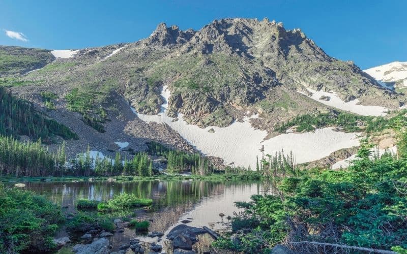
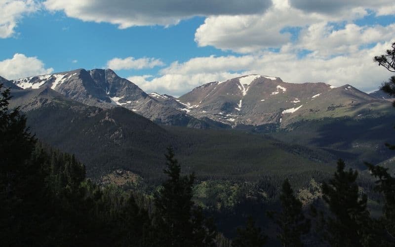
11. Mount Ida
- Type: Out and back
- Access: Via Milner Pass
- Length: 10 miles
- Total Ascent: 2,122 feet
With 360-degree views of the Mummy Range and dozens of RMNPs other giants, the relatively unfrequented, 12,880-foot Mount Ida offers one of the best viewpoints in all of Rocky Mountain National Park. It’s also one of the most easily accessible high peaks in the park.
The trail begins at Poudre Lake and climbs gradually through dense pine and fir forest before reaching a broad expanse of alpine tundra at around 11,400 feet, where you’ll have clear views of the Never Summer Mountains, Specimen Mountain, Shadow Mountain Lake, and eventually Mt. Ida herself.
From 12,250 feet onwards, the trail becomes less distinct, following sporadic cairns through a boulder field and talus on its way to the summit, where you’ll be treated to expansive views of the Mummy Range, Terra Tomah Mountain, Mt. Julian, Cracktop Mountain, Longs Peak, Julian Lake, and the vibrant blue waters of Inkwell Lake and Azure Lake over 1,000 feet below.
For much of the entire hike, you’ll be on the Continental Divide Trail, so sure to have some words of encouragement ready for CDT thru-hikers!
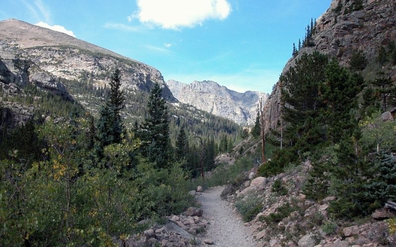
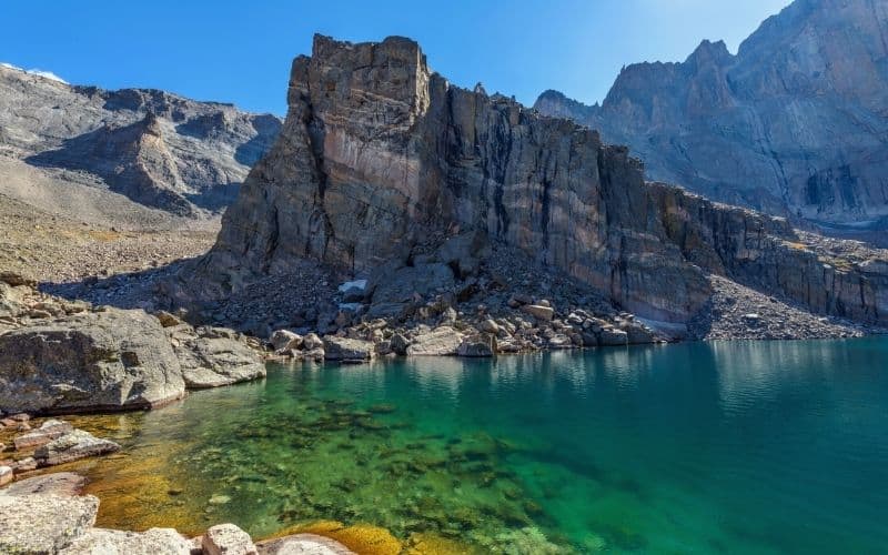
12. Sky Pond Trail via Glacier Gorge Trail
- Type: Out and back
- Access: Via Glacier Gorge Trailhead
- Length: 9 miles
- Total Ascent: 1,785 feet
On paper, the hike to Sky Pond appears nothing out of the ordinary, with less than 1,800 feet of ascent and a moderate total mileage of 9 miles. But while this trail is easy-going for most of those 9 miles, it involves a very exposed, 120-foot scramble that must be done in both directions and so is not one for the faint-hearted.
One of the most endearing factors about this route, however, is its inclusion of so many highlights, from the impressive Alberta Falls, Icy Brooks waterfalls, and Timberline Falls to the almost heavenly Loch Vale, Sky Pond itself, and even that slightly scary scramble.
To reach Sky Pond, continue past Alberta Falls on the Glacier Creek Trail and make your way up past the North Longs Peak Trail Junction onto the Loch Vale Trail.
Past the wonderfully picturesque “loch” – where you’ll enjoy stunning views of Taylor Peak, the Taylor Glacier, Thatchtop Mountain, The Sharkstooth, and Powell Peak – the aforementioned scramble begins up the side of Timberline Falls. Although the handholds are generous, we advise taking extreme care, particularly in wet conditions.
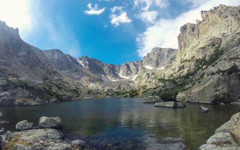
After 4.5 miles, you’ll finally arrive at Sky Pond (10,900 ft.), a simply sublime alpine lake surrounded on three sides by towering granite spires and near-vertical cliffs.
13. Deer Mountain
- Type: Out and back
- Access: About 3 miles west of the Beaver Meadows entrance on Trail Ridge Road
- Length: 6.2 miles
- Total Ascent: 1,100 feet
Keen to bag your first peak in Rocky Mountain National Park? If so, there are none more baggable than this.
From the Deer Mountain Trailhead, the route climbs steadily up through a forest of ponderosa pines. While the forest blocks most of the views on the way up, those you’ll enjoy at the top are well worth the wait. From the 10,013-foot summit, you’ll be able to see Longs Peak, Moraine Park, Upper Beavers Meadows, and Estes Park.
While this hike is unlikely to set your world on fire, it’s relatively unfrequented so a good pick for peeps who want a quieter time of things. Its lower elevation also makes it a great acclimatization hike to get yourself in shape for some of Rocky Mountain National Park’s bigger peaks.
14. Gem Lake Trail
- Type: Out and back
- Access: Lumpy Ridge Trailhead, just north of Estes Park on Lumpy Ridge Road
- Length: 4 miles
- Total Ascent: 1,090 feet
Gem by name, gem by nature! This short and sweet, family-friendly hike is one of Rocky Mountain National Park’s most popular lake hikes, partially because it’s not so long or strenuous, but mainly because it squeezes so much awesomeness into very few miles.
Along the way, you’ll be treated to gorgeous views of Rocky Mountain National Park, Estes Park, Longs Peak, and the Continental Divide. The scenic lake at the trail’s end is also one of the most photogenic we’ve ever seen.
Best Hard Hikes in Rocky Mountain National Park
15. Flattop Mountain Trail and Hallett Peak
- Type: Out and back
- Access: Via Glacier Gorge Trailhead off Highway 34
- Length: 8.5 miles
- Total Ascent: 2,866 feet
This hike follows the trail described for Ptarmigan Lake above, but instead of descending to the lake continues to take in two summits located smack bang in the middle of the Continental Divide.
From the Bear Lake Trailhead, the trail starts in pine forest before continuing up through a boulder field and aspen groves to the Bierstadt Moraine and eventually the steep mountain trail, on which you’ll be treated to striking views of Longs Peak, Chiefs Head Peak, the Keyboard of the Winds, and the turquoise waters of the aptly named Dream Lake and Emerald Lake.
The wide summit of Flattop Mountain (12,324 ft.) offers views of the Mummy Range, Notchtop Mountain and the valley below that are so stupendous that it might be tempting to call it a day here, but doing so would be a grave mistake.
Just over half a mile away, the pointy summit of Hallett Peak provides further gobsmacking panoramas and also the chance to tick another big summit (12,720 ft.) off your list while gazing at all the others yet to be added!
16. Chasm Lake
- Type: Out and back
- Access: Via Longs Peak Trailhead, 8.9 miles south of Estes Park on Colorado Highway 7
- Length: 8.5 miles
- Total Ascent: 2,570 feet
This hike is ideal for those who don’t fancy taking on the testy summit slopes of Longs Peak but want to enjoy views that are every bit as impressive.
This 8.5-mile out-and-back hike is fairly challenging and features over 2,500 feet of ascent, but avoids the airy passages encountered on Longs Peak, thus making it a better option for anyone who doesn’t have a head for exposure or the legs for very steep ascents.
It also, more to the point, ends in a giant glacial cirque at 9,400 feet that’s as pretty as any you’re ever likely to come across and you’d be loath to leave in any case!
Beginning at Longs Peak Trailhead and following the East Longs Peak Trail, this route winds its way through forest for the first few miles before climbing into scenic alpine tundra, where you’ll catch your first glimpse of the mighty Longs Peak.
After passing Chasm Junction at just under 9,000 feet and the idyllic Chasm Meadows, the going gets a touch tougher and more exposed, with a short, lung-burster of an ascent taking you up the side of a waterfall below Chasm Lake.
When you finally reach the lake, the imposing bulk of Longs Peak will be bared in all its glory, reflected in the lake’s crystal-clear waters – which, we might add, provide the perfect tonic to burning calves and blistering feet!
17. The Mummy Kill
- Type: Point-to-point
- Access: Via Lawn Lake Trailhead
- Length: 16.7 miles (one-way)
- Total Ascent: 4,880 feet
For those of you with a slightly masochistic streak and not put off by a few tricky logistics, the “Mummy Marathon” might just present the ideal challenge in Rocky Mountain National Park.
The objective of this hike is to summit all of the six main peaks in the Mummy Range, which means one heck of a long day (figure 12-16 hours, depending on your fitness levels) but also an almost unimaginable amount of epic mountain scenery.
The six peaks summited on the hike are Mount Chapin (12,454 ft.), Mount Chiquita (13,069 ft.), Ypsilon Mountain (13,514 ft), Fairchild Mountain (13,502 ft.), Hagues Peak (13,560 ft.), and Mummy Mountain (13,425 ft.).
To do this hike, you’ll need two vehicles, leaving one at your starting point at Lawn Lake and the other, for the return journey, at Chapin Pass Trailhead on Fall River Road.
From Lawn Lake Trailhead, the route follows a marked path to Mount Chapin, Mount Chiquita, and Ypsilon Mountain. Thereafter, the trail becomes less evident and in places, almost non-existent, so good navigation skills are a must. The going is rarely easy and the terrain varies from rough Class II/III ridge hiking to stiff, exposed Class IV scrambling on Hagues Peak.
After reaching the peak of Mummy Mountain, don’t be patting yourself on the back or celebrating just yet – a long slog through dense forest and an unexceptional 5-mile hike back to the car still await! Then, pat and celebrate away…you’ll deserve it!
To avoid afternoon thunderstorms, you should only attempt this route in good weather.
18. Longs Peak (Keyhole Route)
- Type: Out and back
- Access: Via Longs Peak Trailhead, 9 miles south of Estes Park on Highway 7
- Length: 15 miles
- Total ascent: 5,100 feet
The tallest and most iconic mountain in Rocky Mountain National Park, Longs Peak (14,259 ft.) offers one of the most enjoyable and thrilling summit hikes in all of Colorado. If that is, you have both a good head for heights and calves made of some kind of titanium-steel alloy.
The route follows the same trail as described for Chasm Lake (above), before embarking on the ever-so-slightly infamous Keyhole Route. That infamy derives from the trail’s distinct turn for the testy beyond Chasm Lake, with a series of airy, exposed traverses below and above huge cliff faces and semi-scrambles up the rock and boulder-strewn slabs below the summit.
No one would blame you for opting out and ending your day at Chasm Lake, but by taking on that final, challenging, and slightly scary final stretch you’ll reap more than ample rewards, with the summit offering up uninterrupted, 360-degree views of just about every mountain in a fifty-mile radius!
If you plan to make a two-day trip of this hike by camping, make sure you pick up a wilderness permit at the Beaver Meadows Visitor Center (near the Estes Park Visitor Center) or at the Kawuneeche Visitor Center, which is near the Grand Lake entrance.
19. Bonus Hike: Lake Estes Trail
- Type: Loop
- Access: Via North Street Vain Avenue (Highway 36) on the lake’s west side
- Length: 3.8 miles
- Total Ascent: 190 feet
Those looking for a simple, easily accessible trail in the Rocky Mountain National Park area (and who have sated themselves with all of the above hikes!) could do a lot worse than start their search with the Lake Estes Trail in Rocky Mountain National Park’s neighboring Estes Park.
This 3.8-mile loop is accessible year-round, suitable for hikers of all fitness levels, and is an ideal choice for parents looking to introduce their kids to hiking on something gentle before testing their mettle further afield.
‘Easy,’ however, doesn’t mean ‘boring’ – not in the slightest. In addition to the potential for elk sightings along the way, this trail provides non-stop, uninterrupted views across the lake to the surrounding mountains. It’s also paved, dog-friendly, and has toilets and picnic tables every half mile or so, making it perfect for a laid-back outing with all the family.
Final Thoughts
Rocky Mountain National Park offers a veritable smorgasbord of awesome hiking trails to explore and enjoy. We hope the above list has helped you choose the ideal options for your visit and would love to hear from you post-trip – let us know how it goes by dropping a comment in the box below! And if you’d like to share this post with your friends, share away!
If you need more information, contact the national parks service visitor center for updates on trail conditions. This is particularly important in the shoulder seasons as access to the trails may be restricted due to snow.
Save for later!!! ⤵️