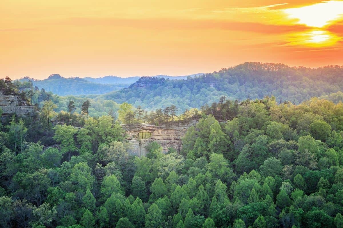
The Red River Gorge Geological Area located in Daniel Boone National Forest, is a paradise for hikers, rock climbing, and all nature lovers.
Discover our nine favorite trails in Red River Gorge, ranging from simple, family-friendly outings to strenuous backpacking trips. This designated geologic area boasts stunning sandstone rock formations, wildflowers, black bears, bobcats, and more.
So, pack your bags and go explore the Daniel Boone National Forest, which offers some of the best hiking near Lexington, Kentucky.
Do
Don’t

| Hike Name | Type | Difficulty | Duration | Length | Elevation Gain |
|---|---|---|---|---|---|
| Star Gap Arch & Arch Of Triumph Trail + Double Arch | Out-and-back with side trails, partially unmarked | Moderate | ~3 hours | 6.1 miles (9.8 km) | 984 ft (300 m) |
| Wildcat Trail | Point-to-point | Easy | ~1 hour | 1.9 mile (2.9 km) | 230 ft (70 m) |
| Pinch Em Tight Trail And Hanson’s Point | Out-and-back trail | Moderate | ~3 hours | 5.4 miles (8.7 km) | 475 ft (140 m) |
| Swift Camp Creek Trail, Clifty Wilderness | Point-to-point | Hard | ~3 hours 45 mins | 6.8 miles (10.9 km) | 950 ft (290 m) |
| Indian Staircase And Indian Arch | Lollipop | Challenging | ~2 hours | 3.5 miles (5.6 km) | 650 ft (198 m) |
| Auxier Ridge Loop | Loop | Challenging | ~3 hours | 5 miles (8 km) | 860 ft (250 m) |
| Natural Bridge And Laurel Ridge Trail | Loop | Easy | ~1 hour | 1.9 miles (3 km) | 500 ft (152 m) |
| Rough Trail to Gray’s Arch | Loop | Moderate | ~2.5 hours | 4.7 miles (7.6 km) | 406 ft (124 m) |
| Whittleton Arch | Out-and-Back | Easy | ~1.5 hours | 2.5 miles (4 km) | 328 ft (100m) |
What are the Best Red River Gorge Trails?
Here is the list of our 9 favorite Red River Gorge hikes.
- Double Arch Trail, Star Gap Arch, and Arch of Triumph
- Wildcat Trail
- Pinch Em Tight Trail and Hanson’s Point
- Swift Camp Creek Trail, Clifty Wilderness
- Indian Staircase and Indian Arch
- Auxier Ridge Loop
- Natural Bridge and Laurel Ridge Trail
- Rough Trail and Gray’s Arch
- Whittleton Arch
Table of Contents
1. Star Gap Arch & Arch Of Triumph Trail + Double Arch
One of the best trails in Red River Gorge is the 6.1-mile (9.8 km) trail to Start Gap & Arch of Triumph giving you expansive views over the area.
The trail starts in the Auxier Ridge parking lot, and you’ll follow an unused gravel road to get to the arches. Both of these are unmarked trails, and involve some scrambling but they’re well worth the effort!
From the top of each arch you’ll enjoy expansive views of different valleys. You’ll see granite walls peeking from valleys of green trees. After you find these arches, the short Double Arch Trail will be a breeze. This arch is truly unique as it is actually two arches stacked on top of each other.
This hike can also be combined with the Auxier Ridge and Courthouse Rock trails to create a 7.3-mile loop hike.
Here’s some more information about this hike.
- Length: 6.1 miles (9.8 km)
- Elevation gain: 984 ft (300 m)
- Duration: ~3 hours
- Difficulty: Moderate
- Type: Out-and-back with side trails, partially unmarked
2. Wildcat Trail
The Wildcat trail is an excellent short hike that can be combined with others in the area or hiked on its own as an out-and-back route (just double the 1.9-mile distance).
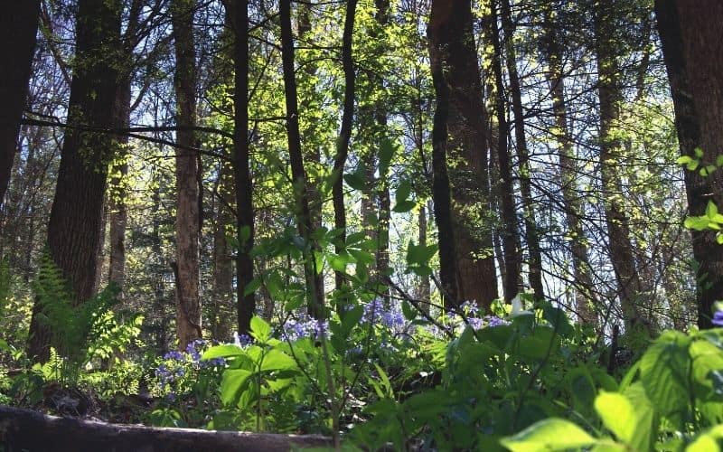
Starting from the trailhead on Sky Bridge Road, you’ll follow Wildcat Creek for the majority of this hike. Expect to see wildflowers, mossy trees, and plenty of wildlife. You can also take a side trail to an old cemetery from here. After you pass an old logging road, follow the unmarked trail uphill at a fork. A few hundred yards uphill you’ll find the cemetery.
The route ends at the Swift Camp Creek trail. You can extend your day by looping back to where you started from here.
Here’s some more information about this hike.
- Distance: 1.9 mile (2.9 km)
- Elevation gain: 230 ft (70 m)
- Duration: ~1 hour
- Difficulty: Easy
- Type: Point-to-point
3. Pinch Em Tight Trail and Hanson’s Point
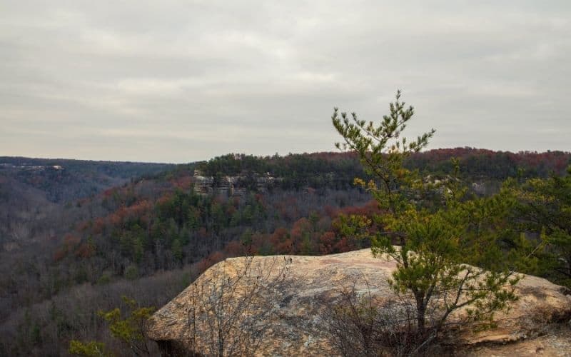
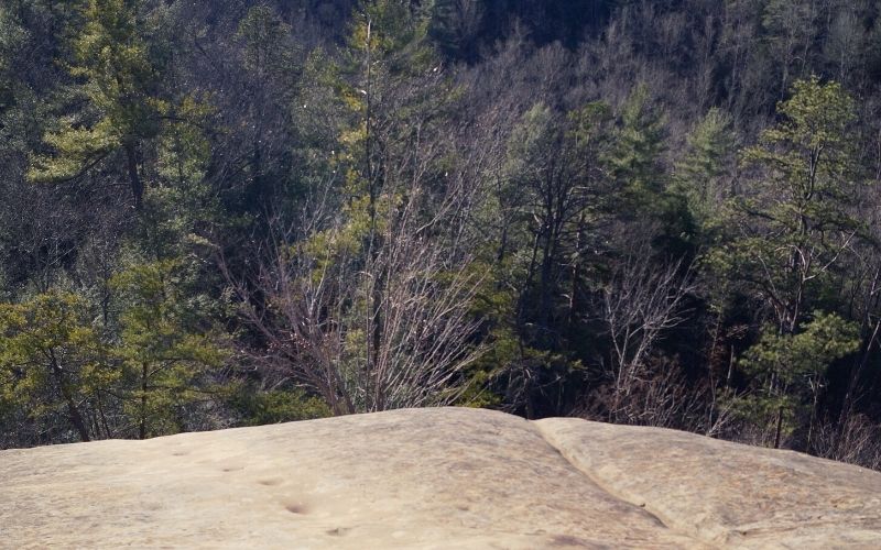
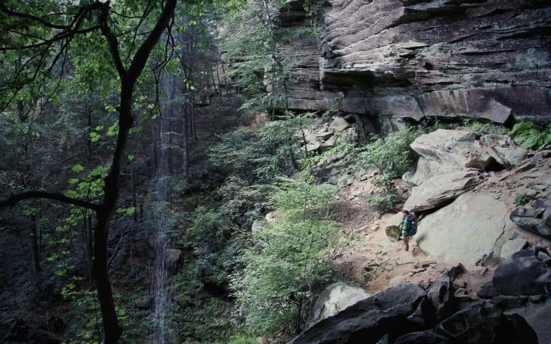
The Pinch Em Tight is a moderately difficult out-and-back trail that leads to Hanson’s Point, a large rock outcropping with stunning views of the gorge.
Though this route is harder to follow than some, the views at the end are worth the difficulty. Most of the trail is surrounded by pine trees. You’ll know you’re getting close to the payoff when it gets steeper. The path will be pretty narrow by then, too.
Suddenly, you’ll be out of the trees and surrounded by beautiful views. You’ll see the sandstone cliffs jutting out of the forest below. These cliffs will make you understand why Red River Gorge is also a world-class climbing destination.
Here’s some more information about this hike.
- Distance: 5.4 miles (8.7 km)
- Difficulty: Moderate: 475 ft (140 m)
- Duration: ~3 hours
- Type: Out-and-back trail
4. Swift Camp Creek Trail, Clifty Wilderness
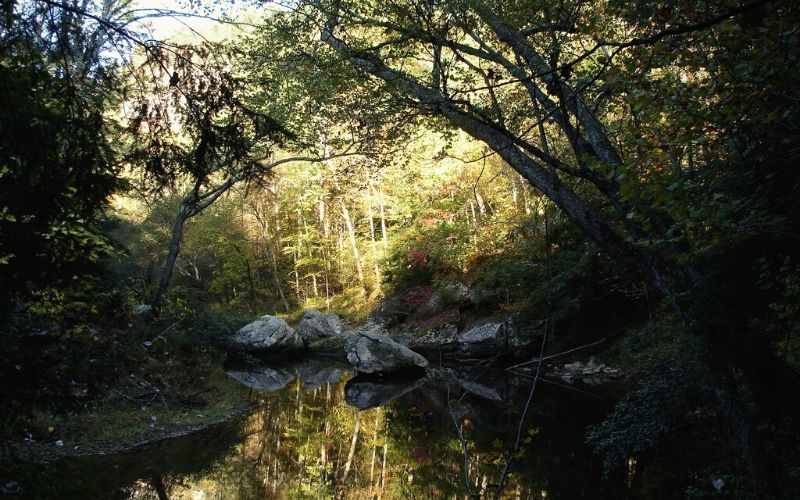
A day on the 6.8-mile (10.9 km) Swift Camp Creek Trail offers you a wonderful taste of everything that Red River Gorge has to offer. This is a point-to-point, so you’ll need to double the distance if you want to make a day hike out of it and do an out-and-back. A better option is to bring a tent and split it into two days by doing some backcountry camping.
This trail weaves through dense forest and feels wild. You’ll see historic rock shelters where ancient indigenous people lived. There will be steep climbs and descents. But, you’ll get magnificent views of the surrounding countryside from the tops of those climbs.
The trail follows a stream. There are great swimming holes all along it, so bring your swimsuit and take a dip!
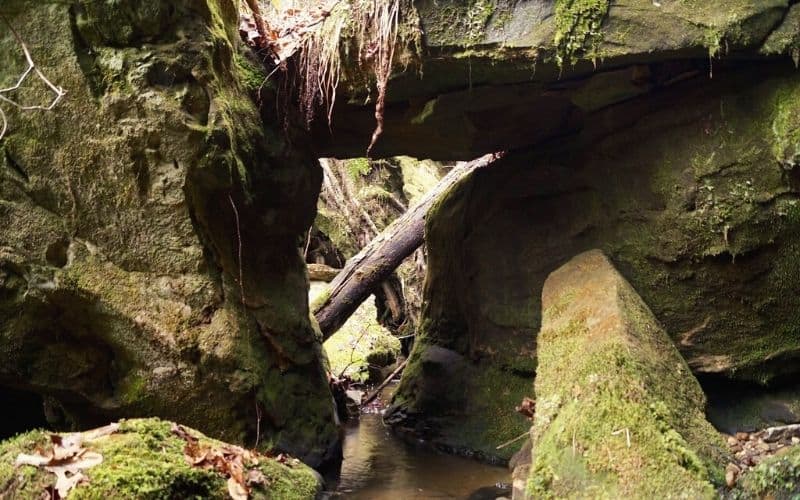
Before you head back, you can add the short 1.3-mile Rock Bridge trail to Creation Falls onto the end of this hike. This would make for one long day of hiking, so making this a two-day trip is recommended.
Here’s some more information about this hike.
- Distance: 6.8 miles (10.9 km)
- Elevation Gain: 950 feet (290 m)
- Duration: ~3 hours 45 mins
- Difficulty: Hard
- Type: Point-to-point
5. Indian Staircase and Indian Arch
The 3.5-mile (5.6 km) Indian staircase is not an official trail, but a series of pockets in steep sandstone rock leading to the top of a cliff. Getting up there, we assure you, is a truly unique experience, and the views from the top are well worth the scary scrambling you have to do to get there.
The hike starts on the Bison Way Trail, and then goes onto Sheltowee Trace National Recreation Trail. From the Sheltowee Trace, you’ll turn onto an unmarked dirt path after about half a mile. After some scrambling and bushwacking, you’ll be on the Indian Staircase.
Be ready for some difficult scrambling on the way up. This route can be very dangerous, so don’t attempt it alone or if you have no prior experience of scrambling. And of course, be sure to bring a topographical map, compass, and GPS for navigation.
Here’s some more information about this hike.
- Distance: 3.5 miles (5.6 km)
- Elevation gain: 650 ft (198 m)
- Duration: ~2 hours
- Difficulty: Challenging
- Type: Lollipop
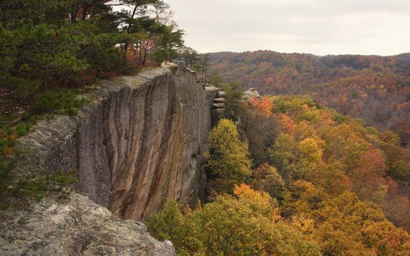
6. Auxier Ridge Loop
The 5-mile (8 km) Auxier Ridge loop is an epic offering panoramic ridge-top views. We’ve rated this as ‘challenging’ since there’s a fair bit of climbing involved. Most of this elevation gain will be going up stairs, so it is not as difficult as other hiking trips in the area.
Take Auxier Ridge Trail up to the top, where you’ll be rewarded with views of Haystack Rock and Courthouse Rock. Then, take the Courthouse Rock Trail back down to complete the loop.
Here’s some more information about this hike.
- Distance: 5 miles (8 km)
- Elevation Gain: 860 ft (250 m)
- Duration: ~3 hours
- Difficulty: Challenging
- Type: Loop
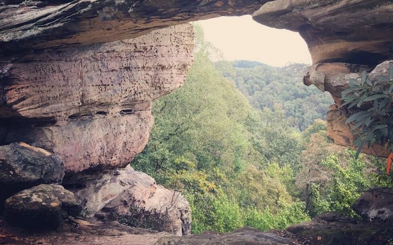
7. Natural Bridge and Laurel Ridge Trail
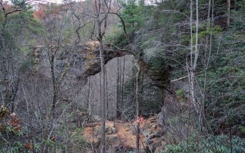
The 1.9-mile hike to the Natural Bridge via the Laurel Ridge trail isn’t technically in the Red River Gorge, but it is one of the more famous sites in the area. This hike is within the Natural Bridge State Park and leads to the Natural Bridge, a giant rock bridge carved over millions of years. This bridge is over 75 feet long and 65 feet high.
There are several ways to get to the top of the Natural Bridge, but we think this way is best. Taking the Natural Bridge Trail up and Laurel Ridge down via Battleship Rock makes for a more interesting loop. On the way down Laurel Ridge, head out to Lovers Leap for another epic view.
Also, there is a skylift to Natural Bridge if you don’t feel like hiking. Check the park’s website (above) for more info.
Here’s some more information about this hike.
- 1.9 miles (3 km)
- Elevation Gain: 500 ft (152 m)
- Duration: ~1 hour
- Difficulty: Easy
- Type: Loop
8. Rough Trail and Gray’s Arch
The 4.7-mile loop along the Rough Trail to the beautiful Gray’s Arch is one of the most popular hikes in the area. It starts off flat, winding through dense forest, then turns steep near the arch. Rough Trail can get pretty rough, too, as the name suggests. Be ready for lots of up and down if you venture further along this one.
Gray’s Arch provides views of the surrounding area. You can scramble up to the top of this rock bridge from the back side, just be sure to take extra care when doing so!
Here’s some more information about this hike.
- 4.7 miles (7.6 km)
- Elevation Gain: 406ft (124 m)
- Duration: ~2.5 hours
- Difficulty: Moderate
- Type: Loop
9. Whittleton Arch
The 2.5 mile trek to Whittleton Arch is one of the easier hikes on this list but has no shortage of natural beauty. This out-and-back follows a creek up to Whittleton Arch. You’ll see wildflowers and loads of other wildlife on the way up.
This arch is very impressive. It has a stream flowing off the top that falls into the huge boulders below. An easy climb to the top lets you see where the water pools before it tumbles off the sandstone arch.
Here’s some more information about this hike.
- Distance: 2.5 miles (4 km)
- Elevation gain: 328 ft (100m)
- Duration: ~1.5 hours
- Difficulty: Easy
- Type: Out-and-Back
Red River Gorge Hiking: The Only Time It’s Good to Be In “The Red”!
Start playing some bluegrass music. It’s time to put on your hiking boots and head to the Red River Gorge to check out those interesting rock formations and do some arch hunting!
We hope you found this list of best hikes in Red River Gorge area helpful in planning your next trip. Did we miss your favorite hike? Have any questions? Leave us a comment!