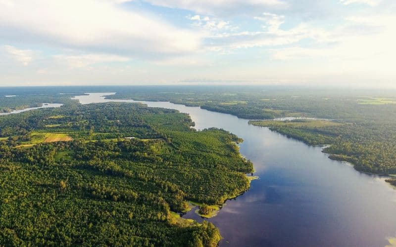
There are more than cotton fields in Alabama!
Believe it or not, Alabama has world-class hiking. You can chase waterfalls, scramble to summits, explore narrow canyons, and wander through stunning forests, all in the Yellowhammer State.
Use this guide to find the perfect hiking trail for your next adventure. We’ve included something for everyone, from easy boardwalk trails and beautiful waterfall loops to formidable rock scrambles and all-day epics.
Table of Contents
- 1. Rainbow Mountain Loop Trail, Rainbow Mountain Preserve
- 2. Peavine Falls, Oak Mountain State Park
- 3. Pulpit Rock, Cheaha State Park
- 4. Lost Falls Trail, DeSoto State Park
- 5. Stone Cuts Trail, Monte Sano State Park
- 6. Little River Falls, Little River Canyon National Preserve
- 7. Cheaha Mountain via Lake Trail, Cheaha State Park
- 8. Alum Hollow Trail, Green Mountain Nature Preserve
- 9. Walls of Jericho Trail
- Best Hikes in Alabama: Happy Hiking!
1. Rainbow Mountain Loop Trail, Rainbow Mountain Preserve
- Type: Loop
- Length: 1.5 miles
- Difficulty: Moderate
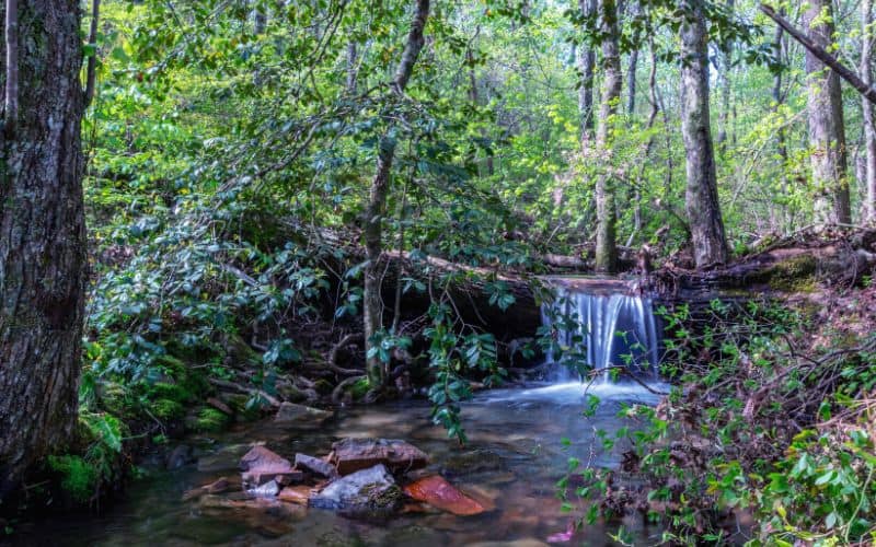
The Rainbow Mountain Loop Trail in Rainbow Mountain Nature Preserve offers hikers an outdoor adventure without leaving the city. Start from the parking area next to the pavilion and follow this rocky trail into a beautiful hardwood forest.
This loop trail takes hikers down into a wooded valley where you can find red cedars, oaks, and hickory trees, as well as various caves and trickling waterfalls. This is the perfect place to reconnect with nature for Madison city-dwellers.
Balance Rock Trail at the end (or beginning) of the loop adds a short detour to a unique rock formation. Download a map from the above link before you enjoy this oasis in the suburbs.
2. Peavine Falls, Oak Mountain State Park
- Type: Loop
- Length: 1.6 miles
- Difficulty: Moderate
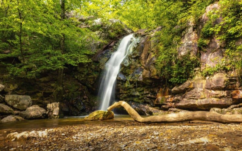
Peavine Falls is a 65-foot waterfall at the top of Oak Mountain State Park. Several trails lead to this must-see waterfall, but we recommend combining the Green and White trails into a 1.6-mile loop on the flanks of Double Oak Mountain.
Start from the Green Trailhead near the Park Office on Terrace Drive. (You can also pick up a map at the office). Then take the Green Trail to the Peavine Falls parking lot, where you will meet the White Trail. Take the White trail to the waterfalls at the end.
The trail is steep and rocky in places, but the waterfall is simply stunning. Peavine Falls is spring fed, so it always runs. However, there will be more rushing water after a rainstorm.
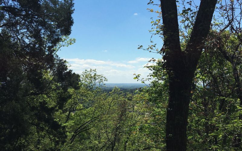
3. Pulpit Rock, Cheaha State Park
- Type: Out and back
- Length: 0.6 miles
- Difficulty: Easy
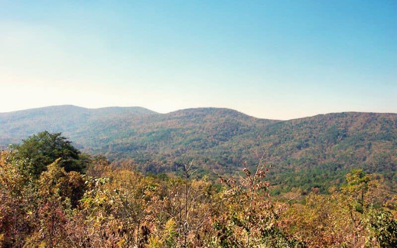
At 2,047 feet above sea level, on the southern portion of the Appalachian mountains, Cheaha State Park is home to the highest point in Alabama. There are several hiking trails within the park, including the short hike to Cheaha Falls or the epic Chinnabee Silent Trail. For our money, however, Pulpit Rock provides the best overlook.
Use the Pulpit Rock parking area and follow the red blazes up the east side of Cheaha Mountain. The is a short trail but uneven and rocky in places. The reward is spectacular views of Talladega National Forest as far as the eye can see. Depending on the weather, you may even be above the clouds!
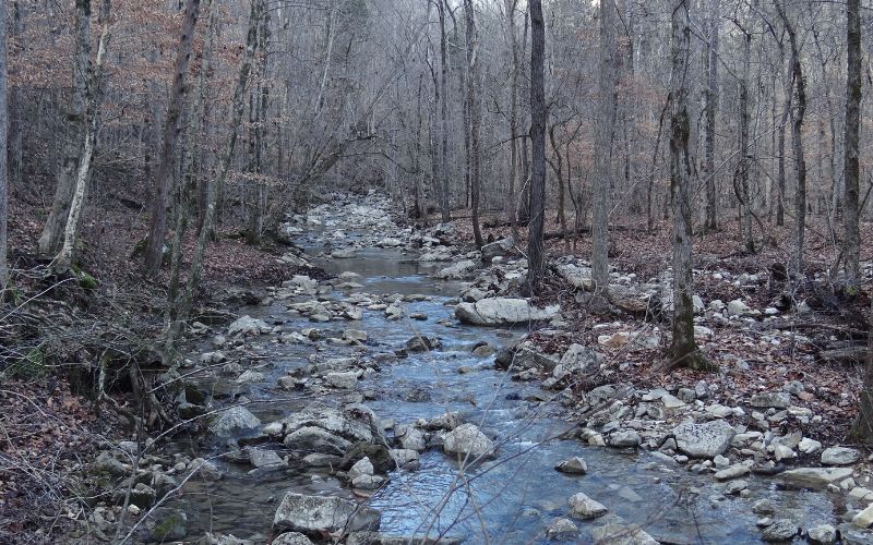
4. Lost Falls Trail, DeSoto State Park
- Type: Loop
- Length: 2.3 miles
- Difficulty: Moderate
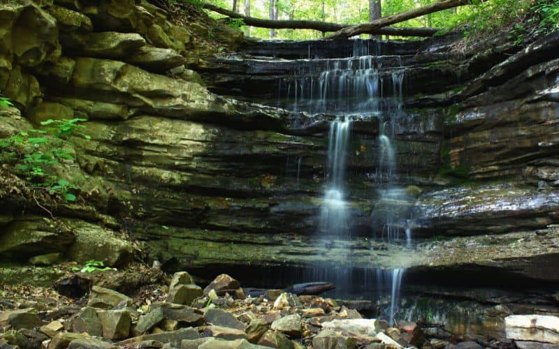
There are many waterfalls in Desoto State Park, in the northeastern corner of the state. However, everyone comes to see Lost and Laurel Falls. This 2.3-mile loop trail combines orange and blue-blazed trails for a moderately challenging hike.
There is a lot to see on this hike!
First up on the orange trail is Needle Eye Rock, a boulder split in half. After this, the trail dips into a secluded ravine on the blue trail. From there, you pass the signature attractions, Laurel and Lost Falls.
Next, you get to see water-eroded caves and don’t forget about the park’s smallest waterfall, Azalea Cascade, which is only 3 feet tall but mesmerizing nonetheless. In other words, make sure you bring your camera!
There are several ways to extend this hike. You can add around a mile on the Red Trail at the far end of the loop, 0.5 miles on the Purple Trail to visit the Never Neverland Backcountry Site, or up to 12 miles on the Desoto Scout Trail!
5. Stone Cuts Trail, Monte Sano State Park
- Type: Loop
- Length: 2.4 miles
- Difficulty: Moderate
Monte Sano State Park in North Alabama attracts thousands of visitors every year. People come from miles around to experience summer wildflowers, winter waterfalls, and the spectacle of the changing leaves in fall. One of the park’s most popular trails is Stone Cuts Trail, a unique and mystifying hike.
Begin on the Broken Road Trail. Hike the old road for a quarter mile and turn left onto Mountain Mist Road. Follow signs for Stone Cuts Trail. There is a “bypass” option. Don’t take this one, or you’ll miss all the best features.
The trail passes towering limestone walls, through underground caves, and around giant sinkholes. There are benches along the path where you can stop and take in the breathtaking views.
6. Little River Falls, Little River Canyon National Preserve
- Type: Out and back
- Length: 1.7 miles
- Difficulty: Easy
Little River Canyon National Preserve is an idyllic place where visitors can get away from the noise of everyday life.
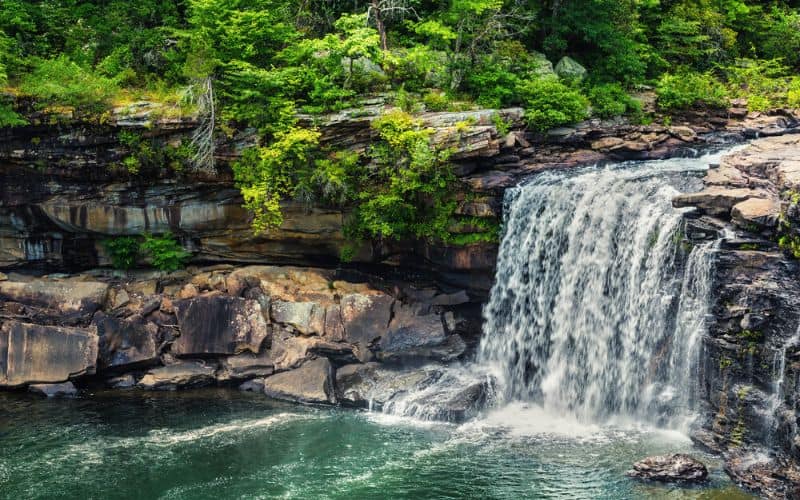
Little River Falls Trail, appropriate for all skill levels and ages, provides access to beautiful waterfalls, sandstone cliffs, and canyon rims. Find the Little River Falls trailhead at the visitor center, where you can also learn about the area’s geology and pick up a trail map.
Follow the boardwalk trail to a viewing platform. For more of a challenge, use the Eberhart Trail to descend into the canyon, where you will find peaceful summer swimming holes. Entrance to the preserve is free, but the area is closed after dark.
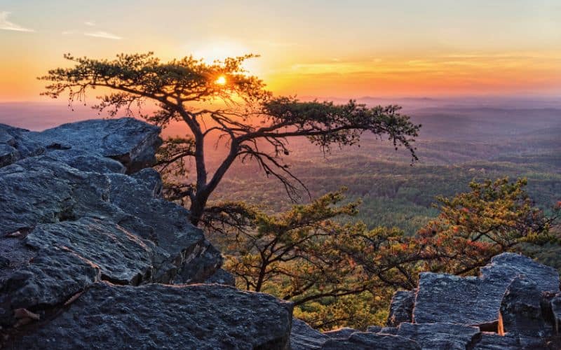
7. Cheaha Mountain via Lake Trail, Cheaha State Park
- Type: Out and back
- Length: 3.3 miles
- Difficulty: Challenging
Cheaha State Park offers both family-friendly waterfall hikes and challenging summit trails. Lake Trail leads hikers up steep slopes to the top of Cheaha Mountain, the highest point in Alabama at 2,413 feet.
This is a challenging hike, especially by Alabama standards. Most of the trail is steep and rocky. We recommend sturdy hiking boots. The trail becomes a scramble in the last mile, but you’re almost there!
The summit is a treat and not only for the panoramic vistas. At the top, you’ll also find a life-size Big Foot cut-out, an observation tower, and a Conservation Corp Museum. You might want to get out your trekking poles for the hike back down!
8. Alum Hollow Trail, Green Mountain Nature Preserve
- Type: Out and back
- Length: 2.2 miles
- Difficulty: Easy
The streams and waterfalls in Green Mountain Nature Preserve flow most of the year and give visitors a chance to get outside and breathe truly fresh air. Bring the whole family on an outing down Alum Hollow Trail, which provides the best hike in the preserve.
Starting from the trailhead off South Shawnee Road, the trail works along a bluff line. The bluff provides fantastic views of the surrounding landscapes. Although the trail is relatively flat, there is one steep section as you hike down to the waterfalls, where sure footing is a must
Once you’ve had your fill of the falls, walk around the corner to Alum Cave, a historic Native American shelter. To hike back out, retrace your steps and return the way you came.
9. Walls of Jericho Trail
- Type: Out and back
- Length: 8.1 miles
- Difficulty: Challenging
You will feel The Walls of Jericho Trail in your legs the next day, but the scenery is worth it. Start from the northern parking area on Highway 79 and head west toward Hurricane Creek. The trail then parallels Turkey Creek into the Walls of Jericho’s imposing limestone canyons.
At Clark Cemetery, there is a fork in the trail. For the best experience of the “walls,” take the lower route into a rock amphitheater. Continuing from the amphitheater, the trail arrives at two different waterfalls and a series of caves.
The trail ends at the third and largest of the waterfalls, which becomes inaccessible during high-water events. Use common sense, and don’t attempt to cross swollen creeks.
Best Hikes in Alabama: Happy Hiking!
When it comes to variety and beauty, Alabama hiking has it all. You can stand above the clouds and slink through deep canyons all in the same state.
We hope our guide to the best hikes in Alabama changes your mind about what The Yellowhammer State has to offer and inspires you to lace up your hiking boots and hit the trail.
Let us know which is your favorite hiking trail in the comments below, and don’t forget to share this with your hiking partner.
