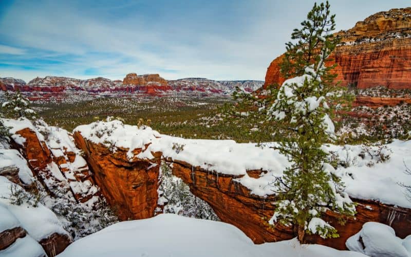
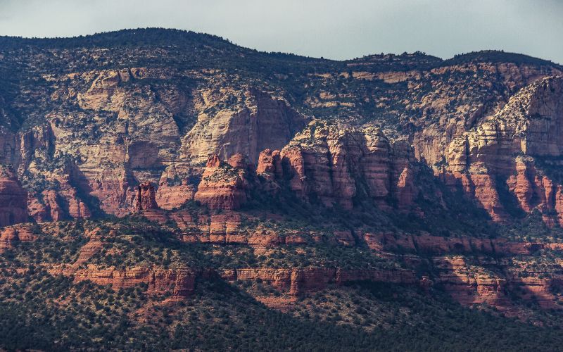
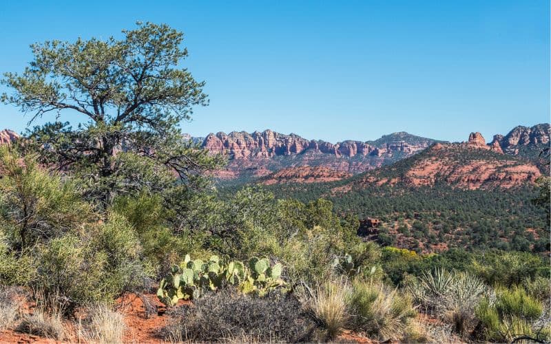
The Devils Bridge Trail is a gem of Sedona, Arizona hiking. Along the way, you can spot yucca, cacti, and views of red rock buttes and walls. At the end of the trail, you find an imposing, picture-perfect sandstone arch that you can – if you can muster the nerve! – walk across.
This is an easy hike, granted, but presents enough of a challenge that you’ll still feel like you earned all those awesome photos you’ll snap along the way!
Continue below for information on when to go, how to get there, and other helpful tips.

Table of Contents
What do you need to know about Devil’s Bridge in Sedona?
One of the most popular hikes in Sedona, if not Arizona, the short hike to Devil’s Bridge is easily manageable for most hikers. Here’s a brief overview.
- Type: Out and back
- Length: Between 2 and 4.2 miles depending on your vehicle and parking availability
- Time: 1-3 hours
- Elevation gain: 515 feet (157m)
- Difficulty: Easy to moderate with one short scrambly section (depends on trailhead route)
In the next sections, we’ll cover the following.
- Trail route
- When to visit
- How to Get there
Devil’s Bridge Trail Route
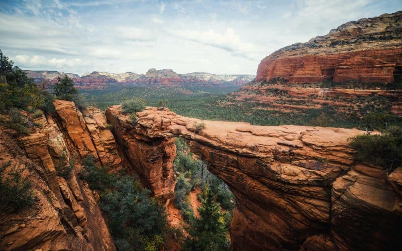
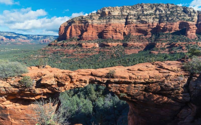
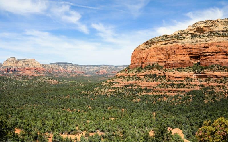
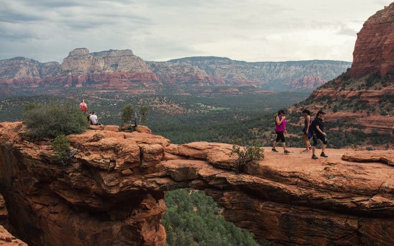
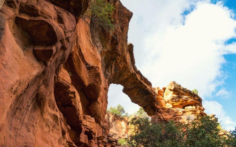
Once you’ve reached the Devil’s Bridge Trailhead, a brief hike along the trail route leads you to Devil’s Bridge, the largest natural arch in the Sedona area.
The hiking trail begins on an old access road. Shortly, the access road turns into a well-maintained and gradual trail for much of the hike. During these 3/4s of a mile, there are a few rock ledges to be aware of. You should also keep your eyes peeled for a balancing rock up in the surrounding mountains.
The trail narrows and steepens dramatically in the last quarter of a mile. At this point, you will have to ascend two steep, uneven sets of rocky steps. It’s a good idea to use three points of contact on the rock staircases and steady yourself with your hands.
The rock steps are intimidating, but you are almost there! At the end of the second set of steps, you arrive at the bridge!
At the top, there is a large, flat viewing area at the top where you can catch your breath and marvel at the 50-foot sandstone arch. This is also a good spot to wait your turn to walk over the bridge and take your photo.
Once you’ve had your fill at the arch, return on the same trail. When it comes to descending the rock stairs, there is no rush. Use your hands and take your time.
When should you visit Devil’s Bridge?
The best time to visit the Devil’s Bridge is in April or May, with highs in the 70s and 80s, or in the fall with October offering similar temperatures to the spring.
Winter weather in the Sedona area is suitable for hiking, with highs around 60°F. However, the trail can become icy and slippery after a snowstorm. Avoid the trail the day after a snowfall, or bring microspikes or Yaktrax.
Summer hiking in the desert can be challenging due to the extreme heat. This doesn’t stop people from venturing out. The heat is manageable at the right time of day.
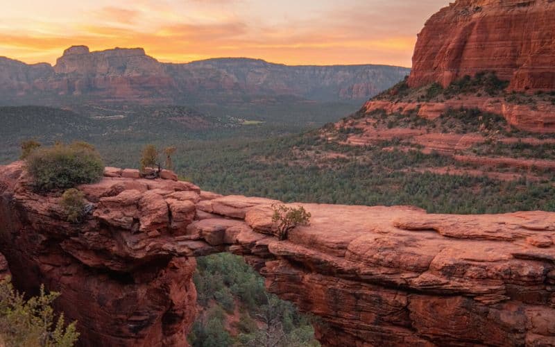
With the Devil’s Bridge hike, the earlier, the better. It is one of the most popular trails in the area, and the limited parking area fills up fast. Try and be at the trailhead by 7 am to get a parking spot. If you can catch the sunrise from the arch, you’re in for a fantastic start to your day.
The other option is to wait until late afternoon. By 4 pm, the parking lots and trail will be slightly less busy. The afternoon light is also great for photos at the arch.
How to get to Devil’s Bridge trail?
The most challenging aspect of the Devil’s Bridge hike is getting to the trail in the first place! There are five different points for this hike, with numerous ways to get there as described below.
- With a 4×4 Vehicle
- Without a 4×4 Vehicle
- Overflow Parking
- Sedona Shuttle
- Mescal Trailhead
With a 4×4 Vehicle
You can access the Devil’s Bridge Trailhead by driving a reliable 4×4 vehicle with high clearance. Drive down Dry Creek Road, passing the paved parking lot for the Dry Creek Vista Trail. At this point the pavement ends and you begin down Forest Road 52, more of an off-roading trail. From the trailhead, the hike is a 2-mile round trip.
Only attempt this drive with a suitable vehicle. It is a very rocky dirt road. There are several sections with large boulders and big drops. You will bottom out in a standard or low-clearance vehicle and risk damage to your car.
If you are determined to hike as little as possible but lack the vehicle, there are many places to rent 4X4, high-clearance vehicles in Sedona. You can rent a jeep, an ATV, or a side-by-side UTV.

With a Non-4×4 Vehicle
For those without a 4×4, you can park in the paved lot for the Dry Creek Vista Trail and walk along the road to the trailhead. To reach it, drive down Dry Creek Road for a short distance. From there it’s a 4.6-mile hike (round trip) from the paved lot, with most of the journey spent on the dirt road.
We do not recommend this option. The walk along the road to the trailhead is unpleasant, to say the least. It is dusty and hot, with very little shade. This is also a popular jeep trail, so watch out for 4×4 vehicles and Jeep tours. They don’t like slowing down or stopping for pedestrians.
Overflow Parking
In the likely event that the parking lot at Dry Creek Vista is full, you might need to use overflow parking. Starting around 7:15 am, when the lot is full, cars begin street parking along Boynton Pass Road.
Depending on how far cars are backed up, you might have to hike five or more miles along the road. There is plenty of room for parking on either side of Boynton Pass Road, but we don’t recommend this either. Instead, use one of the below options.
If you park at the Dry Creek parking lot/Chuckwagon parking lot, you will need a Red Rock Pass, which costs $5. If you drive directly to the official Devil’s Bridge trailhead or use the Mescal Trail, then you don’t need the pass.
Sedona Shuttle
In March 2022, the city of Sedona started a trail shuttle service. The free shuttle runs Thursday through Sunday, 7:00 am to 5:30 pm, and operates seven days a week during peak season.
For service to the Dry Creek Vista and Devils Bridge area, catch the blue Number 11 or brown Number 12 shuttle in West Sedona at the Posse Grounds Park and Ride. Leaving your vehicle at the park and ride is also free.
The Number 12 only goes as far as the Dry Creek Vista Trailhead parking lot and takes around 15 minutes.
From the bus stop, you can catch the number 11 up via Mescal Trailhead or walk the dirt Forest Road 152 to get to Dry Creek Road and the Devil’s Bridge Trailhead.
The number 11 shuttle takes about 25 minutes and stops at Dry Creek Vista and Mescal trailhead. To avoid walking on the road, take this shuttle to the end at the Mescal Trailhead.
Mescal Trailhead
Mescal Trailhead is located off Long Canyon Road and extends the hike to Devils Bridge, making the total distance 4.2 miles for a round trip. This is our recommended option if the parking lots are full, you don’t have a 4×4 vehicle, or you took the Sedona Shuttle.
In this case, the added mileage is along a singletrack trail through gorgeous desert scenery on the Mescal and Chuckwagon Trail. We’ve got more information on this hike below.
What else should you know about hiking Devil’s Trail?
Whether you drive to the top, take the shuttle, or opt for the Mescal and Chuckwagon hiking trails, you should consider the points in the list below.
- Crowding
- Hiking in Summer Heat
- Fall Potential
Crowding
Devil’s Bridge is one of the most popular, and crowded, hikes in the Sedona area with the iconic arch drawing thousands of visitors every year. Even if you start at the crack of dawn, in the dead of winter, you’ll have to share the trail.
Most hikers want their photo taken on top of the arch. It makes a great profile picture. Don’t be surprised if there are people doing photoshoots on the arch. You will probably have to wait to walk across the bridge.
Everyone is there to enjoy a scenic hike and stand in awe of Sedona’s largest arch. Be patient and courteous to other hikers.
Hiking in Summer Heat
When hiking near Sedona in the middle of summer, be prepared for extreme temperatures. In July and August, the Sedona area quickly reaches triple digits. In such high heat, even on an “easy hike,” there is a risk of heat exhaustion and dehydration.
Start early to avoid the hottest part of the day. You should also protect yourself from the sun with sunscreen, a long-sleeved shirt, and a hat.
Most importantly, carry plenty of water. On hot days, have more than you think you’ll need. Don’t forget to pack salty snacks and electrolytes, too.
Fall Potential
People travel from far and wide to walk across the bridge, and while falls are uncommon, they are not unheard of and can lead to unfortunate outcomes. The natural arch is over 50 feet high and only 5 feet wide so use caution when stepping out onto it.
Keep dogs and children away from the edge. Take your time and watch your step on the bridge and the trail.
Devils Bridge Hike, Sedona: Extensions, Side Trips, And Nearby Attractions
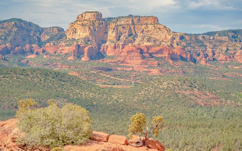
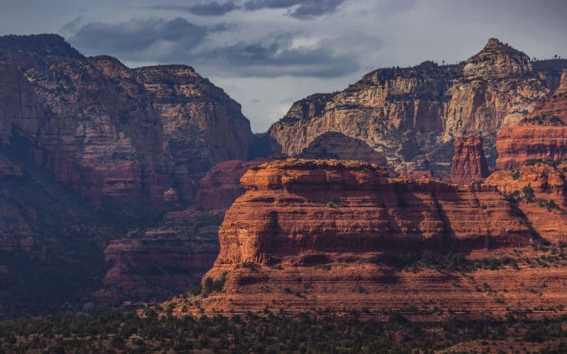
Sedona, Arizona, is a paradise for outdoor enthusiasts, offering seemingly endless options for adventures. The following list has a few other hikes and nearby attractions to consider during your visit.
- Chuckwagon, Devils Bridge Out and Back
- Mescal And Chuckwagon Trail
- Mescal Mountain Trail
- Red Rock State Park
Chuckwagon, Devils Bridge Out and Back
If you want to make a day of it, try combining the Devil’s Bridge hike with the Chuckwagon Trail. Instead of walking along the road from the Dry Creek Vista Trailhead, you can hike the Chuckwagon Trail to reach the Devils Bridge Trailhead. You can also turn the hike into a loop by walking back on Forest Road 152.
This option adds 2.1 miles to the hike for a total of 5.8 miles round trip. The trail is moderately challenging, with some stepping stones and ravine hiking. From the Chuckwagon Trail, you get stunning views of Sedona’s red rocks and imposing cliff bands.
Mescal And Chuckwagon Trail
Mescal Trail is well-marked and easy to follow but ends shortly after the Mescal Trailhead, where it intersects with the Chuckwagon Trail. This trail will take you to Dry Canyon Road and eventually connect to the Devil’s Bridge Trailhead.
The Chuckwagon Trail is a memorable lesson in desert beauty. The trail is lined with yucca and cacti. From the path, you get views of the surrounding red-rock mountains of Sedona.
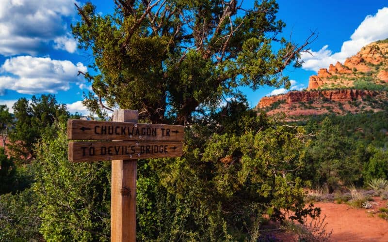
After a couple of miles of scenic up-and-down trail, look for a fork in the path. Here the Devil’s Bridge Trail splits away from Chuckwagon. There is a sign marking the spot; you can’t miss it. From here, cross Dry Creek Road to the parking lot for Devils Bridge. Whew, you made it!
Mescal Mountain Trail
For another scenic hike in the area, try the Mescal Mountain Trail. This 6-mile out-and-back hike takes you across open slick rock. Begin at the Mescal Trail parking area on Long Canyon Road and follow the Mescal Trail for an easy yet beautiful hike.
The trail winds along open ridges with spectacular views of the surrounding mesas and Secret Mountain Wilderness of Sedona.
Red Rock State Park
Red Rock State Park offers views of otherworldly rock formations accessible through a 5-mile trail network in the heart of Coconino National Forest. The visitor center serves as a starting point for guided tours, includingvwalks focused on geology, archaeology, and bird watching.
While out hiking, look for wildlife. There are bobcats, mountain lions, coyotes, javelinas, and river otters, to name a few. Red Rock Park has something for the whole family and is a must-visit for anyone in the area.
Ready to Hike Devil’s Bridge?
The Devil’s Bridge has become an Instagram sensation and for good reason. This hike offers breathtaking views of the Sedona desert and a unique opportunity to walk across a natural arch. Although the trail will likely be busy with other hikers, the journey is truly worth it.
Now that you have all the beta for tackling the Devil’s Bridge trail, it’s time to get out there!
If you found this guide helpful, let us know in the comments, and don’t forget to share it with your hiking partners.