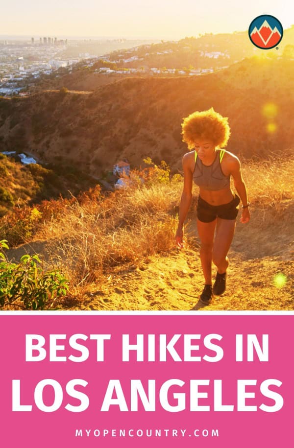
Navigating the myriad of trails in Los Angeles can be overwhelming for outdoor lovers. With a diverse range of hiking options set against the city’s extensive landscape, selecting the ideal trail becomes a challenge. Each path offers a distinct experience, from tranquil walks amongst blossoming wildflowers to challenging ascents up rugged terrains.
For those looking to escape the city’s relentless pace, identifying a trail that matches their fitness level and aesthetic desires proves to be the first step towards uncovering the natural splendor LA has to offer.
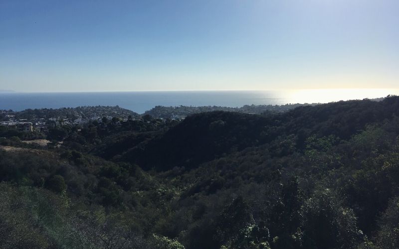
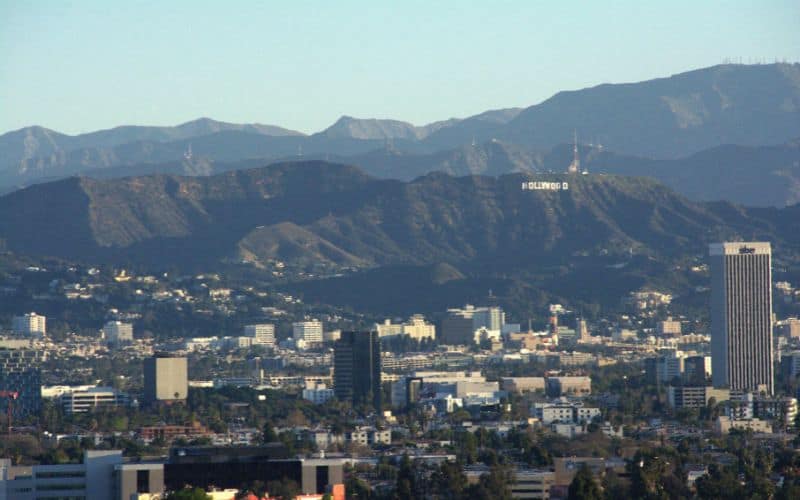
Whether you’re admiring the City of Angel’s famous Hollywood sign or taking in panoramic views of the Pacific Ocean, this area’s hikes provide unforgettable views and classic Southern California scenery.
In this guide, we’ll cover 15 of the most popular hiking trails near LA, including descriptions of each trail, parking info, difficulty, length, and all the highlights you can expect to see along the way.
Do
Don’t

Save for later!!! ⤵️
| Trail Name | Type | Difficulty | Distance | Elevation Gain |
|---|---|---|---|---|
| Malibu Lake Trail | Out-and-back | Moderate | 6.44 miles (10.36 km) | 367 ft (112 m) |
| Sturtevant Falls | Out-and-back | Moderate | 3.3 miles (5.3 km) | 710 feet (216 m) |
| West Observatory Trail | Out-and-back | Easy | 2 miles (3.22 km) | 580 feet (177 m) |
| Mount Baldy | Out-and-back/Loop | Strenuous | 11 miles (17.7 km) | 4100 feet (1250 m) |
| Temescal Canyon Trail | Loop | Moderate | 3.1 miles (5 km) | 843 feet (257 m) |
| Solstice Canyon Trail | Loop | Moderate | 3 miles (4.8 km) | 689 feet (210 m) |
| Escondido Falls Trail | Out-and-back | Moderate | 3.6 miles (5.8 km) | 463 feet (142 m) |
| Baldwin Hills Scenic Overlook | Out-and-back | Moderate | 1.3 miles (2.1 km) | 454 feet (139 m) |
| Eaton Canyon Falls | Out-and-back | Moderate | 3.5 miles (5.63 km) | 450 feet (137 m) |
| Inspiration Point Trail | Loop | Easy | 2.2 miles (3.54 km) | 377 feet (115 m) |
| Los Liones Trail | Out-and-back | Moderate | 4.7 miles (7.56 km) | 1190 feet (363 m) |
Table of Contents
- Where Are the Best Places To Go Hiking In Los Angeles?
- 1. West Observatory Trail, Griffith Park
- 2. Inspiration Point Trail, Will Rogers State Historic Park
- 3. Malibu Lake Trail, Malibu Creek State Park
- 4. Echo Mountain via Sam Merrill Trail, Altadena
- 5. Baldwin Hills Scenic Overlook
- 6. Temescal Canyon Trail, Topanga State Park
- 7. Vasquez Rocks Trail, Agua Dulce
- 8. Sturtevant Falls, Angeles National Forest
- 9. Mount Baldy Trail, Angeles National Forest
- 10. Los Liones Trail to Parker Mesa
- 11. Solstice Canyon Trail & Rising Sun Trail
- 12. Escondido Falls Trail, Escondido Canyon Park
- 13. Eaton Canyon Falls, Eaton Canyon Natural Area
- 14. Brush Canyon Trail
- 15. Runyon Canyon Trail, West Hollywood
- Best Hiking Trails Near Los Angeles: The Verdict
Where Are the Best Places To Go Hiking In Los Angeles?
Our list of hiking trails in and around Los Angeles includes the list below.
- West Observatory Trail, Griffith Park
- Inspiration Point Trail, Will Rogers State Historic Park
- Malibu Lake Trail, Malibu Creek State Park
- Sam Merrill Trail, Altadena
- Baldwin Hills Scenic Overlook
- Temescal Canyon Trail, Topanga State Park
- Vasquez Rocks Trail, Agua Dulce
- Sturtevant Falls, Angeles National Forest
- Mount Baldy, Angeles National Forest
- Los Liones Trail to Parker Mesa
- Solstice Canyon Trail & Rising Sun Trail
- Escondido Falls Trail, Escondido Canyon Park
- Eaton Canyon Falls, Eaton Canyon Natural Area
- Brush Canyon Trail
- Runyon Canyon Trail, West Hollywood
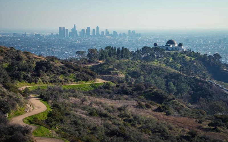
1. West Observatory Trail, Griffith Park
Probably the most famous hike in Griffith Park, the 2-mile (3.22 km) West Observatory Trail features incredible views of the Griffith Park Observatory, the famous Hollywood sign, the Hollywood Hills, part of the San Fernando Valley, and the city.
The hike begins at the creek past the restrooms by the Fern Dell Picnic area close to Los Feliz Blvd. Once at the creek, stay to the left and head up the gradual climb toward the observatory. Once at the observatory, take a peek inside, continue to the summit of Mount Hollywood, or head back to Fern Dell to complete the hike in about an hour.
If you want to explore more, Griffith Park is one of the largest urban parks in North America, comprising over 4,210 acres. The park offers something for everyone, including the Los Angeles Zoo, golf courses, museums, and a variety of outdoor activities for mountain bikers, hikers, horseback riding, and more.
Trail details are given below.
- Type: Out-and-back
- Difficulty: Easy
- Length: 2 miles (3.22 km)
- Elevation gain: 580 feet (177 m)
- Trailhead: About 0.5 miles from Fern Dell entrance
- Parking: Yes, street parking
- Dog Friendly: Yes, leashed
2. Inspiration Point Trail, Will Rogers State Historic Park
Inspiration Point Trail is one of our favorite LA hikes when we’re looking for a quick hiking fix and a healthy hit of awesome views (including the LA basin, Santa Monica Bay, and even Catalina Island on clear days!).
This 2.2-mile (3.54 km) loop within is located within Will Rogers State Park and is one of the easier trails in the park and the Backbone Trail System, involving just 377 feet of elevation gain.
You can hop on the main path from the trails near the park’s polo field. The path is covered by shade-giving eucalyptus trees and climbs to an overlook called Inspiration Point, which provides great views of the Los Angeles basin and beyond.
Paid parking is available near the trailhead. Dogs aren’t allowed.
The park is named after the early Hollywood star who owned the land as a private ranch. This loop was Will Rogers’ favorite trail and he would often invite his famous friends for a hike. In 1944, the ranch was given to the California State Parks system by Will’s wife as a living memorial to the star.
Trail details are given below.
- Type: Loop
- Difficulty: Easy
- Length: 2.2 miles (3.54 km)
- Elevation gain: 377 feet (115 m)
- Trailhead: Near park entrance
- Parking: Yes
- Dog Friendly: No
3. Malibu Lake Trail, Malibu Creek State Park
The Malibu Lake Trail is rightly considered to be one of the LA area’s most beautful hiking trails owing to its stunning views of the Santa Monica Mountains and Malibu Lake, and its surprisingly wild feel.
This moderately challenging 6.44-mile (10.36 km) out-and-back hike covers 367 ft (112m) of elevation and takes a little under two and a quarter hours to complete.
The trail starts at Las Virgenes Road and Waycross Dr (parking available). It then follows Malibu Creek through increasingly pretty terrain before ending near the scenic Malibu Lake, where you’ll find many areas to stop for a picnic or just take in the views.
The temperate Southern California weather allows for year-round hiking along this busy trail, but keep in mind that dogs aren’t allowed.
With over 10,000 acres of land in the stunning Santa Monica Mountains, there are lots of other trails you can hop on to extend your hike. Alternatively, you can seek out the park’s historical filming locations for productions such as Planet of the Apes, Butch Cassidy and the Sundance Kid, and M*A*S*H*.
Trail details are given below.
- Type: Out-and-back
- Difficulty: Moderate
- Length: 6.44 miles (10.36 km)
- Elevation gain: 367 ft (112m)
- Trailhead: Las Virgenes Road and Waycross Drive
- Parking: Yes
- Dog Friendly: No
4. Echo Mountain via Sam Merrill Trail, Altadena
The Sam Merril Trail to Echo Mountain’s summit is one of the best LA hikes for views over the city and historical intrigue.
This 5.3-mile out-and-back hike provides a decent workout, rising 1421 feet to the ruins of the 19th-century Echo Mountain House from the trailhead. Despite the elevation gain, however, the trail is never steep, is only moderately challenging, and takes around 3 hours to complete.
The trail begins at the parking lot at the north end of North Lake Avenue. From there, it veers into Las Flores Canyon before you hit a series of switchbacks affording awesome views over the San Gabriel Valley. After around 2.4 miles, the trail levels off and you’ll enjoy a breezy stroll to the summit and aforementioned ruins.
The ruins are the remains of former Victorian resort built in 1893 and razed to the ground by fires in 1900 and 1905. In its short lifetime, the resort became a popular honeymoon destination and was dubbed “The White City in the Sky” owing to its prominence on the skyline and visibility from both Pasadena and downtown LA.
The existing path was originally constructed by Sam Merrill, an acquaintance of the “Father of the National Parks”, John Muir.
Did You Know? The Sam Merrill Trail is a popular “haunt” of ghosthunters, who have frequented the area in hunt of the supernatural following reports of ghost sightings.
Trail details are given below.
- Type: Out-and-back
- Difficulty: Moderate
- Length: 5.3 miles (8.5 km)
- Elevation gain: 1421 feet (433m)
- Trailhead: Cobb Estate Gate, East Loma Alta Drive/North Lake Avenue
- Parking: Yes (limited)
- Dog Friendly: Yes
5. Baldwin Hills Scenic Overlook
The Baldwin Hills Scenic Overlook is one of the best hikes near LA for hikers seeking a short but relatively challenging trail with great views and the chance to see an array of native wildflowers.
This out-and-back hike, located in southern LA’s industrial zone, is just 1.3 miles long but involves 454 feet of elevation gain, so provides a good workout. That said, it can be completed in circa 30-45 minutes if you have decent fitness levels.
The trail sets off from the park entrance on Jefferson Blvd (parking available). From there, take the direct route to the top of a steep staircase. Climb the 260-stone steps for an intense workout with rewarding, north-facing views of Los Angeles at the top. Take the switchbacks down, as they wind back and forth across the stairs until you reach the bottom.
This is a popular exercise spot and gets busy after work hours until the sun sets and on weekends. Visit midday during a weekday for fewer crowds. Dogs, sadly, aren’t allowed.
Trail details are given below.
- Type: Out-and-back
- Difficulty: Moderate
- Length: 1.3 miles (2.1 km)
- Elevation gain: 454 feet (139 m)
- Trailhead: Park entrance off Jefferson Blvd.
- Parking: Yes
- Dog Friendly: No
6. Temescal Canyon Trail, Topanga State Park
The Temescal Canyon Trail is a good option for anyone looking for a great hike near LA that’s a little quieter than others but still offers outstanding views of the city and the Pacific Ocean.
This moderately difficult, 3.1-mile (5 km) loop takes about 2 hours to complete. Elevation gain is moderate (843 feet/257m) and the trail never too steep. The trail starts just off Sunset Blvd in Pacific Palisades at the Temescal Gateway Park, where you can find paid parking. Alternatively, you can park for free on Temescal Canyon Road and walk an extra 5-10minutes to the trailhead.
The trail passes unique and otherworldly rock formations (like Skull Rock), seasonal wildflowers, a wooded canyon floor, and a waterfall near the bridge. The trail ascends 843 feet up to a ridge close to Temescal Ridge Trail. Along the way, you see unforgettable vistas of Malibu, Downtown LA, the mountains, the ocean, and even Catalina Island.
If you’re looking for more to do, then Topanga State Park has 36 miles of trails along the Santa Monica Mountains’ cliffs and canyons, and is considered the world’s largest wildland within a major city’s limits. The park is home to open grassland, live oak trees, and breathtaking views of the Pacific Ocean.
Trail details are given below.
- Type: Loop
- Difficulty: Moderate
- Length: 3.1 miles (5 km)
- Elevation gain: 843 feet (257 m)
- Trailhead: Temescal Gateway Park
- Parking: Yes
- Dog Friendly: No
7. Vasquez Rocks Trail, Agua Dulce
The Vasquez Rocks Trail requires venturing a little further afield, but it’s a must for any list of the best hikes near LA owing to its unique scenery, pictographs, and the chance to filming locations for numerous Hollywood movie scenes.
This 3.3-mile loop starts just off Escondido Road on the south side of Agua Dulce and gains just 472 feet in elevation, allowing most hikers to complete it around 1.5 hours. The trail is well-marked and well-maintained, and the homeward (eastern) leg will have you taking in a small section of the Pacific Crest Trail. The PCT may have a rep for gnarliness, but this small slice is pleasingly mellow.
Start out at the spillover parking lot past the ranger station (before the main parking lot). From here, continue on the PCT until reaching the famous slanting rocks and, shortly thereafter, a cluster of rocks adorned with remarkably clear pictographs. The geological extravaganza continues as you head south and eventually take a sharp right to return via either the Horse Trail (shorter) or Foot Trail (1/2 mile longer).
The trail is open year-round and dogs are permitted but must be kept on a leash. Despite being a little further from the city, the park attracts hundreds of visitors per day, so make sure to pack a little bit of patience and don’t expect a quiet time of things!
There aren’t any options to extend this hike as a loop, but if you have time and energy to burn you can add as many miles as you wish by continuing south for an out-and-back leg on the PCT instead of turning right onto the Foot or Horse Trail.
Vasquez Rocks is named after 19th-century bandit Tiburcio Vásquez, who ran local law officials ragged before retreating to the area to hide out between his sprees of lawbreaking. The park has featured in numerous TV shows and movies over the years, including Bonanza, Gunsmoke, Buffy the Vampire Slayer, Star Trek, Dracula, Planet of the Apes, and Bill and Ted’s Bogus Journey.
Trail details are given below.
- Type: Loop
- Difficulty: Moderate
- Length: 3.3miles (5.3km)
- Elevation gain: 472 feet (144m)
- Trailhead: Just off Escondido Road
- Parking: Yes
- Dog Friendly: Yes
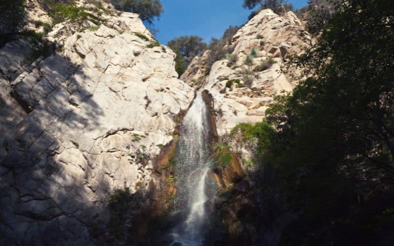
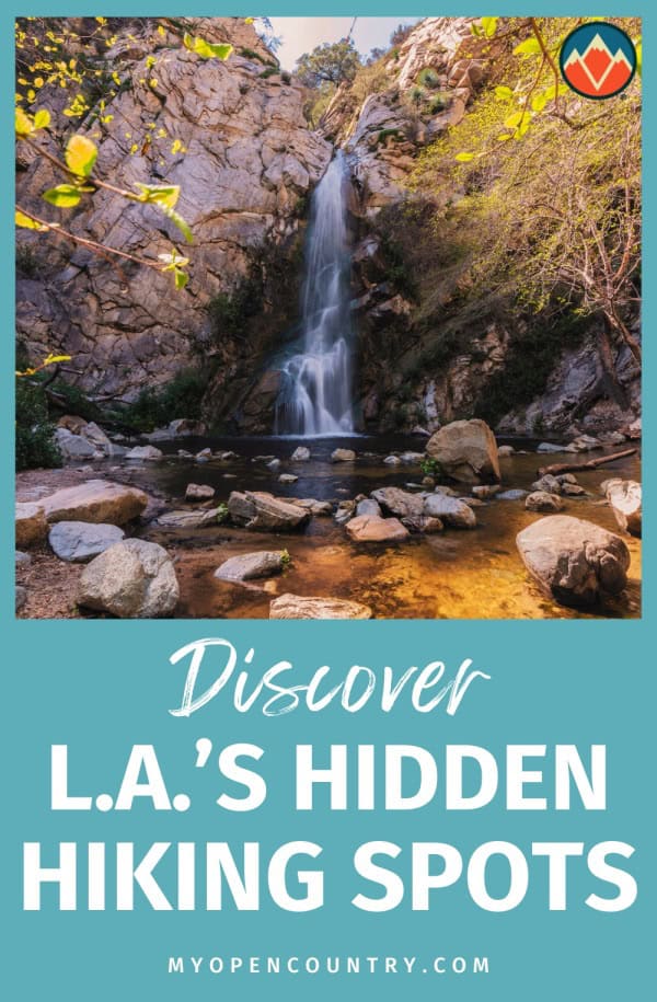
8. Sturtevant Falls, Angeles National Forest
One of the more popular waterfall hikes near Los Angeles is the one to the beautiful Sturtevant Falls. Located in Angeles National Forest, this 3.3-mile (5.3 km) hike in the San Gabriel Mountains dates back to the early 1900s and offers a shady forest walk along Santa Anita Creek.
Starting at Chantry Flat, the trail leads down into Santa Anita Canyon and crosses a bridge before reaching the 50-foot waterfall. Along the way, you’ll see some interesting cabins and smaller cascades. There’s an option to extend the hike and visit another waterfall nearby, Hermit Falls.
Since this shaded trail can get quite busy, the optimal time to visit is on a weekday morning. Parking is available at Chantry Flats, but you will need to buy a pass to park.
Trail details are given below.
- Type: Out-and-back
- Difficulty: Moderate
- Length: 3.3 miles (5.3 km)
- Elevation gain: 710 feet (216 m)
- Trailhead: Chantry Flat
- Parking: Yes, permit required
- Dog Friendly: Yes, leashed
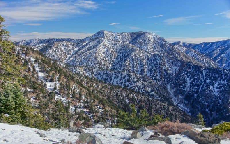
9. Mount Baldy Trail, Angeles National Forest
The Mount Baldy Trail is one of the top trails in Southern California for hikers seeking a full-day adventure, with the summit hike packing in plenty of elevation gain and letting you enjoy an almost-alpine experience just 45-minutes from downtown LA.
At 10,069 feet, Mount Baldy, officially known as Mount San Antonio, is the highest peak in the San Gabriel Mountains and Los Angeles County. The steep trail climbs 3,950 feet (1200 m) from the trailhead at the Manker Campground (parking available), through the subalpine zone to the peak’s rocky summit. Here, you’ll enjoy sweeping views of the inland desert, the city of LA, and the Pacific.
There are two main paths to the top of the mountain. If you’re an experienced hiker looking for a challenge, ascend to the summit via the Baldy Bowl Ski Hut Trail. But beware, this route has around 4,000 feet of elevation gain in under 4 miles. For an easier ascent take the Devil’s Backbone Trail.
Once you’ve seen enough of the breathtaking vista at the summit, you can head south on the Baldy Bowl Trail to see a unique barren landscape scattered with pine trees deformed by the fierce mountain winds and a bowl littered with boulders.
Trail details are given below.
- Type: Out-and-back/Loop
- Difficulty: Strenuous
- Length: 11 miles (17.7 km)
- Elevation gain: 4100 feet (1250 m)
- Trailhead: About 0.5 miles from Fern Dell entrance
- Parking: Yes, street parking
- Dog Friendly: Yes, leashed
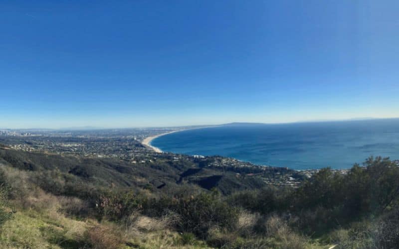
10. Los Liones Trail to Parker Mesa
The Los Liones Trail earns our vote as one of LA’s top hikes on account of its gorgeous coastal views and remarkably lush riparian terrain.
This 4.7-mile (7.3 km) out-and-back hike in Topanga State Park involves around 1,190 feet (363m) of elevation gain and has lots of ups and down, so it’s a good workout and generally considered moderately challenging. Most hikers complete the route in 2.5 to 3.5 hours.
The trail begins on Los Liones Drive at a marked gate. It’s lightly shaded and begins by passing through a verdant riparian canyon. After that, it connects to East Topanga Fire Road, which climbs up to the specatacular Parker Mesa Overlook. Stop to take in the scenic views of the Santa Monica Bay and San Bernardino Mountains before heading back down.
There are multiple parking lots nearby for this (sometimes overly) popular hike. Dogs are not permitted.
There are 36 miles of trails withing Topanga State Park, so if you want to extend your hike, the options abound!
Trail details are given below.
- Type: Out-and-back
- Difficulty: Moderate
- Length: 4.7 miles (7.3 km)
- Elevation gain: 1190 feet (363 m)
- Trailhead: Los Liones Drive
- Parking: Yes
- Dog Friendly: No
11. Solstice Canyon Trail & Rising Sun Trail
Located in the tranquil Santa Monica Mountains National Recreation Area, the Solstice Canyon Trail is one of the region’s most popular day hikes. This easy, 3-mile (4.8 km) loop hike is shaded by forests of oak and sycamore trees, and winds alongside a creek.
The trailhead starts at the small parking lot and is paved for about the first half mile. The built-up path eventually turns to dirt and heads up a gentle slope toward Solstice waterfall.
Along the way, you’ll encounter the remnants of the Keller House, a stone cabin that was built over 100 years ago. Just before arriving at the falls, you’ll reach the Tropical Terrace and the Roberts Ranch House ruins.
Once at the falls, you might get to see some of the local birds, including acorn woodpeckers and red-tailed hawks. On the way there, you’ll also enjoy incredible views of the Pacific Ocean, the Sandstone Peak, and, of course, Solstice Canyon.
After the waterfall, take the steep switchbacks to the top of the hills to the Rising Sun Trail. Above the canyon, you’re rewarded with gorgeous panoramic views of the ocean.
Trail details are given below.
- Type: Loop
- Difficulty: Moderate
- Length: 3 miles (4.8 km)
- Elevation gain: 689 feet (210 m)
- Trailhead: About 0.5 miles from intersection of Corral Canyon Road and Solstice Canyon Road
- Parking: Yes
- Dog Friendly: Yes, leashed
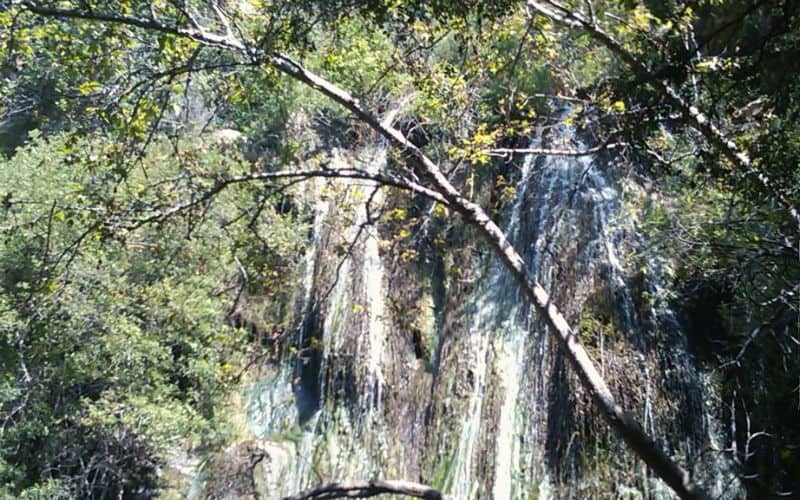
12. Escondido Falls Trail, Escondido Canyon Park
The Escondido Falls Trail is one of the LA area’s must-do hikes for waterfall lovers. It takes you on a short, prettiness-pack trip to the tallest waterfall in the Santa Monica, Escondido Falls.
This 3.6-mile (5.8 km) out-and-back hike has just 463 feet (142m) of elevation gain, so it’s suitable for hikers of all fitness levels. It’s also dog-friendly and has parking at the trailhead at the Escondido Canyon Park entrance on Winding Way, just off the Pacific Coast Highway from Santa Monica.
are the , are the highlight of the Escondido Falls Trail, but there’s plenty more to enjoy along the way.
Once at the trailhead, the trail follows a paved path for about a mile, then meanders along Escondido Canyon Creek for another mile before arriving at the 150-foot tall, multi-tiered waterfalls. It’s a gentle ascent with spotted shade along the canyon walls. There are several river crossings on the way, so wear waterproof hiking shoes during the rainy season.
Take a refreshing dip in the pool below the falls to cool off mid-hike. The water level is usually at its peak during the spring. The upper falls are closed off to the public since they are located on private property.
Trail details are given below.
- Type: Out-and-back
- Difficulty: Moderate
- Length: 3.6 miles (5.8 km)
- Elevation gain: 463 feet (142 m)
- Trailhead: Winding Way off I-10 west
- Parking: Yes
- Dog Friendly: Yes, leashed
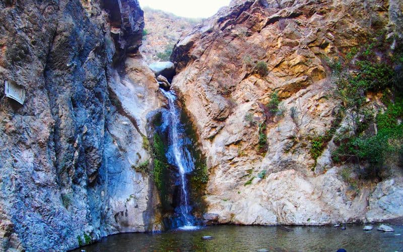
13. Eaton Canyon Falls, Eaton Canyon Natural Area
The Eaton Canyon Falls Trail is one of the most popular hikes in the LA country portion of the San Gabriel Mountains, mostly due to pretty waterfalls themselves but thanks to the trails pretty wildflowers and woodland.
This 3.5-mile (5.63 km) out-and-back trail involves a mere 450 feet (137m) of ascent, rising steadily from the trailhead just past the Eaton Canyon Nature Center on Altadena Dr in Pasadena to the 40-feet-high waterfalls.
The trailhead is located on the northern side of the parking area. From here, walk on the well-marked Eaton Canyon Trail through oak forests and riparian woodlands towards until reaching the stunning waterfall. The trail involves some creek crossing and boulder hopping, so be sure to wear suitable hiking shoes. Otherwise, the hike is very mellow.
Dogs are allowed on this hike but they must be leashed. Free parking is available at the trailhead.
For additional activities, check out the Eaton Canyon Nature Center houses, where you’ll find interesting displays, live animals, and various exhibits.
Trail details are given below.
- Type: Out-and-back
- Difficulty: Moderate
- Length: 3.5 miles (5.63 km)
- Elevation gain: 450 feet (137 m)
- Trailhead: Eaton Canyon Nature Center
- Parking: Yes
- Dog Friendly: Yes, leashed
14. Brush Canyon Trail
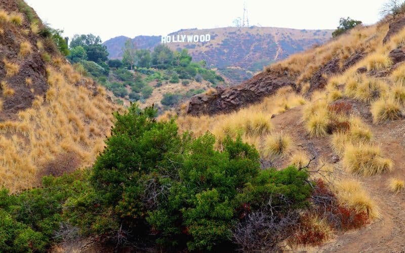
The Brush Canyon Trail is a must-do LA hike, particularly if you want a more challenging alternative to the West Observatory Trail (above) that provides similarly epic views of downtown and the famous Hollywood sign.
This 4.7-mile hike starts at the trailhead on Canyon Drive before looping around Mount Bell via the North Trail and 3-mile Trail, gaining just over a thousand feet of elevation along the way. As you gain height, you’ll enjoy views of the iconic Hollywood sign and downtown LA, and see the famous Griffiths Observatory.
While there’s ample free parking inside Griffiths Park, park authorities close the gates just after sunset each night. So, if you plan on taking in the sunset from the Observatory or Mount Bell, it’s best to find a spot outside the park. And don’t expect to have those views all to yourself – this is a popular trail and can be crazy busy any day of the week. Dogs are allowed on the trail but must be leashed at all times.
If you’d like to extend this hike, you have a few options.
A short, 0.2-mile diversion from North Trail will take you to the summit of Taco Peak. From here, you can continue for roughly another mile before rejoining the North Trail just below Mt. Baby Bell and returning to the Mulholland Trail for the descent.
Alternatively, you can escape some of the crowds by turning onto the Mount Chapel Trail just before reaching Mt. Baby Bell and circle back into Brush Canyon via the Mulholland Trail, adding around 2 miles to your trip.
Trail details are given below.
- Type: Lollipop Loop
- Difficulty: Moderate
- Length: 4.75 miles (7.7 km)
- Elevation gain: 1005 feet (306m)
- Trailhead: Canyon Drive
- Parking: Yes
- Dog Friendly: Yes
15. Runyon Canyon Trail, West Hollywood
The Runyon Canyon Trail is one of the top West Hollywood hikes for anyone looking for a pre-work or evening hike with sweet views.
This loop hike is easy-going, measuring only 2.7 miles and gaining just 758 feet in elevation from the trailhead at the Runyon Canyon Park entrance to the high point at Cloud’s Rest. The path is also wide and well-trodden, so it’s accessible even for hikers with mobility issues or strollers. Highlights include views of downtown and the Santa Monica Mountains from Inspiration Point and Cloud’s Rest, and an – albeit distant – sighting of the Hollywood sign.
The main downsides to this trail are the heavy traffic and lack of parking. Most hikers park on Hillside Avenue, which will add five to ten minutes to your hike, but you may have to go a little further out when things are particularly busy (avoid weekends!). Dogs are allowed on the trail and there are even unleashed areas where they can roam free.
You can extend the hike by turning north onto Indian Rocks Trail at the northernmost point of the loop. This extension is a mini-loop that takes you onto Mulholland Drive and adds just under a mile to your journey.
Trail details are given below.
- Type: Loop
- Difficulty: Moderate
- Length: 2.7 miles (4.3km)
- Elevation gain: 758 feet (231m)
- Trailhead: Runyon Canyon Park, 2000 N Fuller Ave, Los Angeles, CA, 90046
- Parking: No
- Dog Friendly: Yes
Best Hiking Trails Near Los Angeles: The Verdict
Whether it’s summiting Mount Baldy’s 10,069 feet, strolling through the canyons, or taking a refreshing dip at the base of the 150-foot-tall Escondido Falls, the greater Los Angeles area has something for everyone.
Have we missed any of the best hiking trails in Los Angeles? Let us know in the comments below! And if you enjoyed this article, feel free to share it with your
Save for later!!! ⤵️