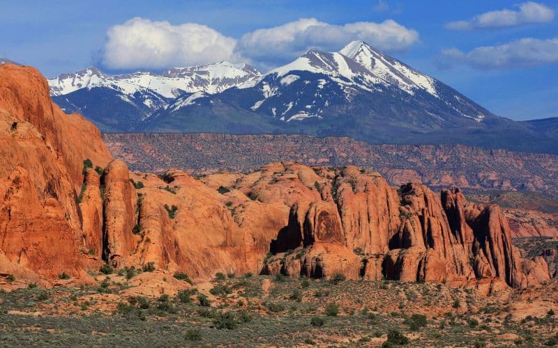
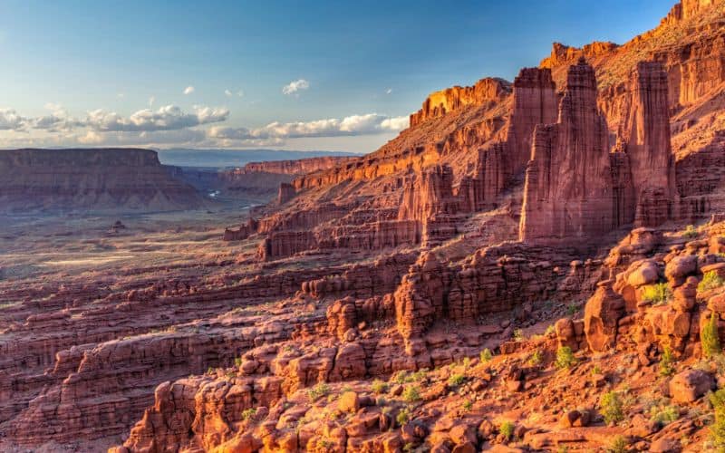
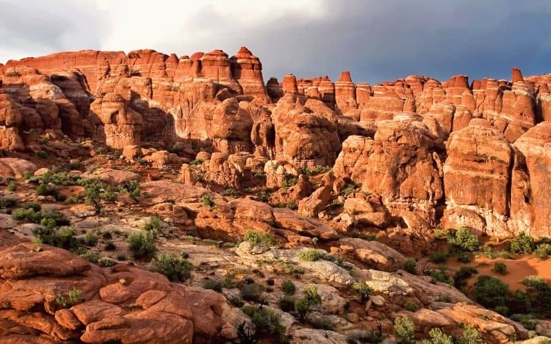
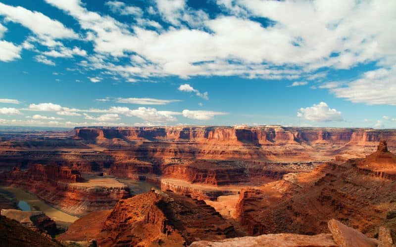
Moab, Utah, is unlike anywhere else in the world. The city is surrounded by state and national parks, canyons, and one-of-a-kind rock formations. Everyone should visit at least once. As Edward Abbey said, “The strangeness and wonder of existence are emphasized here, in the desert.”
With endless trails and hikes in the area, it can be hard to know where to go. We’ve got you covered. In this guide, we explore the top trails Moab has to offer. We’ve included everything from paved hikes for the entire family to permitted canyon squeezes.
Table of Contents
- 1. Fisher Towers Trail
- 2. Windows Loop Trail & Turret Arch Trail, Arches National Park
- 3. Fiery Furnace & Surprise Arch, Arches National Park
- 4. Grandstaff Trail
- 5. Delicate Arch Trail, Arches National Park
- 6. Hidden Valley Trail
- 7. Mesa Arch Trail, Canyonlands National Park
- 8. Dead Horse Rim Loop Trail, Dead Horse Point State Park
- 9. Dinosaur Tracks Trail
- 10. Corona Arch Trail
- 11. Druid Arch Trail
- 12. Mill Creek Trail
- 13. Grand View Point Trail
- Other Awesome Hikes Near Moab
- Happy Hiking!
1. Fisher Towers Trail
- Type: Out and back
- Length: 4.2 miles
- Difficulty: Moderate
- Elevation Gain: 1,469 feet
The Fishers Towers are some of the strangest and most sublime rock formations in the Moab area. Make sure your camera is charged! The well-marked Fisher Towers Trail winds through rock fins, spires, minarets, and pinnacles in and out of the canyon.
Follow road signs to the trailhead, only 16 miles from Moab off route UT-128. Then take the trail down a hill into the canyon. You will pass ancient rock art and several named features, including the Cottontail Tower, an 800-foot-tall rock spire.
Continue down a metal ladder into more canyon layers to Titan Wall, the tallest formation in the area and a popular face for rock climbers. No matter how far you go, stay on the trail at all times! Stepping off the path will damage the living soil, or biocrust, a vital component of the desert ecosystem.
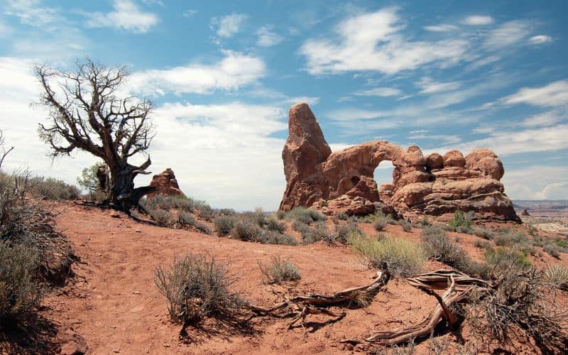
2. Windows Loop Trail & Turret Arch Trail, Arches National Park
- Type: Loop
- Length: 1.2 miles
- Difficulty: Easy
- Elevation Gain: 154 feet
These trails will be busy, but don’t let that stop you from enjoying one of the best hikes in Arches National Park. For a less noticeable incline, hike the loop in a clockwise direction. Clockwise, hikers arrive at the North and South Window Arches first. Carved from one massive sandstone fin, both arches are more than 50 feet high and close to 100 feet wide.
As if that wasn’t enough, beyond the arches are breathtaking views of the La Sal mountains and the Utah desert. Continuing down the loop, Turret Arch is smaller than the Windows but still impressive. From Turret, you’re less than half a mile from the parking area.
3. Fiery Furnace & Surprise Arch, Arches National Park
- Type: Loop
- Length: 2.1 miles
- Difficulty: Challenging
- Elevation Gain: 492 feet
The Fiery Furnace hike feels like a playground as you crawl, climb, and scramble through tight slot canyons with narrow rock walls, over boulders, and along narrow ledges. It’s a ton of fun. However, this is one of the more involved and challenging trails in the national park.
For starters, you need a permit. Reserve permits online up to one week in advance. Pick them up from the ranger station the night before. At pick-up, the rangers ask you to watch an orientation video. Only then can you hike the Fiery Furnace.
Start at Fiery Furnace Overlook (the earlier, the better). Once you show the trailhead ranger your permit, the fun can begin. Follow the brown and white arrows and expect to get lost. It’s a maze out there, so definitely have a map with you.
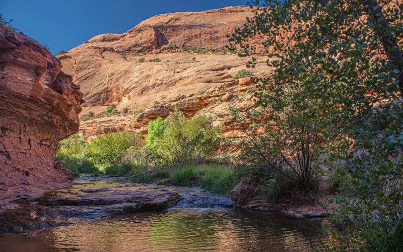
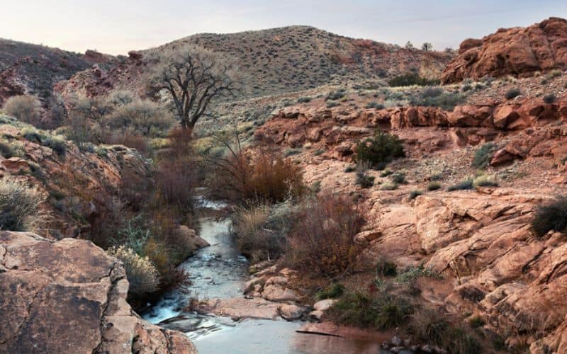
4. Grandstaff Trail
- Type: Out and back
- Length: 5.7 miles
- Difficulty: Moderate
- Elevation Gain: 836 feet
Grandstaff Trail features running water and incredible rock formations. It also offers an escape from the busier national parks all year round. Find the trailhead near Cisco, Utah, off Highway 128.
The trail begins in a shaded cottonwood forest by a babbling brook. The route proceeds into Grandstaff Canyon and crosses the creek eleven times, so bring your waterproof hiking boots. Stay the course for 2.5 miles to reach the main attraction, the Morning Glory Natural Bridge, which spans 243 feet.
Walk under the 75-foot tall formation for the best views of the bridge and rock amphitheater. On your way back, take a lunch or nap break in the shade of the cottonwood trees.
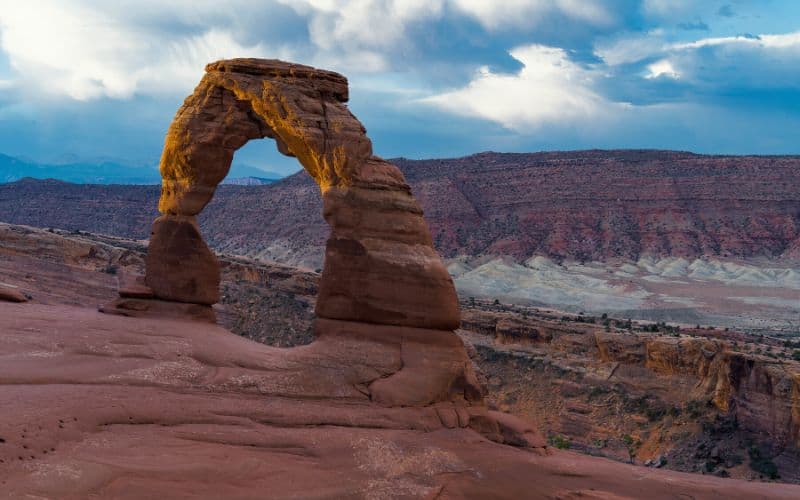
5. Delicate Arch Trail, Arches National Park
- Type: Out and back
- Length: 3.2 miles
- Difficulty: Easy
- Elevation Gain: 629 feet
See the Utah license plate in real life by hiking to the Delicate Arch in Arches National Park. Although a popular and busy trail, this stand-alone arch is a must-see. The opening is 46 feet high by 32 feet wide and frames a different beautiful scene, no matter which way you look.
There are few steep, slick rock sections, but the trail is still considered easy to moderate, and most hikers manage to get to Delicate Arch without too much trouble. Look for cairns along the way, and bring a headlamp if you’re hiking before sunrise (which we recommend to beat the crowds!).
Hike around the bowl, taking your time to examine Delicate Arch, the most famous arch in the world, from every angle.
6. Hidden Valley Trail
- Type: Out and back
- Length: 6.0 miles
- Difficulty: Challenging
- Elevation Gain: 1,171 feet
Hidden Valley Trail is not an easy hike. The trail gains 600 feet of elevation within the first 0.6 miles. The rating works as a deterrent, and those up for the challenge enjoy a less crowded path.
Find the trailhead in Spanish Valley, and don’t forget to sign in at the BLM Registry box near the start of the hike. Then get ready to sweat! The trail follows a series of switchbacks through rock fields as it climbs into Hidden Valley.
You’ll be glad you pushed through the first half mile because Hidden Valley is stunning. The sandstone cliffs and domes rim the valley, along with the grass-covered floor, create a picturesque scene you won’t soon forget.
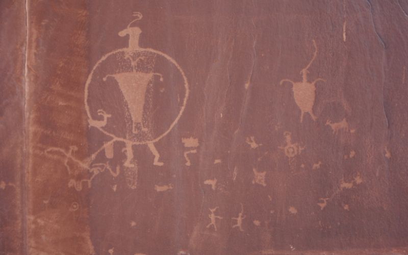
For a chance to see an ancient petroglyph panel, take the westbound trail (right fork) from the second saddle. The route is easy to follow, and you can retrace your steps to get back to the trailhead.
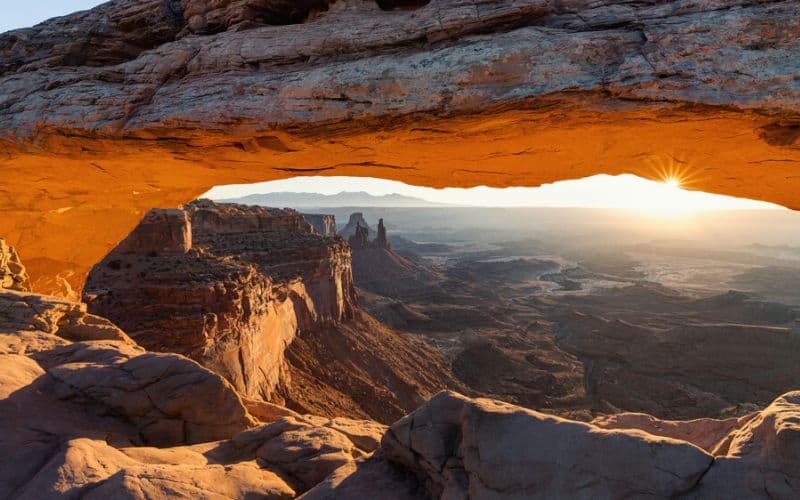
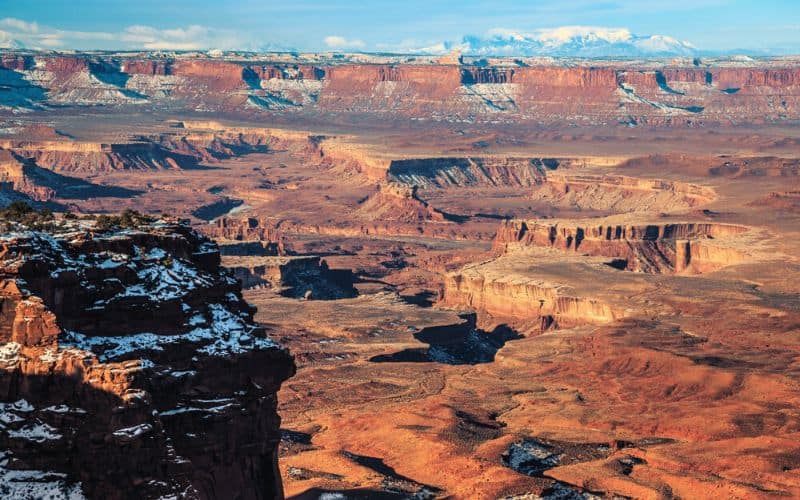
7. Mesa Arch Trail, Canyonlands National Park
- Type: Loop
- Length: 0.7 miles
- Difficulty: Easy
- Elevation Gain: 88 feet
Everything about Mesa Arch Trail is perfect. It’s a short, family and beginner-friendly hike that leads to one of the most iconic views in Canyonlands National Park. The park’s service details the best way to hike the trail with a display at the trailhead.
Hike the loop in a clockwise direction for a mellower hike. To avoid as many stone stairs as possible, hike clockwise to the arch and then turn back. (If you want more of a workout, hike counterclockwise.)
Whichever way you get there, you’re in for a treat. The arch is located at the edge of a 500-foot cliff overlooking Buck Canyon. Through the arch, see miles of desert landscape and the snow-capped La Sal Mountains in the distance.
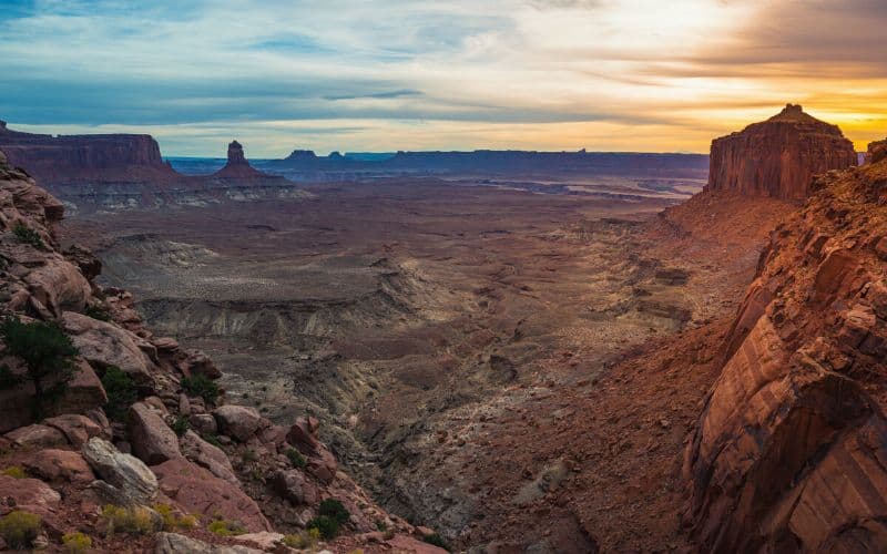
8. Dead Horse Rim Loop Trail, Dead Horse Point State Park
- Type: Loop
- Length: 6.6 miles
- Difficulty: Moderate
- Elevation Gain: 908 feet
Hop on the West and East Rim Trails in Dead Horse Point State Park for a gorgeous six-and-a-half-mile loop. There are eight overlooks in the park, and you can add a few miles to your hike to see them all. There is also the option to drive to the most famous overlook, Dead Horse Point.
For the hikers, start at the visitor center and walk the canyon rim. The first spur trail you encounter leads to Basin Overlook. If you’re pressed for time, keep going. The next overlook is the reason you’re here.
The trail continues to follow the canyon rim and leads hikers through ‘The Neck,’ a narrow plateau section less than 100 feet wide. Past the neck, you’ve arrived at Dead Horse Point and some of the best views near Moab.
From the overlook, admire the intricate maze of canyons, buttes, and plateaus. Far below, you can see the Colorado River twist its way through the rocky landscape. Beyond Dead Horse Point, there are three more overlooks as the trail returns to the visitor center. We recommend stopping at all of them.
9. Dinosaur Tracks Trail
- Type: Out and back
- Length: 0.2 miles
- Difficulty: Easy
- Elevation Gain: 50 feet
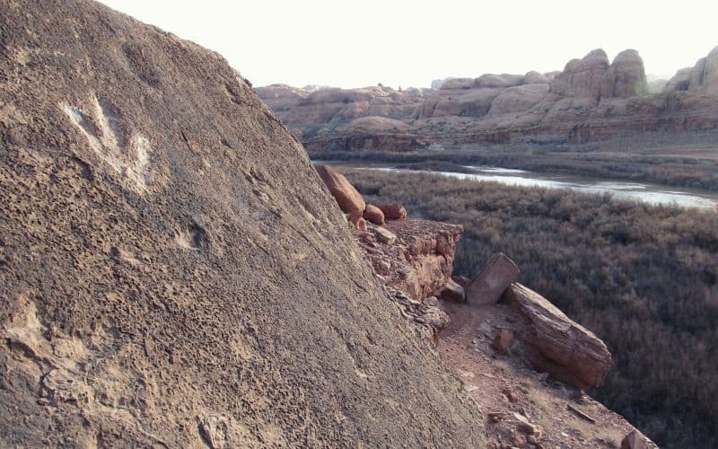
Entice the whole family with a short hike that leads to preserved dinosaur tracks. Just 15 minutes from Moab, this hike offers a unique opportunity to walk where dinosaurs once roamed. The trail starts at the Poison Spider Mesa Trailhead, an off-roading, and mountain biking area.
Don’t follow the Jeeps and ATVs. Take the trail to the right side of the toilets going down a small hill. Follow this to the cliff base and look for a large boulder with three-toed dinosaur footprints.
The three-toed tracks were left more than 150 million years ago during the Jurassic Period. Sometime during that epoch, an Allosaurus walked across what was a muddy sandbar. The Allosaurus was a vicious predator with sharp teeth and claws that walked on two feet like a T-rex.
Various other tracks are spread across the stone slabs on the hillside. See how many you can find before retracing your steps to the trailhead.
10. Corona Arch Trail
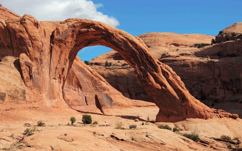
- Type: Out and back
- Length: 4.2 miles
- Difficulty: Moderate
- Elevation Gain: 482
Corona Arch Trail includes two bonus attractions, the Bowtie Arch and the Pinto Arch. To view all three, you have to cross various Slickrock sections, climb a ladder, and use cables to avoid falling. If heights aren’t for you, turn around at the 0.7-mile mark after the first view of Corona Arch.
A few steps past the turn-around, Bowtie Arch can be seen on your left, and in another 1.5 miles, you’ll arrive at the impressive Corona Arch. Corona Arch is huge compared to the Delicate Arch (but not quite as big as Landscape Arch!), measuring 105 feet high by 140 feet wide.
Although this practice has been banned, the opening is even big enough for airplanes to fly through. Look for people rappelling off the arch while you rest. Then, return to the trailhead the way you came.
11. Druid Arch Trail
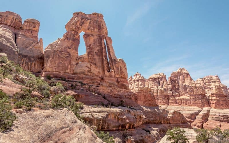
- Type: Out and back
- Length: 10.4 miles
- Difficulty: Moderate to Challenging
- Elevation Gain: 1,614 feet
The Needles District in Canyonlands is home to brightly layered Cedar Mesa Sandstone spires or “needles”. The Druid Arch Trail offers visitors a chance to get up close and personal with these geologic anomalies.
Most people make a long day of the 10+ mile trail as backcountry camping requires a permit. Start early and bring more water than you think you need.
Even if you don’t make it to the arch, every mile of this hike is remarkable.
The first ascent up Elephant Hill has amazing views of the Cedar Mesa Sandstone. The trail follows Elephant Canyon and its benches for relatively easy hiking. However, the last quarter-mile involves a ladder climb and a strenuous ravine scramble.
The Druid Arch is worth it. The angular rock structure seems almost artificial. You’ll have to see it to believe it.
12. Mill Creek Trail
- Type: Out and back
- Length: 1.8 miles
- Difficulty: Moderate
- Elevation Gain: 65 feet
Mill Creek Trail provides a rare opportunity to see a waterfall in the desert. It’s perfect for the whole family and even has off-leash areas for the dogs.
The trail begins with a bit of a scramble but levels off into a wide path. It then meanders its way up an unassuming but beautiful canyon, and past cottonwood stands.
There is one junction where you should cross the creek (be prepared to get your feet wet!) and follow the North Fork. Less than a mile in, you arrive at a scenic waterfall perfect for swimming, jumping, and cooling off.
For this hike, we recommend bringing a swimsuit and having dry shoes in your car for the drive back.
13. Grand View Point Trail
- Type: Out and back
- Length: 1.8 miles
- Difficulty: Easy
- Elevation Gain: 160 feet
At the southern end of the Island in the Sky district, Grand View Point Trail leads to a spectacular overlook of Canyonlands National Park. The best part is you don’t have to struggle up Slickrock to enjoy panoramic canyon views.
The park maintains several interpretive displays that detail some of the most recognizable features, including the confluence of the Green and Colorado River, the Totem Pole rock spire, and the White Rim Road. You’ll want to look at this view for a while, so the park has placed benches along the way.
There is no shortage of hiking options in the Sky district if you want to extend your day. For example, the Crater View and White Rim Overlook Trail are easy to moderate and lead to even more must-see vistas.
Other Awesome Hikes Near Moab
A few of the other hikes near Moab we highly recommend include:
- Landscape Arch Trail, Arches NP
- Double Arch Trail, Arches NP
- Chesler Park Loop/Joint Trail
- Devil’s Garden Loop, Arches NP
- False Kiva Trail, Canyonlands NP
Happy Hiking!
Located in the middle of an incredible desert landscape, Moab, Utah, is a truly unique place. All within an hour of the city, you can see world-famous arches, deep canyon mazes, and even trickling waterfalls.
With so many options, it can be hard to choose, but we hope our guide to the best hiking in Moab makes finding your next adventure a little easier.
Which is your favorite Moab hike? Let us know in the comments below, and don’t forget to share with your hiking partner.
